
IALA Buoyage System
Region B includes the Americas apart from Greenland, plus Japan, South Korea, Taiwan and the Philippines. Greenland and Guam use Region A. Check local charts for island and territorial exceptions.
What IALA stands for — and what the buoyage system is
IALA is the International Organization for Marine Aids to Navigation, an intergovernmental organisation since 22 August 2024. Its abbreviation comes from its former name, the International Association of Marine Aids to Navigation and Lighthouse Authorities. IALA publishes standards and recommendations that help maritime authorities harmonise buoys, beacons, lights and other aids to navigation.
The IALA Maritime Buoyage System defines marks by their colour, shape, topmark and light rhythm. This site covers six buoyage families: lateral, cardinal, isolated danger, safe water, special and emergency wreck marks; the system also covers other aids, including lighthouses. The combined system was agreed in 1980 and its implementation agreement was signed on 15 April 1982. Regions A and B differ in the colours of lateral marks, including preferred-channel marks.
Which countries are Region A and which are Region B?
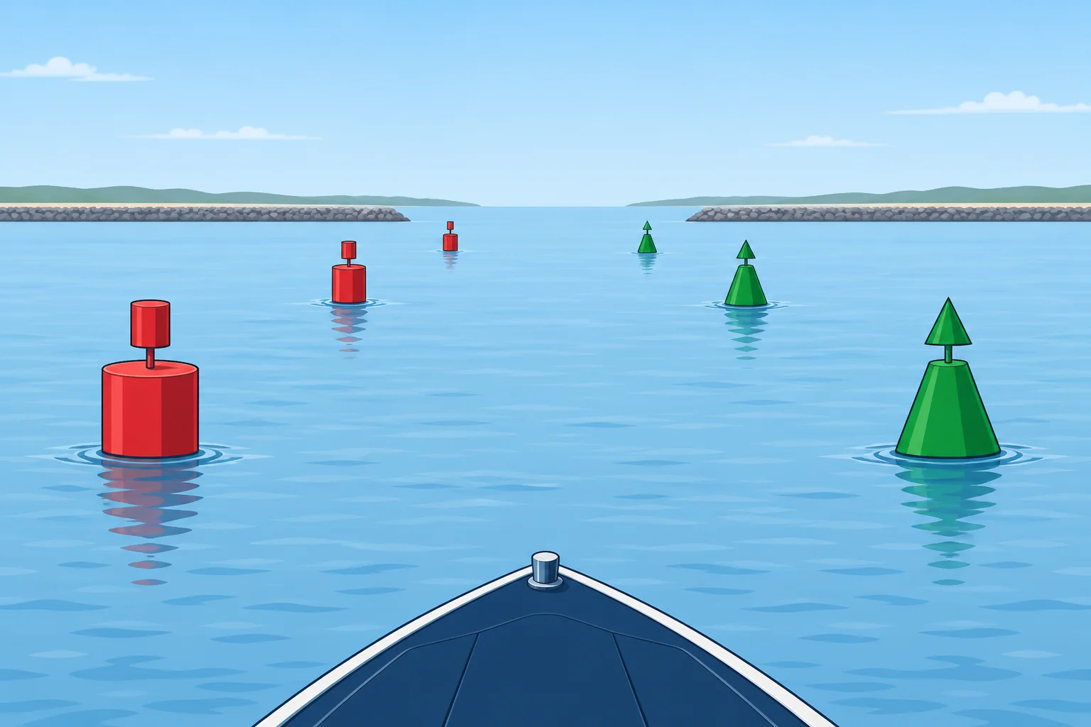
Region A
- Europe — every Atlantic, Mediterranean, Baltic and Black Sea coast
- Africa — the whole continent, Atlantic, Mediterranean and Indian Ocean coasts alike
- The Middle East and the Gulf
- India, and the rest of South Asia
- Most of East and South-East Asia
- Australia and New Zealand
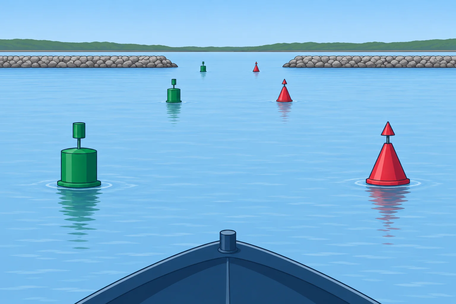
Region B
- The United States and Canada
- Mexico, Central America and the Caribbean
- South America — the whole continent
- Japan
- South Korea
- Taiwan
- The Philippines
IALA Region A and Region B — what A vs B actually changes
Region A vs Region B — side-by-side
- 1IALA Lateral Marks (Region A & B)Channel edges — the marks Region A and B disagree on.
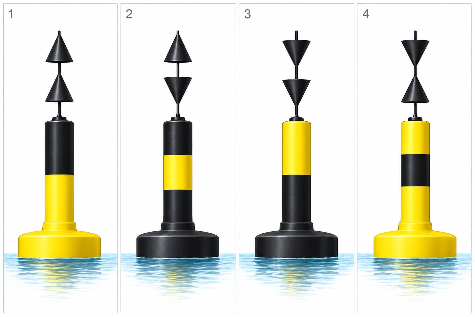 2IALA Cardinal MarksBlack-and-yellow marks plus topmarks — the side of the danger that is safe to pass.
 3IALA Isolated Danger MarksBlack with one or more red bands, two black spheres on top — water all around.
 4IALA Safe Water MarksRed and white vertical stripes — landfall and mid-channel.
 5IALA Special MarksA special mark may also identify a dangerous floating object as a MAtoN
 6IALA Emergency Wreck Marking BuoyMarks new dangers, including wrecks
The IALA Maritime Buoyage System, in plain English
IALA regions around the world
Region A
Europe, Africa, most of Asia, Australia and New Zealand
Region B
The Americas, Japan, South Korea, Taiwan and the Philippines
Check local charts
Study overview. Greenland and Guam use Region A. Grey areas are left unclassified; check local charts for island and territorial exceptions.
East Asia and the western Pacific
- Japan (B)
- South Korea (B)
- Taiwan (B)
- Philippines (B)
- Guam (A)
Sources
North Korea is left unclassified because the IALA and NGA references disagree. Pacific islands without verified assignments are also grey.
The IALA Maritime Buoyage System harmonises fixed and floating aids to navigation. The current R1001 recommendation is edition 2.0, June 2023. IALA became an intergovernmental organisation on 22 August 2024.
This site covers lateral, cardinal, isolated danger, safe water, special and emergency wreck marks. R1001 also covers other aids, including lighthouses. Special marks can include mobile aids marking dangerous floating objects; emergency wreck buoys can mark new dangers beyond wrecks.
The lateral colours change: in Region A, port-hand marks are red and starboard-hand marks green; in Region B, port is green and starboard red, following the conventional direction of buoyage. The other mark families use the same system in both regions.
Region A vs Region B — what actually changes
| Aspect | Region A | Region B |
|---|---|---|
| Port-hand mark colour | Red (can shape) | Green (can shape) |
| Starboard-hand mark colour | Green (cone shape) | Red (cone shape) |
| Memory aid | "Red right going TO sea" | "Red right returning from sea" |
| Cardinal marks | Identical — same colours, same topmarks, same lights | Identical — same colours, same topmarks, same lights |
| Isolated danger / safe water / special / wreck marks | Identical worldwide | Identical worldwide |
| Countries (examples) | UK, Spain, France, Italy, Greece, India, Australia, South Africa | USA, Canada, Mexico, Brazil, Japan, South Korea, Philippines |