

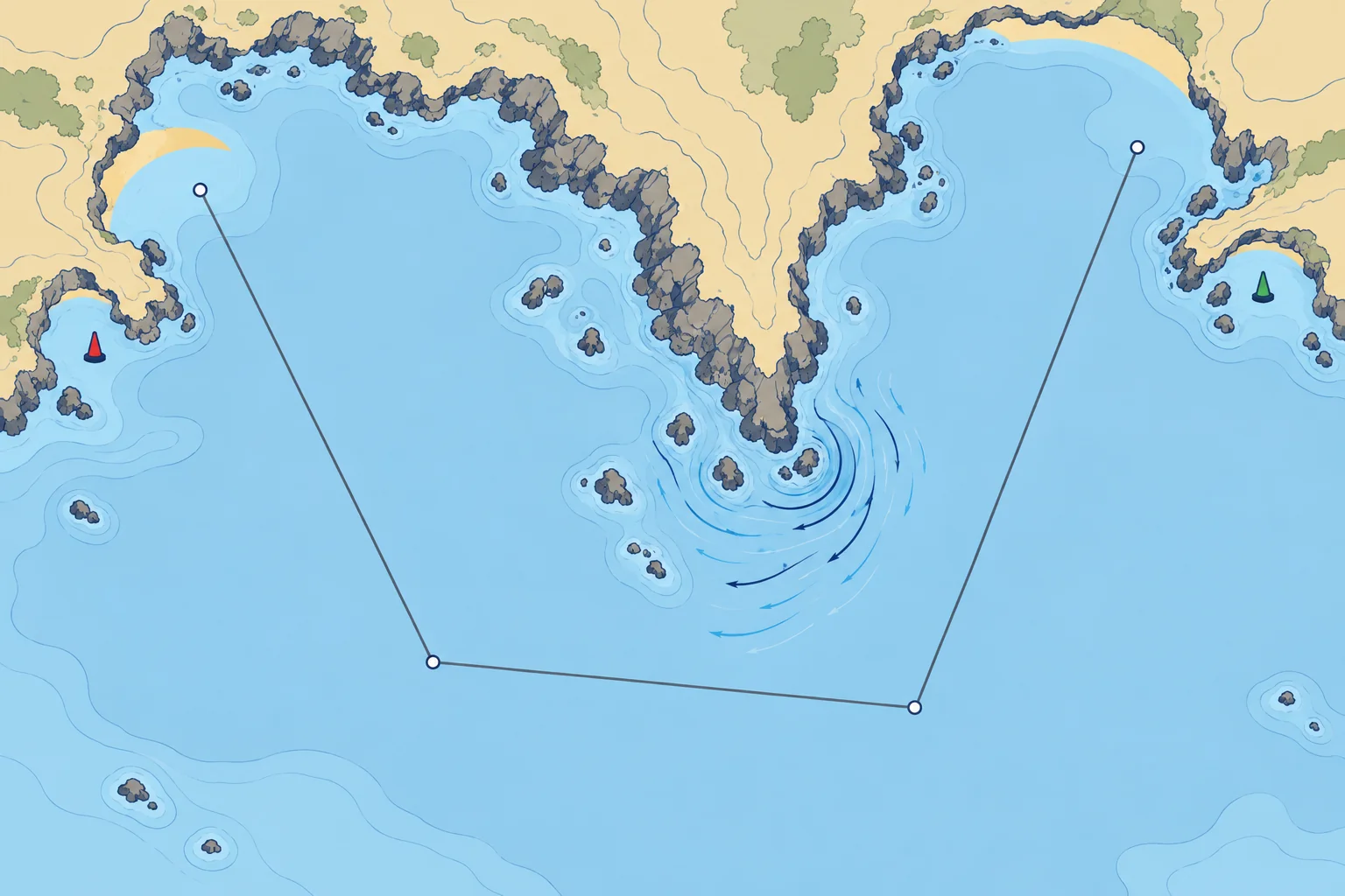
Plan: the route, the timings and the way out
1The lesson in plain words
Draw the route berth to berth with safe margins, time it around the tidal gates, choose your bolt-holes and abort points, write it down and tell someone ashore.
Draw the route
Draw the route on the chart, berth to berth and leg by leg. Keep a clearance margin from every danger, larger at night, in poor visibility, over poorly surveyed areas and wherever the wind or stream could push you towards it. Mark no-go areas clearly. Allow for tide height, water below the keel and overhead clearance. Check every planned leg against the chart, including the departure and arrival approaches.
Timing and tidal gates
A tidal gate is a place you can only pass safely at certain states of the tide: a headland with strong streams, a bar, a lock or a shallow channel. Work the timing backwards from the gates: when must you be there, so when must you leave? Use a realistic average speed over the ground (speed relative to the seabed), allowing for streams, and add a time margin.
Bolt-holes and abort points
Mark ports of refuge, or bolt-holes: places you can enter in the expected wind and tide, by day or night. Note their limits: a harbour with a bar can be dangerous to enter in strong onshore winds. Choose abort points, positions or times where you will turn back or divert if you are late or conditions are worse than planned.
Arrival and the night
Prepare the pilotage for departure and arrival: marks, transits and clearing bearings (the Pilotage unit shows how). On a night passage, list the lights you expect to see and roughly when. Note the VHF channels of ports and the coastguard, and where you will meet heavy traffic.
Write it down and tell someone
Put the plan where the crew can see it: legs with courses and distances, the waypoint list, tide times, gates, refuges, ETA (estimated time of arrival) at each gate and port and VHF channels. Leave the plan with a responsible person ashore, and agree when they should call the coastguard if you have not arrived. Some coastguards also offer free voluntary registration or route-sharing apps; use them where they exist.
2Key data
- Planning speed
- Realistic average speed over the ground, allowing for the stream
- Work back from
- The tidal gates: when you must be there
- Clearance margin
- Larger at night, in poor visibility and over old surveys
- Refuge test
- Can you enter it in the expected wind, tide and darkness?
- Shore contact
- Knows the plan, the ETA and when to call the coastguard
3Key points
- 1
Draw the route berth to berth with clear margins from every danger.
- 2
Time the passage backwards from the tidal gates, at a realistic speed.
- 3
Choose bolt-holes you can enter in the expected conditions, and set abort points.
- 4
Prepare the pilotage and the night lights before you leave.
- 5
Write the plan down and leave it with someone ashore who knows when to raise the alarm.
4Frequent mistakes
Wrong: Choose a departure time without checking the tidal gates.
Right: Check that your arrival falls within each gate’s safe window. Work backwards when a gate determines your departure time.
Wrong: Any harbour on the route counts as a refuge.
Right: A refuge must be safe to enter in the conditions you expect. A bar harbour in an onshore gale is a trap.
Wrong: Tell someone ashore you are going sailing.
Right: Give them the route, the ETA and a clear time at which to call the coastguard if you have not checked in.
5Practice case & exam keys
A headland is 18 M away. Its safe tidal window is 1200–1400. Your planned average speed over the ground is 5 kn (knots). A refuge 6 M short of it is usable today. You can leave at 0900 or 1100. Allow 30 minutes for delay. Which departure works, and what will trigger a diversion?
Show the answer
At 5 kn over the ground, 18 M takes 3 h 36 min. Leaving at 0900 gives an ETA of 1236, or 1306 with the delay margin. Leaving at 1100 gives 1436, outside the window. Choose 0900. Before leaving, set a decision point before the refuge: if your updated headland ETA plus 30 minutes exceeds 1400, divert while the refuge remains reachable.
Exam keys
- Route berth to berth with margins; no-go areas marked; waypoints checked against the chart.
- Tidal gate: plan the timing back from it at a realistic speed plus margin.
- Ports of refuge must be usable in the expected conditions; set abort points.
- Written plan aboard; plan and ETA with a shore contact who knows when to raise the alarm.
Finish this unit
When you've read it, match the terms, then answer three questions. Get them all right to finish the unit; opening the page alone doesn't count.
My notes for this unit
No notes