

Plotting the position line
1The lesson in plain words
Plot the AP, lay off the intercept, draw the line at right angles and label it with the time. Then judge what one line can and cannot tell you.
The sheet
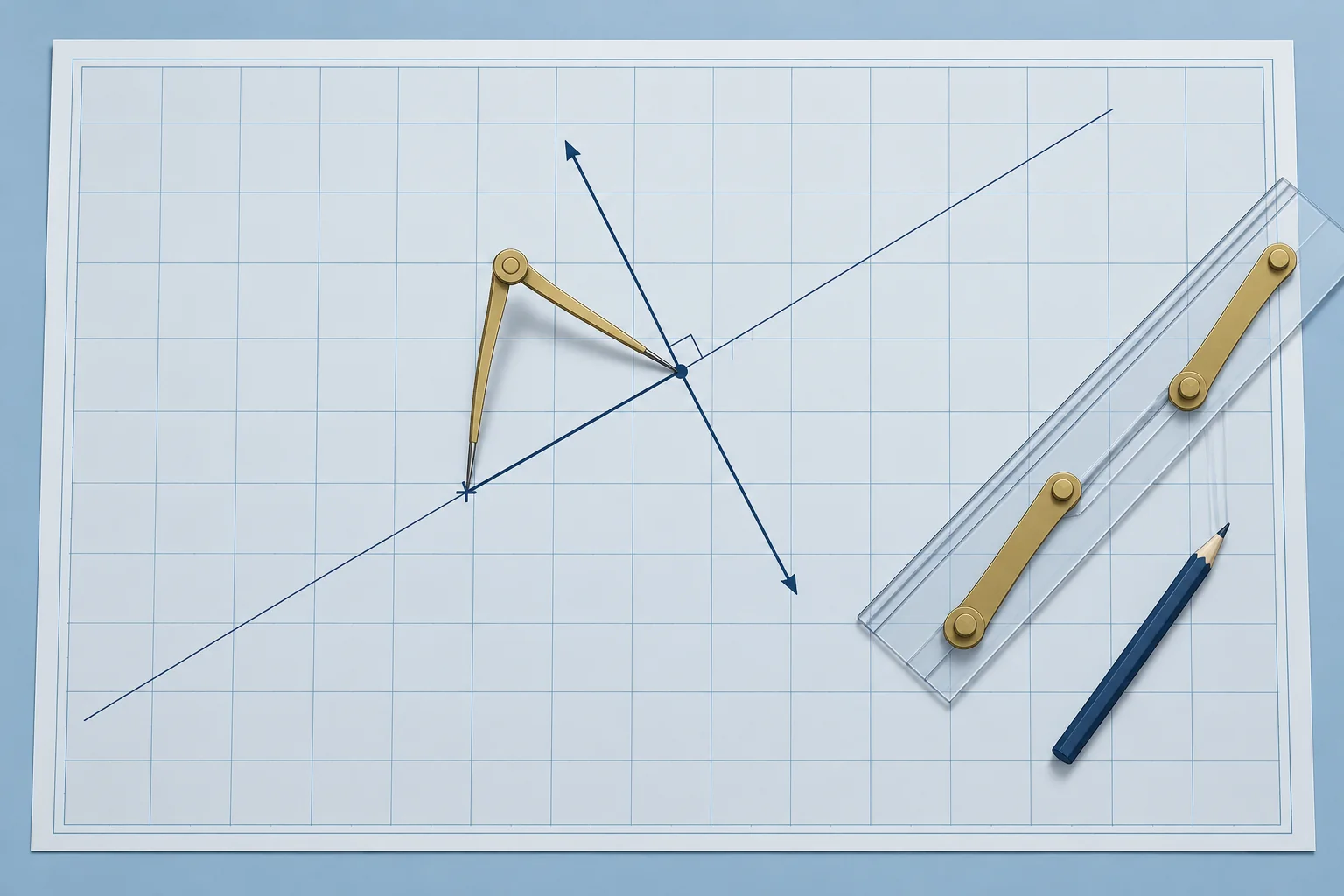
Ocean charts are small scale, so you plot on a plotting sheet: a blank Mercator grid. On a universal plotting sheet, you draw the meridians for your own latitude. Mark the AP from the worked sight: 17°00′N 038°08.1′W. Measure distances on the latitude scale, as on any Mercator chart.
Lay off and draw
From the AP, draw a light line along the azimuth, 133.6°T. Measure 22.0 M along it, towards the Sun. At that point, draw the position line at right angles to the azimuth: along 043.6°–223.6°. Label it with the time, 1142 UT, and the body.
What one line tells you
One line is not a fix. A line from a body bearing near 090° or 270° runs north–south and checks your longitude. A line from a body near 000° or 180° runs east–west and gives your latitude. This line, from 133.6°, checks your position along the south-east to north-west direction.
Errors
Each error moves the line. One minute of error in Ho moves it 1 M towards or away. A timing error moves it east or west: 4 s of time is 1′ of longitude. A hazy horizon or a big swell makes the altitude less certain. A good Sun sight may place the line within a few miles of your position; poor conditions can give much larger errors.
One line, best position
Without a second line, take the estimated position (EP) as the point on the line nearest your DR: the foot of a perpendicular from the DR. Carry the DR on from there. Before crossing a later sight, transfer this line to that sight’s time (next part).
2Key data
- Lay off
- Intercept along Zn if towards, along the reciprocal if away
- Draw
- Position line at 90° to Zn; label it with UT and body
- Worked
- AP 17°00′N 038°08.1′W; 22.0 M towards 133.6°; line 043.6°–223.6°
- Altitude error
- 1′ in Ho moves the line 1 M along Zn
- Timing error
- 4 s of UT moves the line 1′ of longitude east or west
- One line only
- EP: the foot of the perpendicular from the DR
3Key points
- 1
Plot on a plotting sheet or large-scale ocean chart; measure on the latitude scale.
- 2
Lay off the intercept along Zn or its reciprocal; draw the line at 90° and label it with UT.
- 3
A body near east or west checks longitude; a body near north or south gives latitude.
- 4
With one line, use the point on it nearest the DR as your EP.
4Frequent mistakes
Wrong: Measure the intercept on the longitude scale at the top of the sheet.
Right: Use the latitude scale, as for any Mercator distance. Away from the equator the longitude scale is shorter.
Wrong: A single Sun line is a fix if it passes close to the DR.
Right: One line constrains your position across the line but leaves your position along it unknown. You need another suitably crossing line, observed at the same time or transferred, for a fix.
5Practice case & exam keys
At 1142 UT your DR is 16°40′N 038°20′W. The Sun line passes 16.5 M from it, in the direction 133.3°. No other body is in sight. What position do you use, and what do you do next?
Show the answer
Use the estimated position on the line: from the DR, 16.5 M along 133.3°, the foot of the perpendicular. Carry the DR on from there, but remember it is one line, not a fix. For a later Sun sight or noon latitude, first transfer this line by the intervening ground run (next part).
Exam keys
- Plot: AP, azimuth line, intercept towards or away, position line at 90°, label with UT.
- Distances on the latitude scale; plotting sheets for ocean work.
- East–west body → longitude line; north–south body → latitude line.
- One line: EP at the foot of the perpendicular from the DR.
Finish this unit
When you've read it, answer three questions. Get all three right to finish the unit; opening the page alone doesn't count.
My notes for this unit
No notes