

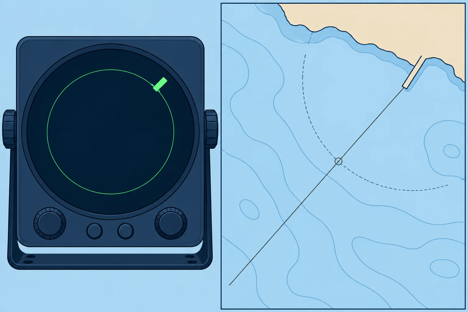
Bearing and range, and bearing with a depth contour
1The lesson in plain words
One object can fix you if you know both its bearing and your distance from it. A clear depth contour can serve as the second line.
One object, two lines
A bearing gives a straight line through an object; a range, your distance from it, gives a circle around it. They cross at right angles. Choose the crossing on the reciprocal bearing (the opposite direction) from the object: if it bears 030°T from you, you bear 210°T from it. Spanish courses call this a fix by demora y distancia.
Ranges by radar
Radar generally measures range more accurately than bearing because its beam spreads echoes sideways. Combine a compass bearing and radar range to the same identifiable point. Multiple radar ranges can give an excellent fix when their circles cross at good angles. Measure to a steep, clearly charted feature such as a cliff or a pier head, not a low beach whose edge moves with the tide.
Other ranges
A plotter gives the range and bearing to a waypoint on a charted object. That is quick, but it comes from the same global navigation satellite system (GNSS) receiver, so it cannot independently check that receiver’s position.
Bearing and depth contour
Where the seabed slopes clearly, a depth contour can be the second line. If your echo sounder shows depth below the transducer (the sounder’s underwater sensor), add its depth below the waterline, then subtract the height of tide (how far the water is above chart datum). That gives the charted depth. Where the bearing crosses that contour, you are. The Tides unit shows how to find the height of tide.
When contours fail
A flat or irregular seabed gives no usable contour, and a bearing may cross the same contour several times. Use contours only where they are steep and distinct, and check the result with the next sounding.
2Key data
- Bearing and range
- Lines cross at 90° on one object
- Radar
- Ranges accurate; bearings less precise
- Charted depth
- Reading below transducer + transducer depth − height of tide
- Spanish terms
- Demora y distancia; situación por veriles
3Key points
- 1
A bearing and a range of one object cross at right angles: a strong fix.
- 2
Radar ranges are accurate; radar bearings are less precise.
- 3
Reduce a sounding to charted depth before matching it to a contour.
- 4
Use depth contours only where the seabed slopes clearly.
4Frequent mistakes
Wrong: Radar bearings are as good as radar ranges.
Right: The radar beam spreads an echo sideways. Trust ranges more than bearings.
Wrong: Compare the sounder reading straight with the charted depth.
Right: Allow for the transducer depth and subtract the height of tide first.
Wrong: A GNSS range to a waypoint checks the GNSS.
Right: It comes from the same receiver. Check with an independent line: a compass bearing, a radar range or the depth.
5Practice case & exam keys
A pier bears 030°T, already corrected, at a radar range of 2.4 M. The sounder reads 15.2 m below a transducer 0.4 m deep; tide height is 2.6 m. The chart at your plotted fix shows 6 m. Do you accept it?
Show the answer
No. The reduced sounding is 15.2 + 0.4 − 2.6 = 13.0 m, which conflicts with 6 m on the chart. Check the pier’s identity, measurements, plotting and sounder reference before accepting the fix or closing danger.
Exam keys
- Bearing and range of one object: the lines cross at 90°.
- A radar range is more accurate than a radar bearing.
- Charted depth = reading below transducer + transducer depth − height of tide.
- Depth contours work only where the seabed slope is steep and distinct.
Finish this unit
When you've read it, match the terms, then answer three questions. Get them all right to finish the unit; opening the page alone doesn't count.
My notes for this unit
No notes