

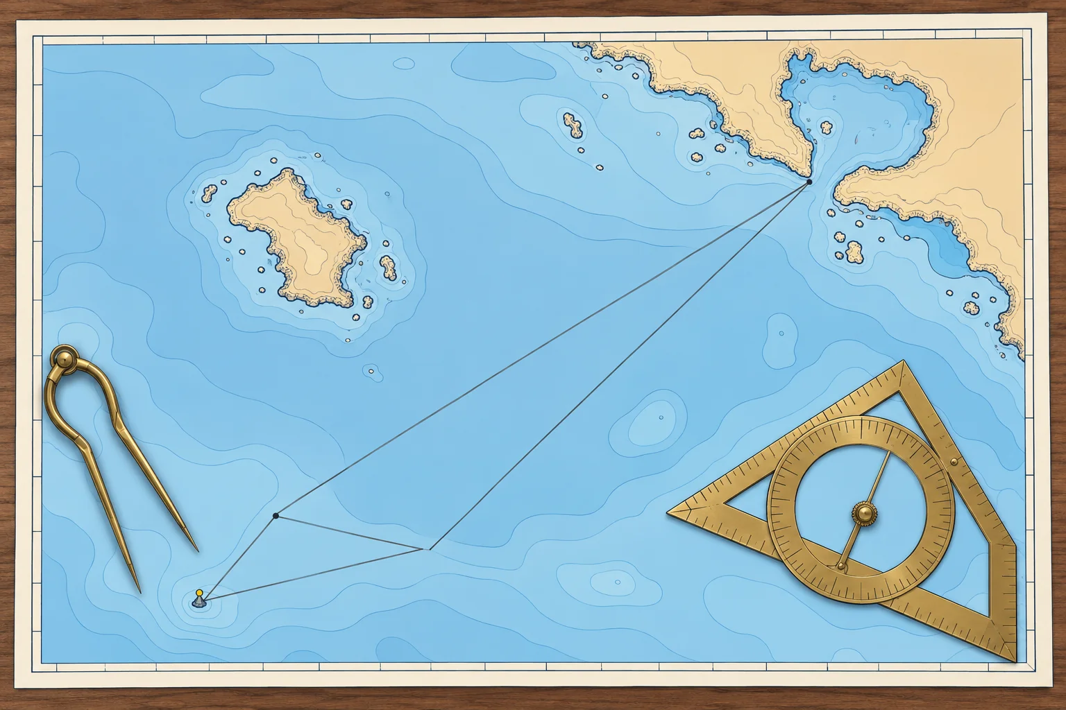
Course to steer: the vector triangle
1The lesson in plain words
To follow a straight line over the ground through a cross-stream, aim up-stream of it. A vector triangle tells you how far, and your speed over the ground.
Why you need it
With a steady cross-stream, holding your initial heading towards the destination gives a displaced straight ground track. If you keep turning the bow towards the destination, your ground track curves down-stream. A course to steer (CTS) offsets the stream so you can follow the planned ground track.
The triangle
A vector is an arrow showing direction and distance. Three vectors form the triangle: the stream, your movement through the water and your movement over the ground, all for the same time. You know the ground-track direction, the stream and your STW. The triangle gives the water-track direction and the distance made good, which gives your SOG.
One hour or more
Use a one-hour triangle for a short leg with a steady stream. For a longer crossing, estimate the duration. Lay off each hour's stream end to end, including any partial hour, then STW × total time. Adjust the trial duration until the cut reaches the destination. This gives one water track for the crossing, but changing streams can carry you off the straight line. Check intermediate positions and clearance. Use hourly courses if you must hold the planned line. This method does not guarantee the shortest passage.
Leeway and compass last
The triangle gives a water track. If you make leeway, steer that many degrees into the wind (towards it), so the leeway brings you back onto the water track. Then convert from true to magnetic and compass (Compass course unit; /navigation/compass-course also has a calculator for this triangle).
Check it is possible
If the stream's component across your track is faster than your STW, no heading can hold the track. A strong foul stream (one running against you) can leave you with little or no progress. Then choose another time, another route or a nearer destination.
2Step by step
Plotting a one-hour course to steer
- 1
Draw the ground track from start A through destination B and beyond.
This is the line you want over the seabed, checked clear of dangers.
- 2
From A, lay off one hour of stream (set and rate) to point C; mark it with three arrowheads.
C is where the water alone would carry you in that hour.
- 3
Open the dividers to one hour of STW on the latitude scale and, from C, cut the ground track at D.
CD is the boat's movement through the water in the same hour.
- 4
Measure the direction of CD and mark it with one arrowhead.
This is the water track to steer, before leeway.
- 5
Measure AD: that distance is your SOG. Divide the distance to B by it for the time.
SOG, not STW, gives a true ETA.
- 6
Apply leeway into the wind, then variation and deviation; give the helm a compass course.
The helm steers a compass heading, not a true water track.
3Key data
- One-hour triangle
- 1 h of stream + 1 h of STW; AD = SOG
- Several hours
- Hourly streams end to end, then STW × number of hours
- Leeway
- Steer into the wind by the leeway angle
- Order of corrections
- Stream → leeway → variation → deviation
4Key points
- 1
Aim up-stream; continually pointing the bow at the destination gives a curved track down-stream.
- 2
Draw the STW vector from the end of the stream vector, to cut the ground track.
- 3
Distance made good in one hour is your SOG; use it for the ETA.
- 4
Apply leeway into the wind after the triangle, then the compass corrections.
5Frequent mistakes
Wrong: Draw the boat's speed from the start position A.
Right: Draw it from C, the end of the stream vector, so it cuts the ground track.
Wrong: Apply leeway downwind of the water track.
Right: Leeway already pushes you downwind. Steer into the wind so you end up on the water track.
Wrong: Work out the ETA from STW.
Right: Use SOG, the distance made good along the ground track per hour.
6Practice case & exam keys
You plan a 3-hour crossing at 5.0 kn STW. The streams are: first hour 200°T 1.0 kn, second hour 220°T 1.5 kn, third hour 240°T 1.0 kn. How do you plot one water track for the crossing? Will this keep you on the straight ground track?
Show the answer
Lay off 1.0 M on 200°T, 1.5 M on 220°T and 1.0 M on 240°T end to end from A. From the last endpoint, use a 15 M radius to cut the ground-track line at D. The joining vector gives your water track. AD ÷ 3 gives average SOG. Check that D reaches the destination in the assumed three hours; otherwise revise the duration and streams. The ground path may curve; check intermediate positions for clearance. Then apply leeway and compass corrections.
Exam keys
- Triangle: stream from A to C, STW from C to cut the track at D, CD = water track.
- AD in one hour = SOG; ETA = distance ÷ SOG.
- Several hours: streams end to end, then STW × hours.
- Leeway into the wind, then variation and deviation.
Finish this unit
When you've read it, match the terms, then answer three questions. Get them all right to finish the unit; opening the page alone doesn't count.
My notes for this unit
No notes