

Tidal diamonds and tidal stream atlases
1The lesson in plain words
Charts and atlases give the stream hour by hour, counted from high water at a standard port. Learn to read both and to pick the right hour.
Tidal streams
A tidal stream is the tide’s horizontal flow; tidal heights are covered in the Tides unit. Flood and ebb name the two main stream phases, usually incoming and outgoing in an estuary. Slack water, where it occurs, means little or no stream, usually near reversal. Stream phases need not match the local rise and fall. Find slack timing from local stream predictions, not simply high water (HW) or low water (LW).
Tidal diamonds
On many charts, a tidal diamond is a letter in a magenta diamond. Its table gives the set (direction the water flows towards, in degrees true) and rates (speeds in knots) at mean springs (larger-range tides) and mean neaps (smaller-range tides). Rows run from six hours before to six hours after HW at a named standard port, the reference port for the table.
Picking the hour
Check the tide table’s time basis. Convert HW and your passage time to the same zone, using the full UTC (Coordinated Universal Time) offset, including daylight saving. Look up HW at the standard port named in the stream table. Each row covers half an hour either side of its time. With HW at 1340, the HW+3 row applies from 1610 to 1710.
Tidal stream atlases
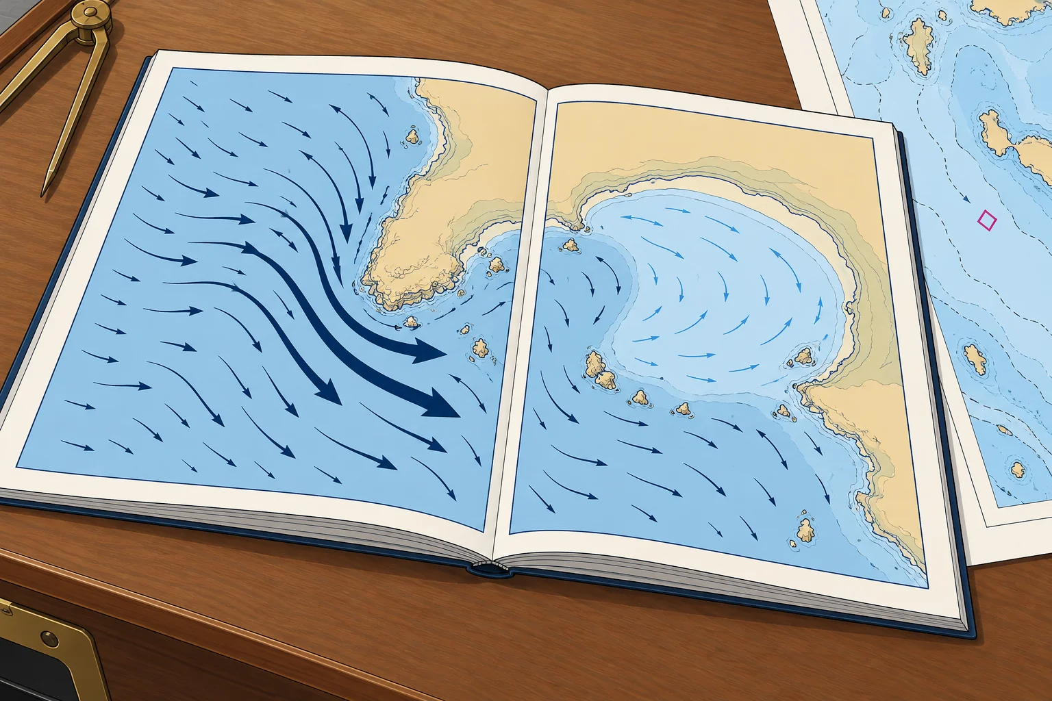
A tidal stream atlas has one page per hour, from HW−6 to HW+6 at its standard port. Arrows show the direction: thick, dark arrows for strong streams, thin ones for weak. Figures give rates in tenths of a knot, neaps first: 08,15 means 0.8 kn at neaps and 1.5 kn at springs. The comma marks the spot the figures refer to.
Other sources
Almanacs reproduce atlas pages, pilot books describe local streams in words, and plotters and apps show modelled streams. Use the source with the best detail for your area and cross-check unusual figures. In much of the Mediterranean tidal streams are weak, but currents still matter: the Strait of Gibraltar has a near-permanent east-going surface current with tidal streams on top.
2Key data
- Diamond table
- Set °T; spring and neap rates (kn); HW−6 to HW+6
- Times refer to
- HW at the standard port named in the table or atlas
- Each hourly row
- From 30 min before to 30 min after its time
- Atlas figures 08,15
- Neaps 0.8 kn, springs 1.5 kn (tenths of a knot)
- Set and rate
- Set: direction towards, °T. Rate: speed, kn.
3Key points
- 1
Diamond tables give set (°T) and spring and neap rates for each hour from HW−6 to HW+6.
- 2
Times count from HW at the named standard port, in the right time zone.
- 3
Each hourly row covers half an hour either side of its time.
- 4
Atlas figures are tenths of a knot, neaps first: 08,15 = 0.8 and 1.5 kn.
4Frequent mistakes
Wrong: The HW+3 row runs from HW+3 to HW+4.
Right: It is centred on HW+3: it runs from HW+2½ to HW+3½.
Wrong: In the atlas, the first figure is the spring rate.
Right: Neaps come first: in 12,25 the neap rate is 1.2 kn and the spring rate 2.5 kn.
Wrong: Slack water is always at high and low water.
Right: Slack means little or no stream. Its timing varies locally and need not coincide with HW or LW. Check local stream predictions.
5Practice case & exam keys
HW at the named standard port is 0915 UTC. Your watch is UTC+2. You pass diamond F at 1410 watch time. A crew member selects HW+5. Which row do you use?
Show the answer
1410 watch time is 1210 UTC, 2 h 55 min after HW. Use HW+3, covering 1145–1245 UTC. HW+5 mixes time zones. Read the set and rates from HW+3.
Exam keys
- Diamond table: set °T, spring and neap rates, HW−6 to HW+6 at a standard port.
- Hour rows are centred: HW+3 covers HW+2½ to HW+3½.
- Atlas: tenths of a knot, neap rate first, then spring.
- Slack water need not coincide with HW or LW.
Finish this unit
When you've read it, match the terms, then answer three questions. Get them all right to finish the unit; opening the page alone doesn't count.
My notes for this unit
No notes