

Limits of the method, and Mercator sailing
1The lesson in plain words
Mid-latitude sailing is often adequate for a few hundred miles. Check its accuracy; use Mercator sailing for exact rhumb-line work on a spherical Earth model.
Distance
Plane and mid-latitude sailing treat a curved surface as flat. Bowditch notes that plane sailing is not meant for more than a few hundred miles. In ordinary latitudes, this approximation is often adequate for runs of a few hundred miles; check whether its accuracy suits your task. Over longer passages, split the route into legs or use Mercator sailing.
Crossing the equator
For an equator-crossing calculation, work one leg to the equator and another beyond it. A mean latitude of 0° does not mean the whole route follows the equator. Bowditch gives the same separate-leg advice. Corrected-mean-latitude tables exist, but Bowditch warns they can add as much error as they remove.
High latitudes
Near a pole, the same latitude span produces a larger fractional change in cos latitude. Using one mean latitude can therefore give a larger longitude error on a slanting leg. Check the latitude span and accuracy required; there is no universal 60° cutoff. Prefer Mercator sailing when the approximation is inadequate.
Mercator sailing
Mercator sailing gives the exact rhumb-line result on a spherical Earth model. Meridional parts give the chart distance from the equator to a latitude, in units of one longitude minute at the equator. DMP means difference of meridional parts. With d.long in minutes, tan C = d.long ÷ DMP, then d = d.lat ÷ cos C. Use magnitudes and name the quadrant from d.lat and d.long. For due east–west courses, use parallel sailing instead.
Rhumb line or great circle
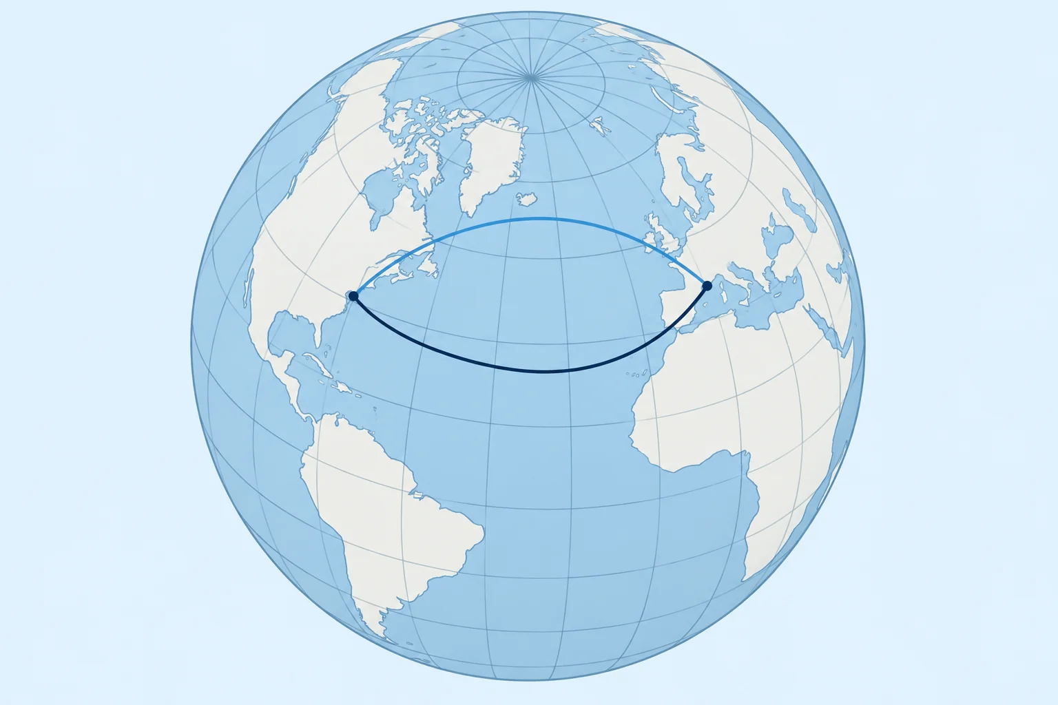
A rhumb line keeps a constant true course. A great-circle arc is the shortest path on a sphere; the routes coincide along a meridian or the equator. See the great-circle unit.
2Key data
- Plane and mid-latitude sailing
- Up to a few hundred miles, ordinary latitudes
- Crossing the equator
- Work each side as a separate leg
- Mercator sailing
- tan C = d.long ÷ DMP; d = d.lat ÷ cos C; E–W: parallel sailing
- Meridional parts
- Use spherical meridional parts with the formulas shown here
- Shortest route
- Great-circle arc; a rhumb line can coincide with it
3Key points
- 1
Mid-latitude sailing is often adequate for a few hundred miles; check the accuracy you need.
- 2
Split a rhumb line that crosses the equator into two legs.
- 3
Mercator sailing with meridional parts gives the exact rhumb line on a spherical Earth model.
- 4
A great-circle arc is shortest; a rhumb line coincides along a meridian or the equator.
4Frequent mistakes
Wrong: Use a mean latitude of 0° for a leg from 5°N to 5°S.
Right: Split the leg at the equator, or use Mercator sailing.
Wrong: Assume the rhumb line is the shortest route.
Right: A great-circle arc is never longer; the routes coincide along a meridian or the equator.
Wrong: Divide d.long by d.lat in Mercator sailing.
Right: Use tan C = d.long ÷ DMP, where DMP means difference of meridional parts.
5Practice case & exam keys
You plan a rhumb-line passage of about 1,142 M from 50°N 005°W to 41°N 029°W. A crew member uses one mid-latitude calculation. What do you advise?
Show the answer
Use Mercator sailing, or divide the same rhumb line into shorter legs. One mid-latitude calculation is an approximation over this distance. Choose the method against the accuracy you need. For a comparison with the shortest route, see the great-circle unit.
Exam keys
- Mid-latitude sailing: runs up to a few hundred miles, not across the equator, check accuracy in high latitudes.
- Equator crossing: two legs.
- Mercator: tan C = d.long ÷ DMP; exact on a spherical Earth model. Due E–W: parallel sailing.
- Rhumb line: constant course. Great-circle arc: shortest; routes can coincide on meridians or the equator.
Finish this unit
When you've read it, match the terms, then answer three questions. Get them all right to finish the unit; opening the page alone doesn't count.
My notes for this unit
No notes