
Ocean, tides and environment · Level R4 · 4 parts · about 12 min
Ocean currents (the main Atlantic currents), waves and swell
4 short parts: What drives them · Atlantic currents · Wind waves · Rogue & steep seas. Each part explains the idea, then gives the points to remember, the common mistakes, a worked case and a practice question; the Academy unit adds all 24 check questions.
1 · What drives them
What drives ocean currents
Steady winds push the sea surface, the Earth’s rotation turns that flow aside, and continents close the loop into huge gyres.
Wind first
An ocean current is a flow of seawater. Most large surface currents are driven by wind stress: the drag of wind on the sea surface. Steady winds, such as the trade winds and westerlies, help maintain these flows. Their strength and direction can vary with location and season.
Coriolis and Ekman
Earth’s rotation deflects moving water right in the northern hemisphere and left in the southern. This is the Coriolis effect. In the ideal Ekman model, surface water moves about 45° right of the wind in the north. Ekman transport, the net movement summed through the wind-driven layer, is about 90° right. Actual surface currents also depend on mixing, coasts, density structure and sea-surface slopes.
Gyres
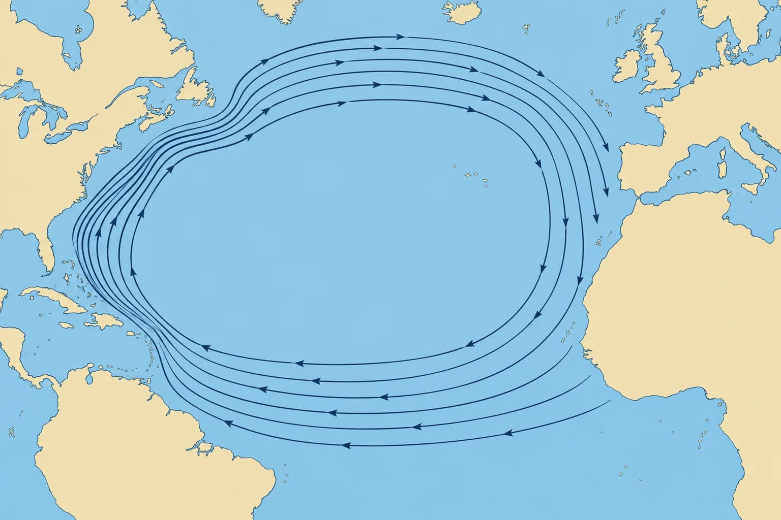
The trade winds blow from the east in the tropics and the westerlies from the west further north. Turned by Coriolis and blocked by continents, the water forms a huge loop called a gyre. In the North Atlantic the subtropical gyre turns clockwise, round a dome of warm water near the Sargasso Sea; southern-hemisphere subtropical gyres turn anticlockwise.
Western intensification
The North Atlantic subtropical gyre is not symmetrical. Its western side, along North America, is narrow, deep and fast; its eastern side, off Europe and Africa, is broad, shallow and slow. That is why the Gulf Stream runs at several knots while the Canary Current off Africa is usually much slower.
Density and naming
Differences in temperature and saltiness also move water. Cold, salty water sinks in the far North Atlantic and spreads slowly at depth, the thermohaline circulation. This deep flow mainly affects climate; use surface-current information for your passage. A current’s set is the direction it flows towards: a current setting 090° flows east. Winds are named for where they come from.
Key figures
- Coriolis deflection
- To the right in the northern hemisphere, left in the southern
- Surface current vs wind
- Ideal model: about 45° right of the wind (northern hemisphere)
- Ekman transport
- Net through wind-driven layer: about 90° right (northern hemisphere)
- North Atlantic subtropical gyre
- Turns clockwise
- Current direction
- Named for where it flows to (its set)
Remember
- Steady winds drive most surface ocean currents.
- Coriolis turns moving water to the right in the northern hemisphere.
- Ekman transport sums movement through the wind-driven layer: about 90° right of the wind in the north.
- The North Atlantic subtropical gyre turns clockwise; its western side is the fastest.
- A current’s set is where it flows towards; a wind is named for where it comes from.
Common mistakes
Wrong: Surface water flows straight downwind.
Right: In the ideal Ekman model, northern-hemisphere surface flow is about 45° right of the wind. Net transport through the wind-driven layer is about 90° right. Actual surface flow varies.
Wrong: A current setting north comes from the north.
Right: A current setting north flows towards the north. A northerly wind comes from the north.
Worked case
Offshore in the North Atlantic, a steady northerly has blown for several days. A crewmate uses the ideal 90° Ekman transport direction as your surface current’s set. Is that justified?
Show the answer
No. Ideal net transport is west, 90° right of the southward wind. Ideal surface flow is south-west, about 45° right. Neither is an observed set: mixing, density structure and sea-surface slopes also affect the actual surface current.
Practice question
What mainly drives the large surface currents of the oceans?
- The tide-raising force of the Moon
- Steady winds blowing over the sea
- Rivers flowing into the oceans
- Heat rising from the seabed
Show the answer
Answer: B. Trade winds and westerlies drag the surface day after day; Coriolis and the continents shape the flow.
2 · Atlantic currents
The main North Atlantic currents
The North Atlantic gyre combines fast western currents with slower eastern currents. Use pilot charts for typical rates and recent analyses for changes.
The loop
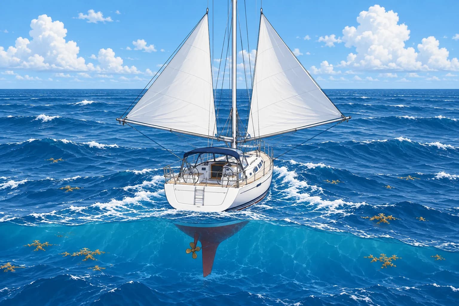
Follow the clockwise subtropical loop: North Equatorial Current west towards the Caribbean; Florida Current and Gulf Stream north and north-east; an eastward return through the Azores Current, south of the Azores; then Canary Current south-west towards the tropics. The North Atlantic Current branches north-east from the Gulf Stream system towards northern Europe.
Gulf Stream
According to NOAA, the Gulf Stream averages about 3.5 knots, reaching about 5 knots at the surface in its core. It is about 100 km wide. Further north it widens, meanders and slows to under 1 knot. It also sheds warm and cold eddies—rotating patches of water that can change current direction and speed.
The eastern side
The North Atlantic Current carries water north-east towards Europe in several branches; speed varies by branch and location. The Azores Current, south of the Azores, averages only about 0.2 knots, with faster jets. The Canary Current flows south-west along Africa and the Canaries at about 0.2–0.6 knots. The North Equatorial Current, between about 10° and 20° N, sets west at only about 0.2–0.3 knots on average, helped by the trade winds.
Using currents on passage
The classic trade-wind route from the Canaries to the Caribbean uses the Canary and North Equatorial Currents and the trade winds together. Returning, yachts sail north towards Bermuda and the Azores to use the westerlies. Pilot charts and routeing guides give average set (flow direction) and rate (speed) by month. Recent current analyses estimate the Gulf Stream’s path and eddies; check their valid time.
Currents and your position
Set is the direction a current flows towards; drift, or rate, is its speed in knots. A 0.5-knot current carries you 12 nautical miles in 24 hours. Dead reckoning estimates your position from a known position using course, speed and elapsed time. Apply the current to your dead-reckoned position to obtain an estimated position. Compare this with your observed position: the actual current may differ from the monthly average.
Key figures
- Gulf Stream (NOAA)
- Average about 3.5 kn; core up to about 5 kn
- Gulf Stream width
- About 100 km
- North Atlantic Current
- North-east towards Europe; speed varies by branch and location
- Azores Current
- About 0.2 kn on average, with faster jets
- Canary Current
- About 0.2–0.6 kn, setting south-west
- Drift example
- 0.5 kn for 24 h = 12 nm
Remember
- Subtropical loop: North Equatorial → Florida/Gulf Stream → Azores → Canary. North Atlantic Current branches north-east.
- The Gulf Stream averages about 3.5 knots and reaches about 5 knots in its core.
- Eastern currents are slow: the Canary Current runs at about 0.2–0.6 knots.
- Use pilot charts for monthly averages and recent current analyses for changes; check each product’s valid time.
- Half a knot for a day is 12 nautical miles: allow for it.
Common mistakes
Wrong: The Gulf Stream is a steady river in a fixed place.
Right: It meanders and sheds eddies. Check a recent current analysis before you cross it.
Wrong: A current of half a knot is too small to matter offshore.
Right: Half a knot for 24 hours is 12 nautical miles. Apply the current to your dead-reckoned position to obtain an estimated position.
Worked case
Your south-west passage is 850 nm at 6 knots through the water. A pilot chart shows an average 0.4-knot following current. Your crew promises arrival nine hours earlier. Is that a sound promise?
Show the answer
It is a useful estimate, not a promise. A constant following current would give 6.4 knots over the ground: about 133 hours instead of 142. But the chart gives a monthly average. Check observed progress with satellite navigation (GNSS) and recent current information before relying on that arrival time.
Practice question
A pilot chart shows a monthly average following current of 0.5 kn. What should you conclude?
- Today’s rate is exactly 0.5 kn
- Actual flow may differ from it
- That rate must last all day
- Your speed through water rises
Show the answer
Answer: B. A monthly average describes typical conditions. Check observed progress and recent current information before relying on it.
3 · Wind waves
Wind waves, swell and wave height
Waves grow with wind speed, fetch and duration. Swell is old wind sea that has travelled away. Forecasts give significant wave height, not the biggest wave.
How waves grow
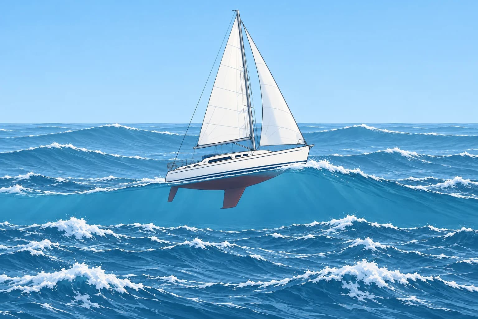
Wind waves grow with three things: wind speed, fetch (the distance of open water the wind blows over) and duration (how long it blows). Growth is limited when the wind is weak, the fetch is short or the duration is brief. Close to an upwind shore, short fetch can limit wave height even in strong wind. When fetch and duration are long enough, the sea is fully developed and grows no more for that wind speed.
Sea and swell
Wind sea is still driven by the local wind. It is usually shorter, steeper and less regular than swell. Swell is waves that have left the wind that made them. Swell is usually longer, smoother and more regular than local wind sea, and can cross an ocean. It may arrive from another direction, even after the generating wind has eased.
Period and length
Wave period is the time between two crests passing a point. Wavelength is the distance between successive crests. Here, deep water means depth greater than about half the wavelength. In deep water, wavelength in metres is about 1.56 × period², and crests travel at about 3 × period knots. A 10-second swell has crests about 156 m apart, moving at about 30 knots. Long-period swell carries energy far.
Significant wave height
Wave height is measured vertically from trough (lowest point) to crest (highest point). Significant wave height (Hs) is the average height of the highest third of the waves. Among about 1,000 waves, the likely highest is roughly 1.9 × Hs; the elapsed time depends on period. This is a statistical estimate, not an upper limit. With Hs of 3 m, that estimate is about 5.7 m.
Reading a wave forecast
Forecasts give the total Hs and often the wind sea and swell separately, each with its period and direction. Wave directions normally name where waves come from. Total Hs is not the sum: it is the square root of the sum of squares. Wind sea of 2.0 m with swell of 1.5 m gives √(4 + 2.25) = 2.5 m. Sea state words and the Beaufort table are in Meteorology.
Key figures
- Wave growth
- Wind speed, fetch and duration can each limit growth
- Deep-water wavelength
- About 1.56 × T² metres (T = period in seconds)
- Deep-water crest speed
- About 3 × T knots
- Significant wave height (Hs)
- Average height of the highest third of waves
- Likely highest of ~1,000 waves
- About 1.9 × Hs; statistical estimate, not an upper limit
- Total Hs
- √(wind sea² + swell²)
Remember
- Wave growth depends on wind speed, fetch and duration; short fetch or duration can limit it.
- Swell has left its generating wind: usually longer and more regular, and often from another direction.
- Hs is the average of the highest third of the waves.
- Among about 1,000 waves, the likely highest is roughly 1.9 × Hs; this is not an upper limit.
- Total Hs = √(sea² + swell²), not the sum.
Common mistakes
Wrong: A forecast Hs of 2 m means no wave will be higher than 2 m.
Right: Hs is an average of the highest third. Among about 1,000 waves, the likely highest is roughly 1.9 × Hs. Larger waves remain possible.
Wrong: Add wind sea and swell heights to get the total sea.
Right: Combine them as the square root of the sum of squares: 2 m and 1.5 m make 2.5 m, not 3.5 m.
Wrong: No wind means no waves.
Right: Swell from a distant storm can arrive in calm weather, and rear up at a harbour entrance.
Worked case
Your offshore forecast gives north-easterly wind sea of 1.5 m at 5 s and north-westerly swell of 2.0 m at 12 s. A crewmate says the total is 3.5 m and that height alone describes the sea. Do you agree?
Show the answer
No. Total Hs is √(1.5² + 2.0²) = 2.5 m. The likely highest among about 1,000 waves is roughly 4.8 m, not an upper limit. Height alone misses the short 5-second wind sea and the longer swell arriving from another direction. Read both systems’ heights, periods and directions.
Practice question
Which three factors decide how big wind waves grow?
- Wind speed, fetch and duration
- Tide, depth and air pressure
- Wind speed, tide and latitude
- Fetch, salinity and depth
Show the answer
Answer: A. Stronger, longer-blowing wind over a longer stretch of water makes bigger waves, up to a fully developed sea.
4 · Rogue & steep seas
Rogue waves, wind against current and breaking seas
A rogue wave is more than twice Hs, the significant wave height. Waves opposing a strong current or entering shallow water can become dangerously steep.
Rogue waves
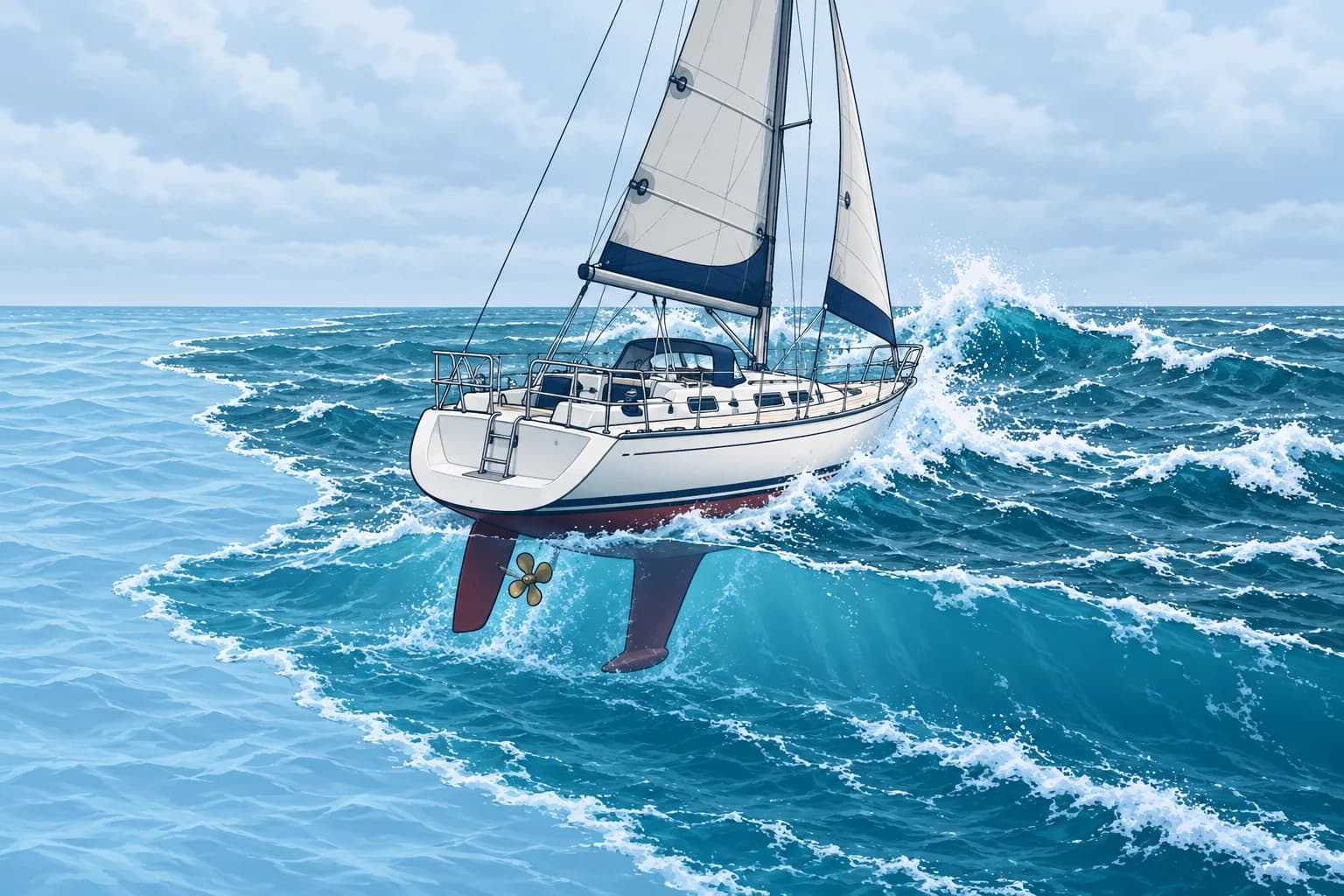
A rogue wave, also called a freak wave, is more than twice the significant wave height. On 1 January 1995, a laser on the Draupner platform in the North Sea recorded a 25.6 m wave in a sea with Hs of about 12 m. Rogue waves are rare and short-lived. They can arrive from a different direction from the surrounding waves.
Why they form
Waves of different speeds and directions sometimes line up their crests: the heights add for a moment. Waves can also be focused where they run against a current, which shortens and steepens them. The Agulhas Current flows mainly south-west along South Africa’s east coast. Strong south-westerly winds drive waves against it and can produce steep, breaking seas. The Gulf Stream has a similar hazard with opposing northerlies.
Wind against current
When wind and waves run against a current, the waves slow, shorten and steepen, and more of them break. Strong northerly winds opposing the north-going Florida Current and Gulf Stream can produce dangerous breaking seas. Avoid that combination. Assess wind strength, current and existing waves together.
Shallow water
Below about half a wavelength in depth, waves begin to feel the seabed. They slow and shorten; closer in, shoaling can make them taller and steeper. Height around 0.8 times the depth is a rough breaking estimate, but waves can break at smaller ratios. It is not a safe-entry threshold. A bar is a shallow ridge near an entrance; a shoal is a shallow patch. Long swell can break there even on a calm day. Avoid exposed bars and entrances in large swell.
Planning around dangerous seas
Read the wave forecast as well as the wind: Hs, swell period and direction. Find the currents and shoals on your route. Assess remaining swell even when the wind runs with the current, and stay clear of shallow banks in heavy swell. Choose a later departure or another route if dangerous seas are forecast along your passage.
Key figures
- Rogue wave
- Height more than 2 × Hs
- Draupner wave, 1 January 1995
- 25.6 m high in a sea of Hs about 12 m
- Wind against current
- Shorter, steeper, breaking waves
- Waves feel the bottom
- Depth less than about half the wavelength
- Breaking in shallow water
- Rough breaking estimate: height ≈ 0.8 × depth; can break lower
Remember
- A rogue wave is more than twice the significant wave height.
- The Draupner wave of 1995 measured 25.6 m in a sea of Hs about 12 m.
- Wind against a strong current, such as a northerly over the Gulf Stream, can produce short, steep, breaking seas.
- Check wind, waves, currents and shoals before departure. Delay or reroute if dangerous seas are forecast.
- Shoaling can steepen swell over bars and shoals. Height ≈ 0.8 × depth is a rough breaking estimate; waves can break lower.
Common mistakes
Wrong: Rogue waves are a myth.
Right: They are measured fact: the Draupner wave reached 25.6 m in a sea of about 12 m Hs.
Wrong: A fair current always makes a passage easier.
Right: Wind or swell opposing a strong current can raise dangerous seas. Check wind, swell and current forecasts together before choosing a crossing window.
Worked case
You plan to cross the Gulf Stream from Florida to the Bahamas in a 12 m yacht. The forecast gives a cold front passing tonight, with north-easterly winds of 20–25 knots behind it for two days, then light south-easterlies.
Show the answer
Delay the crossing. North-easterlies of 20–25 knots opposing the north-going current can create short, steep, breaking seas. After the wind eases and changes direction, reassess the latest wave forecast, remaining swell and observed conditions; a fixed waiting period does not guarantee that the sea has settled. Check a recent current analysis before choosing your crossing window.
Practice question
How is a rogue wave usually defined?
- Any wave exceeding a height of 10 m
- A wave over twice the significant height
- A wave that breaks in deep water
- Any wave from a different direction
Show the answer
Answer: B. A rogue or freak wave is more than twice the significant wave height of the sea around it.