

Global and regional models
1The lesson in plain words
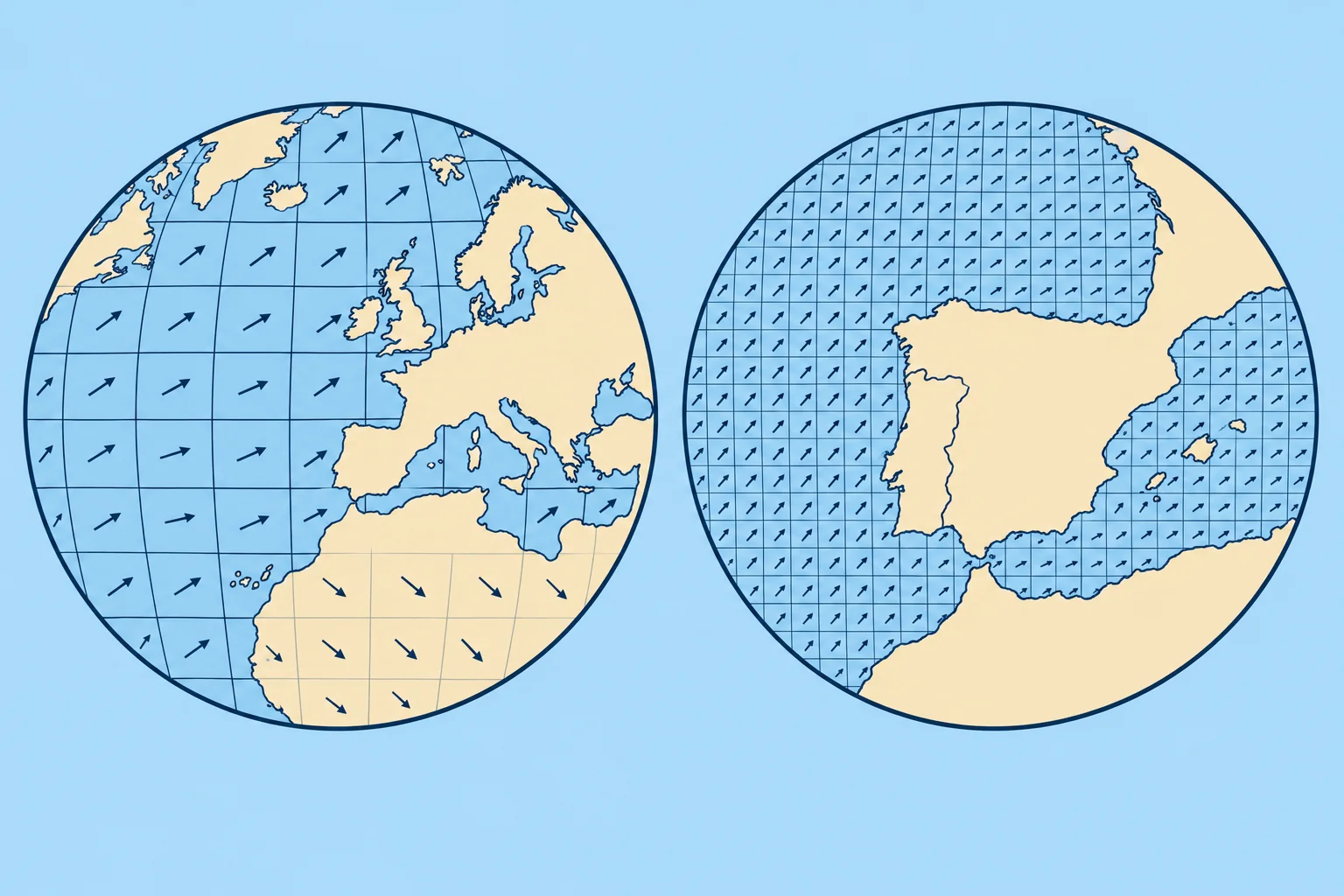
Global models cover the world. Regional models cover smaller areas on finer grids. Their forecast ranges vary; check which product you are using.
GFS
The US GFS (Global Forecast System) of NOAA runs four times a day, at 00, 06, 12 and 18 UTC, and its standard output is on a 0.25° grid, about 28 km in latitude, out to 16 days. It is free and the default model in many apps.
ECMWF
The European Centre for Medium-Range Weather Forecasts runs the IFS (Integrated Forecasting System) at about 9 km, four times a day; its main runs reach 15 days. Since 1 October 2025 ECMWF's real-time forecast data have been open at full native resolution under a free licence, so many apps now offer the 9 km data. ECMWF also runs AIFS, a machine-learning model, also open, on a coarser grid.
Regional models
Regional models cover a limited area at finer grid spacing. Their forecast ranges vary. Germany's DWD runs ICON-EU, about 7 km over Europe for about 5 days, and ICON-D2, about 2 km over central Europe for about 2 days. Météo-France runs AROME at about 1.3 km over France. Spain's AEMET runs HARMONIE-AROME at about 2.5 km for Iberia and the Balearics and for the Canaries, to 48 hours.
Waves
Wave models, such as NOAA's WAVEWATCH III and ECMWF's wave model, use forecast winds to predict wave height, period and direction. Significant wave height is the average height of the highest third of waves; individual waves can be larger. Wind errors affect the wave forecast, and coastal detail is limited.
Which to use
Use a global model for the big picture and days ahead; use a regional model near the coast and for the next day or two. Compare two models: when they agree, confidence is higher; when they disagree, plan for both.
2Key data
- GFS (NOAA)
- 0.25° grid, 4 runs a day, to 16 days
- ECMWF IFS
- About 9 km, 4 runs a day; open data since 1 Oct 2025
- ICON-EU / ICON-D2 (DWD)
- About 7 km to 5 days / about 2 km to about 2 days
- AROME / HARMONIE-AROME
- About 1.3 km (France) / about 2.5 km (AEMET, Spain), to ~2 days
3Key points
- 1
GFS: free, 0.25°, four runs a day, to 16 days.
- 2
ECMWF IFS: about 9 km, open at full resolution since 1 October 2025.
- 3
Regional models add detail; check their coverage and forecast range.
- 4
Compare models: agreement raises confidence; disagreement means plan for both.
4Frequent mistakes
Wrong: The highest-resolution model is always the best forecast.
Right: Finer grids show more detail but can place it wrongly. Compare models and runs.
Wrong: Every regional model has the same forecast range.
Right: Ranges vary: ICON-D2 reaches about two days; ICON-EU reaches about five. Use global models for the longer outlook.
5Practice case & exam keys
You plan to cross from mainland Spain to the Balearics in 48 hours. GFS shows a force 4 on the route; ECMWF IFS shows a force 6 with a stronger gradient near the coast; HARMONIE-AROME shows a force 6 funnelling round the coast at departure. How do you read this?
Show the answer
Force 6 is a plausible outcome; do not average it away. The regional model suggests coastal acceleration, but finer detail can still be misplaced. Model agreement is useful, not proof: models can share errors. Check official AEMET forecasts and warnings, compare later runs for the same place and valid time, and assess the stronger outcome against your own limits.
Exam keys
- GFS: NOAA, 0.25°, 00/06/12/18 UTC, to 16 days.
- ECMWF IFS about 9 km; open data at full resolution since 1 October 2025; AIFS machine-learning model.
- Regional: ICON-EU, ICON-D2, AROME, HARMONIE-AROME (AEMET, about 2.5 km, 48 h).
- Compare models; regional for coast and short range.
Finish this unit
When you've read it, match the terms, then answer three questions. Get them all right to finish the unit; opening the page alone doesn't count.
My notes for this unit
No notes