

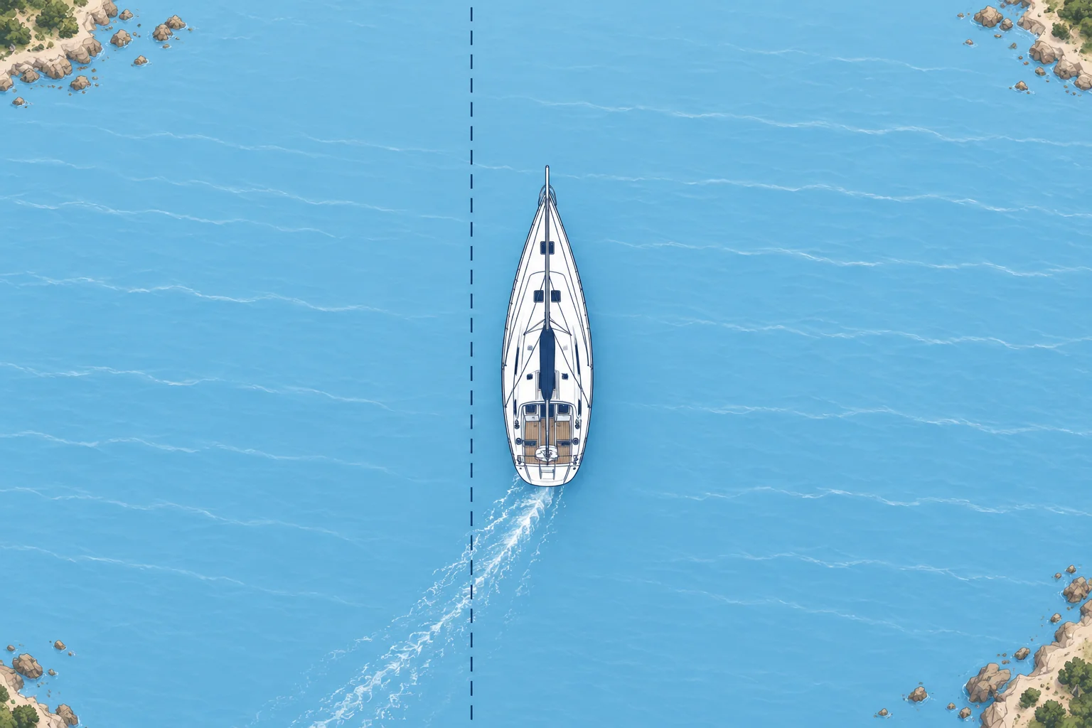
Heading and speed through the water against COG, SOG and XTE
1The lesson in plain words
Heading shows where your bow points; STW is speed through the water. COG and SOG describe movement over the ground. Stream and leeway can separate them.
Bow direction and water speed
Your heading is where the bow points, read on the compass. Your STW (speed through the water) comes from the log, a sensor under the hull. Wind can push you sideways (leeway), so your path through the water may differ from your heading. Compare heading and COG using the same north reference: true or magnetic (°M).
Over the ground
GNSS measures how your position changes over the seabed. COG (course over the ground) is the direction you are actually moving; SOG (speed over the ground) is how fast. A tidal stream carries the water, and you with it, and the wind pushes the boat sideways (leeway). So COG and SOG often differ from heading and STW.
Reading the difference
Heading 000°, COG 010°: something is pushing you to starboard (right) of your heading. Port means left. A lower SOG than STW can indicate an opposing stream. Speeds use kn (knots, nautical miles per hour). Near hazards a big gap between heading and COG is a warning: you are not going where the bow points. At very low speed COG jumps about and means little.
Cross-track error
XTE (cross-track error) is your sideways distance from the planned leg. Check the manual: L/R or arrows may show your side of the leg or the correction direction. Keep XTE small to stay on the line you checked. Steering at the waypoint’s changing bearing in a cross-stream makes a curve down-stream of the leg and may leave safe water. Course correction is covered in Set and drift.
Autopilot modes
Heading mode holds a compass heading; it does not keep you on a charted leg. Track or nav mode uses navigation data to follow the leg and reduce XTE. At a waypoint it may turn automatically or request confirmation. Know your system, check each new leg and keep a lookout.
2Key data
- Heading / STW
- Bow direction: compass; speed through water: log
- COG / SOG
- Over the ground: from GNSS
- XTE
- Distance off leg; check the display’s L/R convention
- Why they differ
- Tidal stream and leeway
3Key points
- 1
Heading is bow direction; STW is speed through water.
- 2
COG and SOG: over the ground, from GNSS.
- 3
The difference comes from tidal stream and leeway.
- 4
XTE is your distance off the planned leg; chasing the waypoint’s bearing can make a curved track.
4Frequent mistakes
Wrong: COG is the same as heading.
Right: Heading is where the bow points; COG is where the boat actually goes. Stream and leeway separate them.
Wrong: Steer at the waypoint's bearing and you will stay on the leg.
Right: In a cross-stream that makes a curve down-stream of the leg. XTE shows your distance off the checked line.
Wrong: A SOG lower than STW means the log is wrong.
Right: An opposing stream can reduce SOG below STW. Compare the readings with the conditions before blaming the log.
5Practice case & exam keys
Your planned leg bears 180°M to a harbour 6 M away. At 5 kn STW your heading is 180°M, but COG shows 165°M. The display places you 0.4 M left of the leg, towards a rocky shore to the east. What do COG and XTE tell you?
Show the answer
COG 165°M is east of the 180°M leg, towards the rocky shore. XTE shows you are already 0.4 M left of the checked line. Check your position and the chart before choosing a safe correction. Matching COG to the leg bearing alone would leave you parallel to it, still 0.4 M off. The Set and drift unit covers choosing a course.
Exam keys
- Heading is bow direction; STW is speed through water. COG and SOG describe movement over the ground.
- Tidal stream and leeway make COG/SOG differ from heading/STW.
- XTE: distance left or right of the planned leg.
- Steering straight at the waypoint in a cross-stream gives a curved track.
Finish this unit
When you've read it, match the terms, then answer three questions. Get them all right to finish the unit; opening the page alone doesn't count.
My notes for this unit
No notes