

Waypoints, routes and the MOB key
1The lesson in plain words
A waypoint is a stored position and a route is a chain of them. The receiver gives bearing and distance in straight lines, so check every leg on the chart.
Waypoints and routes
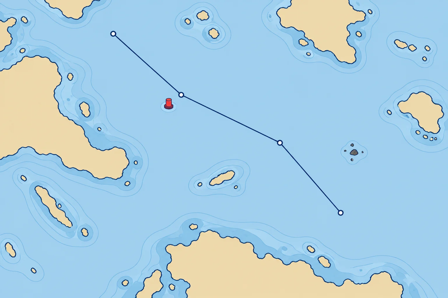
A waypoint is a position you store in the plotter or GNSS receiver, by tapping the chart or typing in a latitude and longitude. A route is a chain of waypoints; each step from one waypoint to the next is a leg. Name waypoints clearly and write their positions in the log or passage plan, so you can plot them on paper if the electronics fail.
What the display tells you
Going to a waypoint, the receiver shows BRG (bearing from you to the waypoint), DTW (distance to it) and an ETA (estimated time of arrival), based on the receiver’s speed or progress assumptions. BRG and DTW are direct, straight-line figures; ETA estimates arrival. None proves the water between you and the waypoint is clear of rocks, shallows or traffic.
Check every leg
Before you sail, check each leg on the largest-scale chart available, the one showing most detail. Make sure no leg crosses land, shallows, a wreck or a restricted area, and that every waypoint lies in safe water. Do not put a waypoint exactly on a buoy: other boats may do the same, and you would steer straight at it. Set it a short distance off, on the safe side.
Typing errors
One wrong digit can put a waypoint miles away. Read back every position you type, compare the plotter's bearing and distance for each leg with what you measure on the chart, and look at the whole route on screen at several zoom levels. Distances use nautical miles (M). A knot is one nautical mile per hour.
The MOB key
Press MOB (man overboard) the moment someone falls in. The plotter stores that position and shows the bearing and distance back to it. The mark is fixed to the seabed, but the person drifts with the water, so in a tidal stream look down-stream of the mark and keep someone pointing at the person. Recovery is in the Emergencies module.
2Key data
- BRG
- Bearing from you to the waypoint
- DTW
- Straight-line distance to the waypoint
- ETA
- Arrival estimate; depends on speed assumptions
- MOB key
- Stores the position; the person drifts with the stream
3Key points
- 1
Waypoint = stored position; route = chain of waypoints; leg = one step.
- 2
BRG and DTW give direct bearing and distance; ETA estimates arrival. None guarantees a safe leg.
- 3
Check every leg on the largest-scale chart; set waypoints off buoys, on the safe side.
- 4
MOB stores a fixed position; the person drifts with the stream.
4Frequent mistakes
Wrong: If the plotter accepts the route, it must be safe.
Right: The plotter joins waypoints with straight lines. Only your check on the chart shows whether a leg crosses a hazard.
Wrong: The MOB position shows exactly where the person is.
Right: It marks where the boat was when you pressed it. In a stream they drift away from it: keep watching and pointing at them.
Wrong: Store waypoints only in the plotter.
Right: Write them down too, so you can plot the route on paper if the plotter fails.
5Practice case & exam keys
You build a three-leg route to a harbour on the small-scale view. On the 1:25 000 chart the second leg passes 50 m off a charted rock, and the last waypoint sits right on the entrance buoy. What do you change?
Show the answer
Move the second leg's waypoints so the leg clears the rock with enough clearance for position uncertainty and the conditions. Move the last waypoint a short distance off the buoy on its safe side. Then compare each leg's bearing and distance with the chart, look at the route at several zoom levels and write the waypoints in the log.
Exam keys
- Waypoints, routes and legs; write their positions down.
- BRG and DTW are straight-line figures; ETA is an arrival estimate.
- Check every leg on a large-scale chart; never put a waypoint on a buoy.
- MOB: press at once; the casualty drifts with the stream.
Finish this unit
When you've read it, match the terms, then answer three questions. Get them all right to finish the unit; opening the page alone doesn't count.
My notes for this unit
No notes