

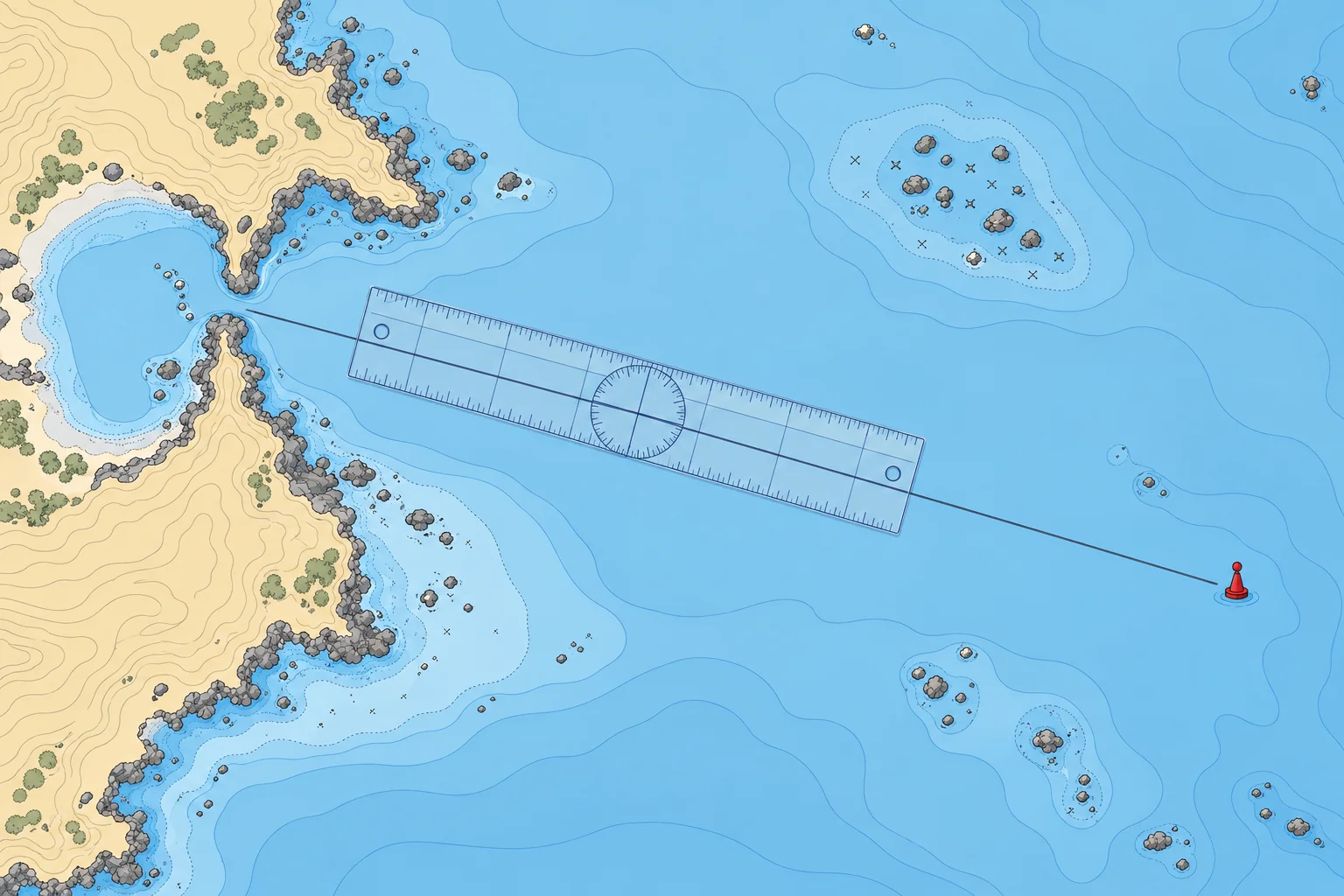
Laying off a course and checking it for dangers
1The lesson in plain words
Draw the course from departure to destination, measure its true direction, then check the whole line and a margin either side for dangers.
Terms
Your planned ground track is the line you intend to follow over the seabed. Your course to steer is the direction you intend to steer; your heading is where the bow actually points. Stream (water movement) and leeway (sideways movement caused by wind) can make your heading differ from your ground track. Chart directions are measured clockwise from true north (°T). Set and drift teaches how to find the required heading. Convert that true heading for the steering compass; see Compass course.
Laying it off
Mark your departure point and your destination or first waypoint (a chosen point on the route). Join them with a straight pencil line. On a Mercator chart this line, a rhumb line, crosses every meridian at the same angle, so its true track direction stays constant. On longer passages, break the route into legs at headlands, buoys or other turning points.
Measuring direction
Lay the plotter's edge along the line with its direction arrow pointing the way you will travel. Turn the rose until its north–south grid lines follow a meridian and its north mark points to chart north. Read the true track direction at the index, for example 227°T. Write it along the line with the leg's distance: "227°T 8.4 M".
Checking for dangers
A line on paper is not yet a safe track. Look along it and a good distance either side for rocks, shoals, wrecks, overfalls, fish farms, traffic separation schemes and restricted areas. Move the line if it passes too close. Allow more room off a lee shore (a coast the wind blows towards), at night, in poor visibility, and where the stream sets towards danger.
Keep it simple
Choose turning points you can recognise and reach safely. A leg may end near a buoy or another identifiable mark, with clearance from it. Check your progress before starting the next leg. The Pilotage unit covers more detailed coastal checks.
2Key data
- Chart directions
- True (°T): meridians point to true north
- Writing a leg
- Course and distance on the line, e.g. 227°T 8.4 M
- Rhumb line
- Straight on a Mercator chart; one angle to every meridian
- Safety margin
- Wider off a lee shore or where stream sets towards danger
3Key points
- 1
A plotted true track is not automatically the heading to steer.
- 2
Point the plotter arrow along your track; align its north–south grid with a meridian and its north mark to chart north.
- 3
Check the line and a margin either side for every danger, then adjust it.
- 4
Break long routes into legs that end at marks you can identify.
4Frequent mistakes
Wrong: The plotted true track is automatically the heading to steer.
Right: Wind and stream can move you sideways; Set and drift teaches how to find the heading.
Wrong: If the line misses the rocks, the course is safe.
Right: Check a margin either side. Stream, leeway and steering errors move you off the line.
5Practice case & exam keys
You plan a 12 M leg along a coast with an onshore wind of force 5. The straight line passes 2 cables off a rocky point.
Show the answer
Too close for these conditions. Over 12 M, a 1° steering error alone can use about 2 cables of clearance. Wind and stream may reduce it further. Replot with clearance suited to the wind, stream and uncertainty in your position, or add a waypoint well clear of the point. Note the new true direction and distance, and check the new line for dangers.
Exam keys
- Courses taken from the chart are true (°T).
- Direction arrow along the track; north–south grid along a meridian, rose north towards chart north.
- Write course and distance on each leg.
- Check a safety margin either side, more off a lee shore.
Finish this unit
When you've read it, match the terms, then answer three questions. Get them all right to finish the unit; opening the page alone doesn't count.
My notes for this unit
No notes