

Measuring distance and working with speed and time
1The lesson in plain words
Measure distance on the latitude scale beside the leg. Then distance, speed and time give you how far, how fast and when you will arrive.
Measuring distance
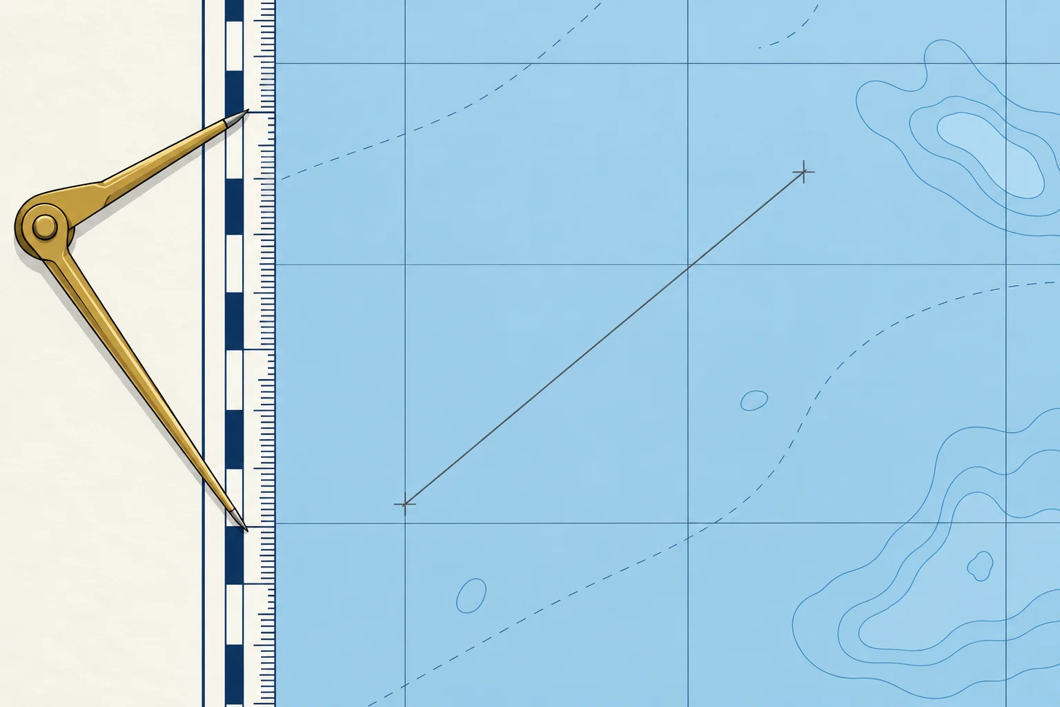
Open the dividers between the two ends of a leg. Carry them, unchanged, to the latitude scale at the side of the chart, at about the same latitude as the leg, and count the minutes. For chartwork, take one minute of latitude as one nautical mile (M). For a long leg, set the dividers to a round figure, such as 5 M, step along the line, then measure the remainder.
Why the side scale
On a Mercator chart the latitude scale stretches towards the poles, so a mile is longer on paper the further you are from the equator. Measuring level with the leg uses the right mile. The longitude scale along the top and bottom is not a distance scale. A large-scale harbour plan may carry its own scale bar.
Speed, time, distance
Distance = speed × time, with speed in knots (nautical miles per hour) and time in hours. Turn minutes into hours by dividing by 60. At 5.5 kn for 1 h 20 min: 5.5 × 80 ÷ 60 = 7.3 M. Rearranged, time = distance ÷ speed and speed = distance ÷ time. In 6 minutes, a tenth of an hour, you cover a tenth of your speed: at 6 kn, 0.6 M.
Working out an ETA
To find your ETA (estimated time of arrival), divide the remaining distance by your expected speed over the ground (SOG), then add that travel time to the present time. Use SOG rather than speed through the water (STW), shown by the log. A 9.0 M leg at 6.0 kn over the ground takes 1 h 30 min: leave at 10:40 and arrive at about 12:10.
Units
One nautical mile is 1852 m, and a cable is 0.1 M, about 185 m. Keep hours and minutes apart: 1.5 h is 1 h 30 min, not 1 h 50 min.
2Key data
- Distance
- Speed (kn) × time (h)
- Time
- Distance ÷ speed
- 6-minute rule
- Distance in 6 min = speed ÷ 10
- Nautical mile
- 1 M = 1852 m; 1′ latitude ≈ 1 M; 1 cable = 0.1 M
- Example
- 5.5 kn for 1 h 20 min = 7.3 M
3Key points
- 1
Measure distance on the latitude scale beside the leg, never on the longitude scale.
- 2
Distance = speed × time, with time in hours: divide minutes by 60.
- 3
In 6 minutes you cover one tenth of your speed, in miles.
- 4
Work out an ETA with speed over the ground, which includes the stream.
4Frequent mistakes
Wrong: 1.5 hours is 1 hour 50 minutes.
Right: 1.5 h is 1 h 30 min. Multiply the decimal part by 60 to get minutes.
Wrong: Measure distance on the scale at the top of the chart.
Right: That is the longitude scale. Use the latitude scale at the side, level with the leg.
Wrong: Use the log speed for the ETA, even with a foul stream.
Right: Use the expected speed over the ground. A foul stream (one against you) delays your arrival.
5Practice case & exam keys
You leave at 09:15 for a waypoint 7.5 M away. A crew member gives an ETA of 10:45 using 5 kn through the water. Expected speed over the ground is 4 kn. Do you accept that ETA?
Show the answer
No. Use speed over the ground for the charted distance: 7.5 ÷ 4 = 1.875 h, about 1 h 53 min. Revise the ETA to about 11:08. The earlier estimate uses speed through the water.
Exam keys
- Distance on the latitude scale, level with the leg.
- D = S × T, T = D ÷ S, S = D ÷ T, with time in hours.
- 6-minute rule: distance in 6 minutes = speed ÷ 10.
- ETA from speed over the ground.
Finish this unit
When you've read it, match the terms, then answer three questions. Get them all right to finish the unit; opening the page alone doesn't count.
My notes for this unit
No notes