
Astronomy and celestial navigation · Level R5 · 5 parts · about 15 min
Sight reduction and the position line
5 short parts: Intercept · By calculator · HO 229 and 249 · Plotting · Sun-run-sun. Each part explains the idea, then gives the points to remember, the common mistakes, a worked case and a practice question; the Academy unit adds all 30 check questions.
1 · Intercept
The intercept method: from altitude to position line
Compare the altitude you observed with the one you would see from an assumed position. The difference, the intercept, places your position line.
The idea
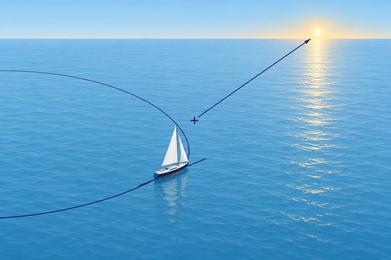
A corrected sextant altitude puts you on a circle of equal altitude around the body's geographical position (Celestial: the celestial sphere). That circle is huge, often thousands of miles across. Near you, a short piece of it is almost straight: a position line. The intercept method, published by Marcq St-Hilaire in 1875, finds that short piece without drawing the circle.
Assumed position
Choose an assumed position (AP) near your dead-reckoning position (DR). From the AP, calculate the computed altitude (Hc) and true azimuth (Zn), the body’s bearing clockwise from true north, for the exact sight time. Then compare Hc with your observed altitude (Ho): the sextant altitude after all corrections (Celestial: the sextant).
Towards or away
The intercept is Ho − Hc, in minutes of arc. Each minute is one nautical mile. If Ho is greater, you are nearer the body than the AP is: the intercept is towards. If Ho is smaller, you are farther away: the intercept is away. A memory aid: Ho Mo To, Ho more, towards.
Drawing it
From the AP, lay off the intercept along Zn if it is towards, or along the reciprocal of Zn if it is away. That end point is the intercept terminal point. Through it, draw the position line at right angles to the azimuth. At the time of the sight, you were somewhere on that line.
Why it works
Near the AP, a change of 1′ in altitude moves the circle 1 M along the azimuth. The method replaces the arc with a straight line, which is accurate when the intercept is short. If an intercept comes out very large, check your work, then rework the sight from a position nearer the result.
Key figures
- Intercept
- Ho − Hc, in minutes of arc = nautical miles
- Direction
- Ho > Hc: towards (Ho Mo To); Ho < Hc: away
- Position line
- At right angles to Zn, through the intercept terminal point
- You need
- Exact UT, Ho, an AP, and the body's GHA and Dec for that UT
- Spanish terms
- Recta de altura = position line; punto determinante = terminal point
Remember
- Intercept = Ho − Hc: one minute of altitude is one mile along the azimuth.
- Ho greater than Hc: towards the body. Smaller: away. Ho Mo To.
- The position line crosses the azimuth at right angles at the intercept terminal point.
- Reduce every sight for its exact UT; the AP is only a convenient starting point.
Common mistakes
Wrong: The position line runs along the azimuth.
Right: It runs at right angles to the azimuth. The azimuth only shows which way to lay off the intercept.
Wrong: An intercept is always laid off towards the body.
Right: When Ho is smaller than Hc you are farther away than the AP: lay it off along the reciprocal of Zn.
Wrong: The intercept is the distance from your real position to the AP.
Right: It is the distance from the AP to the position line, measured along the azimuth. Your position can be anywhere on the line.
Worked case
From your AP, Hc is 41°12.6′ and Zn 214°T. Your sight gives Ho 40°58.4′. A crew member lays off 14.2 M along 214° and draws the line along 214°. What two corrections do you make?
Show the answer
Ho is 14.2′ smaller than Hc, so the intercept is 14.2 M away: lay it off along 034°, the reciprocal. Then draw the position line through that end point at right angles to the azimuth, along 124°–304°. At the time of the sight you were somewhere on that line.
Practice question
Ho is 35°00.4′ and Hc is 34°38.4′. What is the intercept?
- 22.0 M away
- 22.0 M towards
- 38.4 M towards
- 2.2 M towards
Show the answer
Answer: B. Ho − Hc = +22.0′. Ho is greater, so the intercept is 22.0 M towards the body.
2 · By calculator
Worked: Hc and Zn by formula, 3 December 2026
With latitude, declination and LHA, two formulas give Hc and Zn. Worked: a morning Sun sight in mid-Atlantic on 3 December 2026.
The formulas
sin Hc = sin Lat × sin Dec + cos Lat × cos Dec × cos LHA. Use N positive and S negative for both latitude and declination. For the azimuth: cos Z = (sin Dec − sin Lat × sin Hc) ÷ (cos Lat × cos Hc). This Z runs from 0° to 180°, measured from north. Use degree mode. Take inverse sine for Hc and inverse cosine for Z. Keep full calculator precision until the final rounding.
The sight
On 3 December 2026, your DR is 16°40′N 038°20′W. At 1142:18 UT, your corrected Sun altitude is Ho 35°00.4′. For that UT, the almanac gives GHA 358°08.1′ and Dec S22°08.1′ (Celestial: time and the almanac).
The AP
Use the same AP as the tables need: latitude 17°00′N, longitude 038°08.1′W. LHA = GHA − west longitude = 358°08.1′ − 38°08.1′ = 320°. LHA is more than 180°, so the Sun is east of your meridian, as it should be in the morning.
Hc
sin 17° × sin (−22°08.1′) = −0.1102. cos 17° × cos 22°08.1′ × cos 320° = +0.6786. The sum is 0.5684, so Hc = 34°38.4′. Intercept = 35°00.4′ − 34°38.4′ = 22.0 M towards.
Zn
The cosine formula gives Z = 133.6°. The body is east of you (LHA over 180°), so Zn = Z = 133.6°T. When LHA is under 180°, the body is west of you and Zn = 360° − Z. Check for sense: a December morning Sun at 17°N rises south of east and swings south.
From the DR
With a calculator, you can use the DR directly instead of choosing a whole-degree AP. From the DR: LHA 319°48.1′, Hc 34°43.9′, Zn 133.3°, intercept 16.5 M towards. Plotted from the DR, this gives practically the same position line as the AP did.
Key figures
- Altitude
- sin Hc = sin Lat sin Dec + cos Lat cos Dec cos LHA; S negative
- Azimuth
- cos Z = (sin Dec − sin Lat sin Hc) ÷ (cos Lat cos Hc)
- Naming Zn
- LHA > 180°: Zn = Z; LHA < 180°: Zn = 360° − Z
- Worked inputs
- AP 17°N, LHA 320°, Dec S22°08.1′, Ho 35°00.4′
- Worked result
- Hc 34°38.4′, Zn 133.6°T, intercept 22.0 M towards
Remember
- sin Hc = sin Lat sin Dec + cos Lat cos Dec cos LHA; give south values a minus sign.
- Z from the cosine formula is from north: body east (LHA > 180°) Zn = Z; west, Zn = 360° − Z.
- Take GHA and Dec for the exact UT: 4 seconds of time is 1′ of longitude.
- A calculator can reduce from the DR: different intercept, practically the same line.
Common mistakes
Wrong: LHA = GHA + west longitude.
Right: Subtract west longitude, add east: LHA = GHA − W or + E, then keep it between 0° and 360°.
Wrong: Enter S22°08.1′ as a positive number when your latitude is north.
Right: Enter north latitude and declination as positive, south as negative. Apply each sign independently. Here Dec is −22.135°; using +22.135° gives Hc near 52°.
Wrong: The Z from the formula is the true azimuth.
Right: Z runs 0°–180° from north. Name it from LHA: body west (LHA under 180°) means Zn = 360° − Z.
Worked case
Same sight. A second crew member reduces it from the DR, 16°40′N 038°20′W, and gets 16.5 M towards. The navigator, using AP 17°00′N 038°08.1′W, got 22.0 M towards. One of them must be wrong, says the skipper. Is that right?
Show the answer
No. The intercept depends on where you start. From the DR: LHA 319°48.1′, Hc 34°43.9′, Zn 133.3°, 16.5 M towards. Each intercept, laid off from its own starting point, ends on practically the same position line. Compare the plotted lines, not the intercepts.
Practice question
GHA is 358°08.1′ and the AP longitude is 038°08.1′W. What is LHA?
- 036°16.2′
- 320°00.0′
- 040°00.0′
- 319°52.0′
Show the answer
Answer: B. LHA = GHA − west longitude = 358°08.1′ − 38°08.1′ = 320°.
3 · HO 229 and 249
Sight reduction tables: HO 229 and HO 249
Tables replace the formulas. Enter with whole degrees of latitude, LHA and declination, then correct for the declination minutes. HO 229 is precise; HO 249 is quicker.
Why tables
Before calculators, and still as the backup when electronics fail, navigators used precomputed tables. They solve the same triangle for whole degrees of latitude, LHA and declination. That is why you choose an AP: its latitude is the nearest whole degree to the DR, and its longitude makes LHA a whole degree. The almanac gives GHA and Dec; the tables give Hc and Z.
HO 229
Pub. No. 229, from the US National Geospatial-Intelligence Agency (NGA), is published in Britain as NP 401. It has six volumes, each for a band of about 15° of latitude, and covers every declination. Choose the same name page when latitude and declination have the same name, contrary name when they differ. It gives Hc to 0.1′, the change d for 1° of declination, and Z to 0.1°.
HO 249
Pub. No. 249 (NP 303 in Britain) was made for air navigation. It gives Hc to the nearest minute and Z to the nearest degree, and it is quicker to use. Volumes 2 and 3 cover all latitudes but only declinations 0°–29°: Sun, Moon, planets and many stars. Volume 1, for selected stars, is computed for an epoch, now 2025, and used for about four years either side.
Same sight by HO 229
Latitude 17°, LHA 320°, declination 22°, contrary name: tabulated Hc 34°43.8′, d −40.0′, Z 133.5°. For the 8.1′ of declination: −40.0 × 8.1 ÷ 60 = −5.4′. Hc = 34°38.4′, the same as by formula. Z between 22° and 23° of declination, interpolated, is 133.6°.
Naming Zn
Table Z is measured from your elevated pole: north in north latitude, south in south latitude. This differs from the calculator formula’s north-referenced Z. North latitude: LHA over 180°, Zn = Z; under 180°, Zn = 360° − Z. South latitude: LHA over 180°, Zn = 180° − Z; under 180°, Zn = 180° + Z. The rule is printed on the pages: check it every time.
Key figures
- HO 229 (NP 401)
- Hc to 0.1′, Z to 0.1°; six volumes; every declination
- HO 249 (NP 303)
- Hc to 1′, Z to 1°; Volumes 2–3 for declinations 0°–29°
- HO 249 Volume 1
- Selected stars; epoch 2025, used about four years either side
- Worked by HO 229
- 34°43.8′ + (−40.0 × 8.1 ÷ 60 = −5.4′) = 34°38.4′
- Zn, north latitude
- LHA > 180°: Zn = Z; LHA < 180°: Zn = 360° − Z
- Zn, south latitude
- LHA > 180°: Zn = 180° − Z; LHA < 180°: Zn = 180° + Z
Remember
- Tables need whole-degree latitude and LHA: choose the AP to make them so.
- HO 229: Hc to 0.1′, all declinations. HO 249: Hc to 1′, quicker; Volumes 2–3 stop at 29°.
- Correct the tabulated Hc for the declination minutes with d: here −5.4′.
- Turn Z into Zn with the rule for your hemisphere and LHA.
Common mistakes
Wrong: Enter the tables with your DR longitude and interpolate for the odd minutes of LHA.
Right: Choose the AP longitude so that LHA is a whole degree. The tables are built for that.
Wrong: Use the same-name page because the tables use positive values only.
Right: Latitude N with declination S is contrary name. The wrong page gives an Hc that is far too high.
Wrong: Any edition of HO 249 Volume 1 will do.
Right: Volume 1 is epoch-based. Use the current epoch edition or HO 229. Volumes 2–3 are an alternative only for declinations within 0°–29°.
Worked case
At 17°N in the mid-Atlantic, your calculator and plotter are dead. You have this year's Nautical Almanac and HO 249 Volume 2. The Sun's declination is S22°. Can you still reduce a morning Sun sight, and how precise will the result be?
Show the answer
Yes. Volume 2 covers latitudes 0°–40° and declinations 0°–29°, so the Sun at S22° is in range. Choose an AP that makes latitude and LHA whole degrees, use the contrary-name page, correct Hc for the declination minutes and turn Z into Zn. Hc is rounded to 1′; that is table resolution, not a guarantee of one-mile accuracy.
Practice question
Which of these gives Hc to 0.1′?
- HO 249 Volume 1
- HO 249 Volume 3
- HO 229 (NP 401)
- HO 249 Volume 2
Show the answer
Answer: C. HO 229 tabulates Hc to 0.1′ and Z to 0.1°. HO 249 rounds to the nearest minute and degree.
4 · Plotting
Plotting the position line
Plot the AP, lay off the intercept, draw the line at right angles and label it with the time. Then judge what one line can and cannot tell you.
The sheet
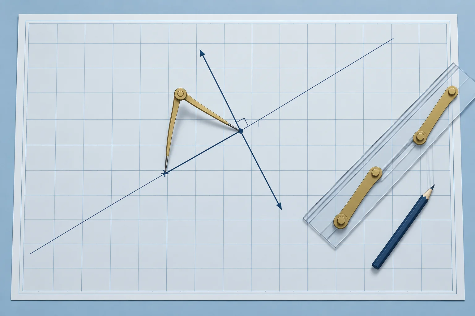
Ocean charts are small scale, so you plot on a plotting sheet: a blank Mercator grid. On a universal plotting sheet, you draw the meridians for your own latitude. Mark the AP from the worked sight: 17°00′N 038°08.1′W. Measure distances on the latitude scale, as on any Mercator chart.
Lay off and draw
From the AP, draw a light line along the azimuth, 133.6°T. Measure 22.0 M along it, towards the Sun. At that point, draw the position line at right angles to the azimuth: along 043.6°–223.6°. Label it with the time, 1142 UT, and the body.
What one line tells you
One line is not a fix. A line from a body bearing near 090° or 270° runs north–south and checks your longitude. A line from a body near 000° or 180° runs east–west and gives your latitude. This line, from 133.6°, checks your position along the south-east to north-west direction.
Errors
Each error moves the line. One minute of error in Ho moves it 1 M towards or away. A timing error moves it east or west: 4 s of time is 1′ of longitude. A hazy horizon or a big swell makes the altitude less certain. A good Sun sight may place the line within a few miles of your position; poor conditions can give much larger errors.
One line, best position
Without a second line, take the estimated position (EP) as the point on the line nearest your DR: the foot of a perpendicular from the DR. Carry the DR on from there. Before crossing a later sight, transfer this line to that sight’s time (next part).
Key figures
- Lay off
- Intercept along Zn if towards, along the reciprocal if away
- Draw
- Position line at 90° to Zn; label it with UT and body
- Worked
- AP 17°00′N 038°08.1′W; 22.0 M towards 133.6°; line 043.6°–223.6°
- Altitude error
- 1′ in Ho moves the line 1 M along Zn
- Timing error
- 4 s of UT moves the line 1′ of longitude east or west
- One line only
- EP: the foot of the perpendicular from the DR
Remember
- Plot on a plotting sheet or large-scale ocean chart; measure on the latitude scale.
- Lay off the intercept along Zn or its reciprocal; draw the line at 90° and label it with UT.
- A body near east or west checks longitude; a body near north or south gives latitude.
- With one line, use the point on it nearest the DR as your EP.
Common mistakes
Wrong: Measure the intercept on the longitude scale at the top of the sheet.
Right: Use the latitude scale, as for any Mercator distance. Away from the equator the longitude scale is shorter.
Wrong: A single Sun line is a fix if it passes close to the DR.
Right: One line constrains your position across the line but leaves your position along it unknown. You need another suitably crossing line, observed at the same time or transferred, for a fix.
Worked case
At 1142 UT your DR is 16°40′N 038°20′W. The Sun line passes 16.5 M from it, in the direction 133.3°. No other body is in sight. What position do you use, and what do you do next?
Show the answer
Use the estimated position on the line: from the DR, 16.5 M along 133.3°, the foot of the perpendicular. Carry the DR on from there, but remember it is one line, not a fix. For a later Sun sight or noon latitude, first transfer this line by the intervening ground run (next part).
Practice question
From an AP, the intercept is 22.0 M towards 133.6°. Along which direction do you draw the position line?
- 133.6°–313.6°
- 043.6°–223.6°
- 090°–270°
- 000°–180°
Show the answer
Answer: B. The position line is at right angles to the azimuth: 133.6° − 90° = 043.6°, and its reciprocal 223.6°.
5 · Sun-run-sun
Worked: running fix with the Sun, morning sight and noon latitude
Transfer the morning Sun line along your run to noon, then cross it with the noon latitude. Worked on 3 December 2026.
The idea
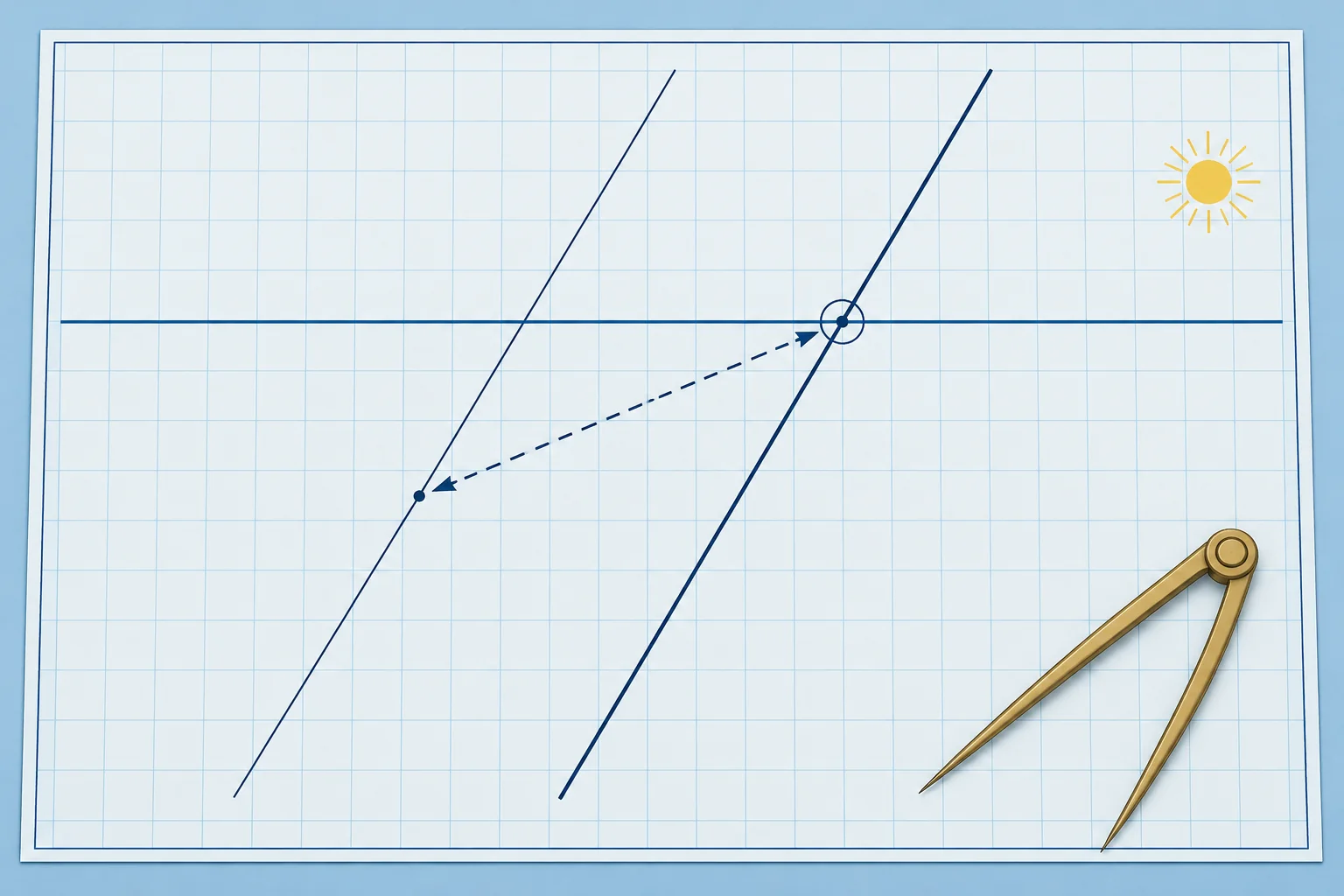
By day you often have only the Sun. Its azimuth changes through the morning. Choose two sights whose lines cross at a useful angle. Move the earlier line along your ground track for the time between, exactly as in a coastal running fix (Navigation: advanced fixes). The classic pair is a morning sight and the noon latitude (Celestial: the noon sight).
The morning line
From the worked sight: at 1142 UT, intercept 22.0 M towards 133.6° from AP 17°00′N 038°08.1′W. The intercept terminal point is 16°44.8′N 037°51.5′W. Your estimated ground track is 260°T at 6.5 kn.
Noon
The almanac gives the Sun's meridian passage at Greenwich as 1150. With your DR longitude, about 038°38′W, local noon falls about 2 h 34 min later, near 1424 UT, so start watching a few minutes early. The noon sight gives latitude 16°28.0′N at 1423 UT (Celestial: the noon sight).
The run
From 1142 to 1423 UT is 2 h 41 min. At 6.5 kn that is 17.4 M along 260°T. Move the intercept terminal point by that run, to 16°41.8′N 038°09.4′W. Through it, draw the morning line again, parallel to the first, with double arrowheads: a transferred position line.
The fix
The transferred line crosses latitude 16°28.0′N at 038°23′W: your running fix at 1423 UT. Your DR for that time was 16°37.0′N 038°37.9′W, so the fix is about 9 M south and 14 M east of it. Log it, and restart the DR from the fix.
Limits
The fix is only as good as the run. An unallowed current of 0.5 kn over 2 h 41 min gives a 1.3 M error in the run; its effect on the fix depends on its direction and the crossing angle. Aim for a smaller angle between the lines of at least about 30°; near 90° is best. Here it is 46.4°, with azimuths 133.6° and 180°. Judge the angle, not elapsed time: near an overhead passage, azimuth can change quickly.
Key figures
- Morning line
- 1142 UT: 22.0 M towards 133.6° from AP 17°00′N 038°08.1′W
- Noon latitude
- Given noon latitude: 16°28.0′N at 1423 UT
- Run
- 2 h 41 min at 6.5 kn = 17.4 M along 260°T
- Running fix
- 16°28.0′N 038°23′W at 1423 UT
- Angle of cut
- Azimuth 133.6° to 180°: about 46°
Remember
- Transfer the morning line by the run over the ground; cross it with the noon latitude.
- Move the intercept terminal point, then draw the line parallel through it.
- Aim for a smaller angle between the lines of at least about 30°; near 90° is best.
- Unknown current adds error to the run; its effect on the fix depends on its direction and the crossing angle.
Common mistakes
Wrong: Move the morning line along the azimuth to bring it up to noon.
Right: Move it along your ground track, 260°T here, by the distance run. The line keeps its direction.
Wrong: Take the noon latitude at the time of Greenwich meridian passage, 1150 UT.
Right: Local noon is later in west longitude: add the longitude in time. At about 38°W it falls near 1423 UT.
Wrong: Two Sun sights 20 minutes apart always give a good running fix.
Right: Judge the angle between the lines, not elapsed time. Aim for a smaller crossing angle of at least about 30°; near 90° is best.
Worked case
You take a morning Sun line at 0910 UT and the noon latitude at 1150 UT. You steered 250°T at 6 kn, but you later learn that the current was setting 270°T at 1 kn. How should you have transferred the morning line?
Show the answer
Use the ground run. In 2 h 40 min, you travel 16.0 M through the water along 250°T. From the intercept terminal point, lay off that vector. From its end, lay off the current vector: 2.7 M along 270°T. Through the final point, draw the morning line parallel to the original. Ignoring this westward current puts the running fix too far east.
Practice question
How is the morning Sun line brought forward to noon?
- Moved along the azimuth by the run
- Moved along the ground track by the run
- Rotated to match the noon azimuth
- Left where it is and crossed at once
Show the answer
Answer: B. A transferred line moves with the boat: along the ground track by the distance made good, keeping its direction.