
Meteorology · Level R3 · 5 parts · about 14 min
Local winds: sea breezes, katabatic winds, gusts and named winds
5 short parts: Breezes · Slope winds · Gusts · Coast effects · Named winds. Each part explains the idea, then gives the points to remember, the common mistakes, a worked case and a practice question; the Academy unit adds all 29 check questions.
1 · Breezes
Sea breezes and land breezes
On a sunny day the land heats faster than the sea and draws in a sea breeze. At night the land cools and a weaker land breeze blows out.

How a sea breeze forms
The sun heats the land much faster than the sea. Air over the land warms and rises, and cooler air from the sea flows in to replace it. A weaker flow higher up returns air to sea. This onshore wind blows from sea to land. It is the sea breeze, called virazón in Spanish.
Its day
It usually starts in the late morning near the shore, spreads out to sea and inland, peaks in mid-afternoon and dies near sunset. It typically reaches 10–15 knots, and can exceed 20 knots on hot coasts. In the Northern Hemisphere its direction tends to veer, or turn clockwise, through the afternoon.
When it fails or grows
Strong daytime heating and a light gradient wind, the background wind from weather systems, favour a distinct sea breeze. Strong offshore flow, from land to sea, can keep the sea breeze offshore; around 15 knots is only a rough guide. Light offshore flow may leave a calm zone between opposing winds. A light onshore background wind can reinforce it; check whether the coastal forecast already includes this.
The land breeze
On a clear night the land cools faster than the sea. Air flows off the land: the land breeze, called terral in Spanish. It is usually weaker, often under 10 knots, and strongest near dawn. Off mountain valleys it combines with cold air sliding downhill and can be much stronger.
Using them
Leave early on a calm morning, before the sea breeze, or use it for a sail back in the afternoon. Expect choppy water and stronger wind off a sunny beach in the afternoon. At anchor, check that the bay is sheltered from both the afternoon sea breeze and the night land breeze.
Key figures
- Sea breeze (virazón)
- Onshore, by day; starts late morning, peaks mid-afternoon
- Typical sea breeze
- 10–15 knots; over 20 knots on hot coasts
- Offshore background wind
- Strong flow may prevent the sea breeze reaching the coast
- Land breeze (terral)
- Offshore, at night; usually under 10 knots, strongest at dawn
- Northern Hemisphere
- Sea breeze tends to veer during the afternoon
Remember
- Sea breeze: by day, from the sea, peaking mid-afternoon.
- Land breeze: by night, off the land, usually lighter.
- Strong daytime heating and light background winds favour a distinct sea breeze.
- An onshore background wind can reinforce the sea breeze.
- Check anchorages for both the afternoon and the night wind.
Common mistakes
Wrong: A forecast of force 2 means a quiet afternoon on a sunny coast.
Right: A broad offshore forecast may miss a local sea breeze. Check the coastal forecast for afternoon strengthening rather than adding a fixed amount.
Wrong: The land breeze blows from the sea at night.
Right: The land breeze blows from the land towards the sea. The sea breeze blows from the sea by day.
Worked case
A sunny summer day on the Costa Brava. The forecast gives a light westerly, offshore, force 2. You plan to sail out at 1100 and return to the harbour at 1700. What wind should you expect? How could this affect your return?
Show the answer
Expect the light offshore wind first, then a possible onshore sea breeze building through the afternoon. Check the coastal forecast and whether your harbour entrance faces that wind. If the expected chop would make entry difficult, return earlier or choose a sheltered alternative.
Practice question
Why does a sea breeze form?
- The sea warms faster than the land
- The land warms faster than the sea
- The tide floods towards the coast
- A front passes along the coast
Show the answer
Answer: B. The land heats faster. Warm air rises over it and cooler sea air flows in.
2 · Slope winds
Katabatic and anabatic winds
Cold air slides down slopes, often at night: a katabatic wind. Warm air creeps up sunny slopes by day: an anabatic wind.

Katabatic winds
On a clear night, high ground cools quickly. The air touching it cools, becomes denser and slides downhill under gravity, like water. This is a katabatic wind. It gathers in valleys and pours out of their mouths onto the sea.
How strong
Ordinary night-time drainage is often light to moderate and strongest late at night or near dawn. Over snow or glaciers, cold air can drain downhill by day too. Steep valleys can concentrate the flow. Severe outflows can reach gale force and extend well offshore; there is no fixed safe distance.
Anabatic winds
By day, sunny slopes warm the air above them. It rises up the slope as an anabatic wind. Its strength depends on heating and terrain, and it often joins the sea breeze.
Fall winds
When a large pool of cold air builds up behind a mountain range and spills over, it can fall to the coast as a violent, gusty fall wind. The bora of the Adriatic is the best-known example in Europe; the Named winds lesson describes it.
At anchor
Look at the land around an anchorage. A valley or gorge opening onto the bay can send a cold, strong gust down at night, even in a calm forecast. Choose an anchorage away from the valley mouth, with a seabed your anchor can grip and room for your boat to swing. Set an anchor alarm.
Key figures
- Katabatic
- Cold air flowing downhill, mostly at night
- Anabatic
- Warm air flowing uphill by day
- Strongest katabatic
- Off snow, glaciers and steep valleys; can reach gale force
- Where
- Often concentrated at valley mouths; offshore reach varies
Remember
- Katabatic: dense cold air slides downhill, often at night.
- Anabatic: warm air rises up sunny slopes by day.
- Katabatic winds pour out of valley mouths and can be sudden and strong.
- A fall wind such as the bora is cold air spilling over mountains.
- Avoid anchoring off a valley mouth on clear nights.
Common mistakes
Wrong: A calm forecast means a calm night in any anchorage.
Right: A katabatic wind can pour down a valley at night even when the gradient wind is light.
Wrong: Anabatic winds are the strong night winds off mountains.
Right: Anabatic winds blow uphill as sunny slopes heat the air. Katabatic winds flow downhill as air cools, often at night.
Worked case
In early spring you anchor in a Norwegian-style fjord inlet below snow-covered mountains. The forecast is light and variable and the sky will be clear. A steep valley opens just upwind of your spot. What should you consider?
Show the answer
Clear sky and snow cover make strong night cooling likely. Cold air will drain down the valley and can pour out across the anchorage as a strong, gusty katabatic wind, perhaps around dawn. Move away from the valley mouth, use enough anchor chain or rope for the depth and expected wind, with good holding, and set an anchor alarm.
Practice question
What is a katabatic wind?
- Warm air rising up a sunny slope
- Cold air flowing down a slope
- Sea air flowing onto the land
- Air spiralling into a deep low
Show the answer
Answer: B. A katabatic wind is cold, dense air flowing downhill, mostly at night.
3 · Gusts
Gusts, lulls and squalls
The mean wind is an average. Gusts are short bursts above it; the gust factor tells you how much stronger they are.

Mean and gust
Wind is never steady. Here we use the World Meteorological Organization (WMO) convention: mean wind is averaged over 10 minutes. A Beaufort force describes wind strength. A gust is a brief peak measured over about 3 seconds. A lull is a brief drop. Check your forecast service’s averaging period. Choose sail area for the gusts you expect.
Gust factor
The gust factor is the gust divided by the mean wind. With a mean of 20 knots and gusts of 28 knots, the gust factor is 28 ÷ 20 = 1.4. Over the open sea in steady air it is often about 1.2–1.4. Off high land, near cliffs and under showers it can reach 1.5 or more.
Why gusts happen
Gusts come from turbulence, or irregular, swirling air movement. Rough land and buildings disturb the flow. In unstable air, rising and sinking currents bring fast air from higher up down to the surface. That is why cold, showery air is so gusty, while warm, stable air over a cold sea is steadier.
Squalls
A squall is a sudden, longer increase. The WMO definition: a rise of at least 16 knots (8 m/s) to 22 knots (11 m/s) or more, lasting at least a minute. Squalls come with shower clouds, lines of towering thunderstorm clouds and cold fronts, often with a sudden wind shift and heavy rain. Squalls and thunderstorms have their own unit later in this module.
Sailing for the gusts
To reef is to reduce sail area. Choose the sail area for the gusts you expect. Watch upwind for dark patches on the water and for shower clouds: they mark gusts arriving. In gusty offshore winds, stay well off the downwind side of high land.
Key figures
- Mean wind
- WMO convention: 10-minute average
- Gust
- Peak over about 3 seconds
- Gust factor
- Gust ÷ mean; e.g. 28 ÷ 20 = 1.4
- Typical gust factor
- Open sea ~1.2–1.4; off high land or in showers 1.5+
- Squall (WMO)
- Rise of ≥16 kn to ≥22 kn, lasting at least 1 minute
Remember
- Here, mean wind means a 10-minute average; gusts are brief peaks.
- Gust factor = gust ÷ mean wind.
- Unstable, showery air and high land make gusts stronger.
- A squall: sudden rise of at least 16 kn to at least 22 kn, lasting at least 1 minute.
- Reef for the gusts and watch the water upwind.
Common mistakes
Wrong: A forecast of force 4 means no wind over 16 knots.
Right: Force 4 is a mean of 11–16 knots. Gusts of 20 knots or more are possible, especially in showers.
Wrong: A gust and a squall are the same thing.
Right: A gust lasts seconds. A WMO squall rises suddenly by at least 16 knots to at least 22 knots and lasts at least a minute.
Worked case
The forecast gives a mean north-westerly of 20 knots, gusting 30 knots, with cold air and showers behind a front. You will sail past high cliffs on the downwind side of an island, where the wind blows off the land. What is the gust factor, and how do you prepare?
Show the answer
The gust factor is 30 ÷ 20 = 1.5. Off the cliffs, gusts can be stronger and come down steeply. Reef to handle 30 knots or more, keep well off the cliffs, and watch for shower clouds and dark water upwind.
Practice question
The mean wind is 15 knots and gusts reach 21 knots. What is the gust factor?
- 1.2
- 1.6
- 1.4
- 6.0
Show the answer
Answer: C. Gust factor = gust ÷ mean = 21 ÷ 15 = 1.4.
4 · Coast effects
Funnelling, headlands and wind shadows
Land bends and squeezes the wind. Expect stronger wind in gaps and off headlands, shadows and eddies in the lee, or downwind side, of high land.
Funnelling
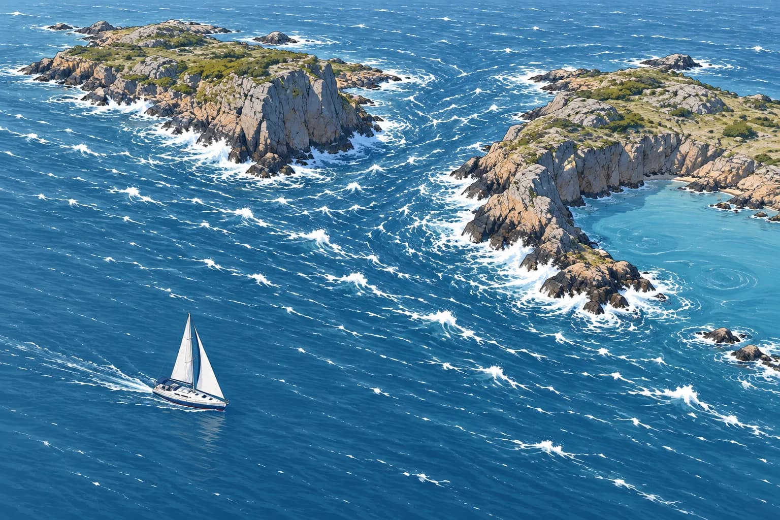
When wind is forced through a narrow gap, such as a strait, a channel between islands or a valley, it speeds up. This is funnelling. It also turns to follow the gap. Wind in a strait can be much stronger than offshore; a local forecast may already include this acceleration.
Headlands
Where wind is forced around an exposed headland or island corner, it can speed up and change direction. This is the corner effect. Allow room off exposed headlands in fresh wind.
Wind shadows
On the lee, or downwind side, of high land, cliffs or tall buildings, the wind may be light or calm, then turn gusty and swirling. Close under high cliffs, strong gusts can drop steeply onto the water. Shore height alone does not guarantee steady wind or suitable shelter.
Along the coast
In the Northern Hemisphere, friction turns the wind farther anticlockwise over land than over sea: it backs. With your back to a wind blowing along the coast, land on your right makes the flows converge, or come together: stronger wind and often more cloud near shore. Land on your left makes them diverge, or spread apart: lighter wind.
Reading the chart
Before a passage, mark gaps, headlands and high land on the chart. Ask where the forecast wind will be squeezed, where it will be blocked and where it will turn. Plan reefs before the headland, not off it.
Key figures
- Funnelling
- Faster wind in straits, channels and valleys
- Corner effect
- Exposed corners can bring stronger wind and shifts
- Lee of high land
- Calm patches, then gusty, swirling wind
- Coastal convergence (NH)
- Back to wind, land on right: stronger near shore
- Coastal divergence (NH)
- Back to wind, land on left: lighter near shore
Remember
- Funnelling speeds the wind up in gaps and straits.
- Headlands can strengthen the wind and change its direction.
- The lee of high land may contain calm patches and strong, swirling gusts.
- NH, back to wind along the coast: land on right → stronger wind.
- Plan reefs before the headland or gap.
Common mistakes
Wrong: The open-sea forecast holds in a narrow strait.
Right: Check the strait-specific forecast and warnings. Do not automatically add one or two forces to a forecast already covering the strait.
Wrong: Sailing close under high cliffs gives the calmest water in a strong wind.
Right: Cliff lee can contain strong, swirling gusts. Keep clear of the turbulent zone and choose shelter for the expected wind direction, with room to manoeuvre.
Worked case
The open-sea forecast west of the Strait of Bonifacio gives a westerly force 5. You plan to motor-sail east through the strait, between Corsica and Sardinia. What should you check?
Show the answer
Westerly winds can strengthen through the strait and around headlands. Check the local strait forecast and warnings; force 5 offshore does not fix the strength inside. Reduce sail before entering if needed, keep clear of rocks and islets, and identify a sheltered alternative.
Practice question
What happens to the wind when it is forced through a narrow strait?
- It slows down and dies away
- It speeds up and follows the gap
- It reverses and blows the other way
- It rises above the gap and forms fog
Show the answer
Answer: B. Funnelling squeezes the flow, so it speeds up and turns to follow the gap.
5 · Named winds
Named winds of the Mediterranean
Recognise the Mediterranean's named winds by their usual direction, region and weather. Check local forecasts and warnings before you sail.
Mistral and tramontana
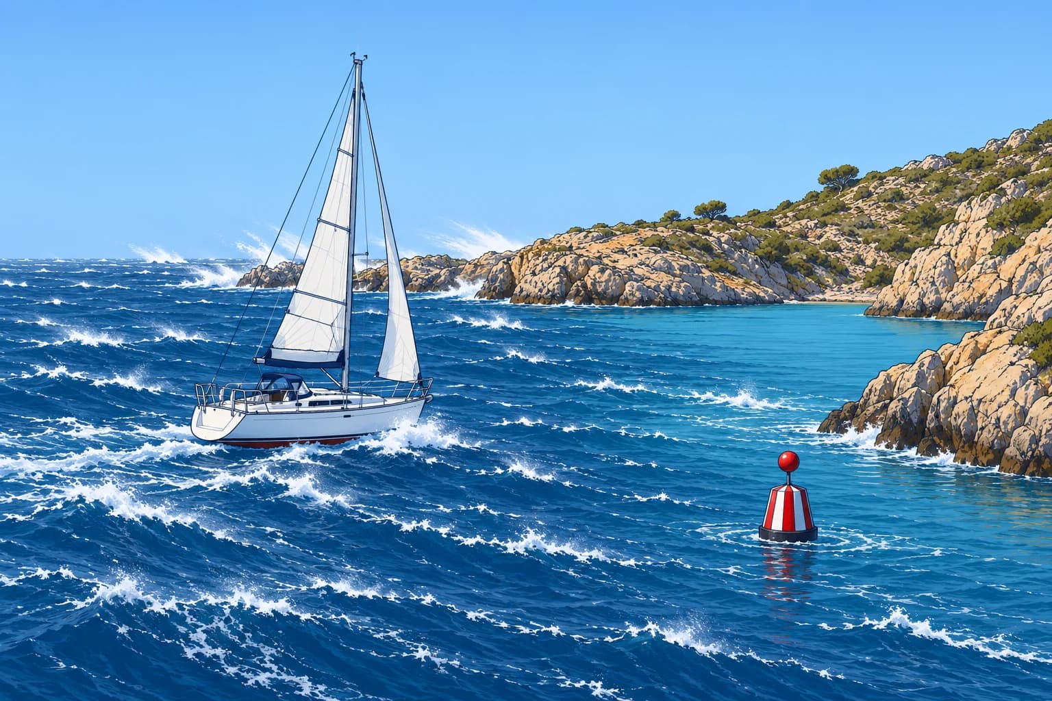
The mistral is a cold north to north-west wind down the Rhône valley into the Gulf of Lion. It blows with high pressure over the Bay of Biscay and a low over the Gulf of Genoa. It often reaches force 6–8 with severe gusts and clear skies, lasting days or over a week. The tramontana is a cold northerly channelled between the Pyrenees and the Massif Central towards the Gulf of Lion and Catalonia, sometimes reaching the Balearics.
Bora
The bora (Croatian bura) is a cold, north-easterly fall wind on the eastern Adriatic coast, mostly in winter. Cold air over the interior spills over the coastal mountains. Its gusts are violent and can start with little warning on a clear day; at its strongest points, gusts above 100 knots have been measured.
Levante and poniente
The levante is an easterly in the Alborán Sea and the Strait of Gibraltar, with high pressure over the western Mediterranean and lower pressure to the west. Funnelling through the strait can raise it to strong or gale force, especially at its western end; it is moist and often hangs a cloud over the Rock of Gibraltar. The poniente is the westerly in the same area; Atlantic lows can drive strong episodes through the strait.
Meltemi
The meltemi (etesian winds) blows over the Aegean from about mid-May to mid-September. It is north-easterly in the north, northerly in the centre and north-westerly in the south. It often blows force 5–7, sometimes 8, under clear skies, usually strongest in the afternoon. It comes from high pressure over the Balkans against low pressure over south-west Asia.
Sirocco
The sirocco is a hot south to south-east wind from the Sahara, drawn north ahead of lows. It can bring dust and haze; after crossing the sea it becomes humid and may bring low cloud and rain. In the Adriatic, the south-easterly is called jugo. It often builds gradually and raises large seas over a long stretch of open water. Spain’s related leveche often blows from the south or south-west.
Key figures
- Mistral / tramontana
- N–NW, Gulf of Lion and Catalonia; high Biscay, low Genoa
- Bora (bura)
- NE fall wind, east Adriatic, mostly winter; violent gusts
- Levante
- E in Alborán and Gibraltar Strait; funnelled, moist
- Poniente
- W in Alborán and Gibraltar Strait; can strengthen with Atlantic lows
- Meltemi
- N in the Aegean, mid-May to mid-Sept; often force 5–7
- Sirocco / jugo
- S–SE from the Sahara ahead of lows; dust, then humid
Remember
- Mistral/tramontana: high over Biscay, low over Genoa; cold, clear, strong.
- Bora: violent NE fall wind on the east Adriatic coast.
- Levante easterly, poniente westerly: both funnelled at Gibraltar.
- Meltemi: summer northerly in the Aegean, strongest in the afternoon.
- Sirocco: warm southerly ahead of lows; dust, humid air and sometimes rain.
Common mistakes
Wrong: Clear blue skies mean no strong wind in the Mediterranean.
Right: The mistral, tramontana, bora and meltemi often blow hard under clear skies.
Wrong: The meltemi always dies at night.
Right: It often eases at night, but in a strong spell it can blow day and night for several days.
Wrong: The sirocco is a cold wind from the Alps.
Right: The sirocco is a hot southerly from the Sahara. The cold northerlies are the mistral, tramontana and bora.
Worked case
You plan to cross from Barcelona to Menorca. The chart shows high pressure building over the Bay of Biscay and a low forming over the Gulf of Genoa. Skies are clear and the barometer is rising at home. What do you expect?
Show the answer
This pattern can bring mistral and tramontana, with strong, cold N–NW winds and steep seas towards Menorca despite clear skies. Check the route forecast and official warnings. Postpone if the expected wind and sea exceed your boat or crew’s limits; reassess when conditions improve.
Practice question
Which pressure pattern brings the mistral?
- A low over Biscay and a high over Genoa
- A high over the Balkans and a low over Asia
- A high over Biscay and a low over Genoa
- A low over the Sahara and a high over Italy
Show the answer
Answer: C. High pressure over the Bay of Biscay and a low over the Gulf of Genoa drive cold air down the Rhône valley.