
Meteorology · Level R4 · 6 parts · about 19 min
Squalls, thunderstorms and waterspouts
6 short parts: Thunderstorms · Squalls · Spot and track · Squall tactics · Lightning · Waterspouts. Each part explains the idea, then gives the points to remember, the common mistakes, a worked case and a practice question; the Academy unit adds all 37 check questions.
1 · Thunderstorms
How thunderstorms form, live and die
Thunderstorms need moisture, unstable air and lift. An ordinary cell lasts about half an hour; multicell storms and supercells can last hours.

Three ingredients
A thunderstorm needs moisture, unstable air that keeps rising once lifted, and a trigger that lifts it. Triggers at sea include cold fronts and troughs, sea-breeze fronts near a hot coast, and air flowing up mountains. Cold air crossing a much warmer sea is heated from below and often makes storms too. Clouds and humidity explained stability; here you see what it produces.
The life cycle
An ordinary single cell has three stages. In the towering cumulus stage, warm air rises and the cloud grows fast, with little rain. In the mature stage, rain and hail fall and drag cold air down in a downdraught beside the rising updraught: lightning, heavy rain and the strongest gusts. In the dissipating stage, the downdraught takes over, rain eases and the cloud spreads out.
How long they last
An ordinary single cell lasts about 30 minutes. Most storms are multicell clusters or lines, where new cells keep forming on one side as old ones die, so the storm lasts hours. A supercell has a rotating updraught, can last hours, and may bring large hail, violent gusts and tornadoes. Do not judge the danger from one cell's life: watch the whole group.
The anvil
At the top of a mature storm the rising air spreads out under the stable layer above, making a flat, spreading anvil. Strong upper winds blow the anvil far ahead of the storm. Lightning can strike from it many kilometres from the rain. A sharp, hard-edged top or a dome bulging above the anvil shows a strong updraught.
When and where at sea
Over land, storms peak in the afternoon after the sun has heated the ground. Over a warm sea they are often commonest at night and in the early morning. In the Mediterranean, a warm sea in late summer and autumn feeds heavy storms. Read the forecast for words such as thundery showers or isolated thunderstorms before you leave.
Key figures
- Ingredients
- Moisture, unstable air and a lifting trigger
- Life cycle
- Towering cumulus → mature → dissipating
- Ordinary single cell
- Lives about 30 minutes
- Most dangerous stage
- Mature: updraught and downdraught side by side
- Over a warm sea
- Often commonest at night and early morning
Remember
- Moisture, unstable air and a trigger make a thunderstorm.
- The mature stage brings lightning, heavy rain, hail and the strongest gusts.
- An ordinary single cell lives about 30 minutes; multicell storms and supercells can last hours.
- Lightning can strike from the anvil far ahead of the rain.
- Over a warm sea, storms are often commonest at night.
Common mistakes
Wrong: Thunderstorms only happen on hot summer afternoons.
Right: Over the sea they are often commonest at night. Cold fronts and cold air over a warm sea bring them in any season.
Wrong: An ordinary single cell lasts half an hour, so the storm will be gone soon.
Right: New cells can keep a multicell cluster or line going for hours. A supercell can also last hours.
Worked case
Off the Balearics in September, isolated thunderstorms are forecast overnight. Your crew say the clear evening rules them out and any storm will be gone in 30 minutes. What is wrong with that assessment?
Show the answer
A warm sea can support night-time storms despite a clear evening. Mediterranean late summer and autumn favour this pattern. Thirty minutes describes an ordinary single cell; multicell storms and supercells can last hours. Lightning can also reach ahead of the rain.
Practice question
In which stage of a thunderstorm's life are lightning, hail and the strongest gusts most likely?
- The towering cumulus stage
- The storm's mature stage
- The storm's dissipating stage
- The spreading anvil stage
Show the answer
Answer: B. In the mature stage updraught and downdraught exist side by side: the storm is at its most violent.
2 · Squalls
Squalls, squall lines, gust fronts and downbursts
The danger in a storm is often the wind that rushes out of it. Learn the cloud that marks the gust front and expect a sudden shift and a big gust.
What hits you first
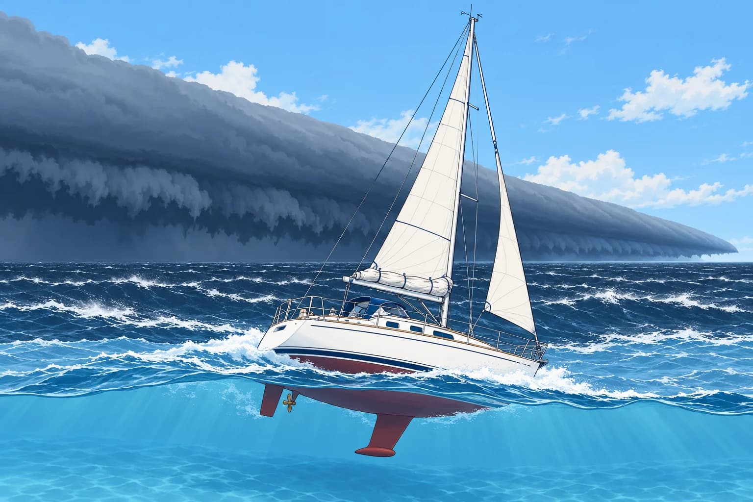
Local winds gave the WMO definition of a squall. Under a thunderstorm, rain-cooled air sinks and spreads out at the surface as a cold outflow. Its leading edge is the gust front. It can arrive several kilometres ahead of the rain. As it passes, the wind jumps, often swings sharply to blow out of the storm, the temperature drops several degrees and the pressure jumps.
Squall lines
A squall line is a long line of thunderstorms, often tens to hundreds of kilometres long. It can form along or ahead of a cold front. Do not count on sailing round a long, approaching line; prepare early. Its broad cold outflow can extend across gaps in the rain. Lines often move faster than single storms and arrive with little warning at night. Expect gusts far above the forecast mean wind.
Arc and roll clouds
An arcus is a low cloud along the gust front. A shelf cloud is attached to the storm base: a dark, wedge-shaped bank, often with a smooth or layered front and ragged cloud below. A roll cloud is a separate horizontal tube of cloud ahead of the storm. With an approaching thunderstorm, either cloud can mark its gust front; watch its movement.
Downbursts
A downburst is a very strong downdraught that spreads out violently on reaching the sea. A microburst is less than 4 km across and lasts only about 5 to 10 minutes, but its winds can exceed 85 knots. A larger macroburst affects a wider area for longer. Look for a rain shaft spreading sideways and a ring of white spray racing outwards on the water.
How big the gusts are
Squall gusts of 30 to 50 knots are common even when the forecast mean is moderate. The US National Weather Service calls a storm severe when gusts reach 50 knots or more. The wind can shift 90° or more in seconds. Rain can cut visibility to a few hundred metres. After the squall the wind may drop sharply, then return.
Key figures
- Gust front
- Leading edge of cold outflow; can be km ahead of the rain
- At the gust front
- Wind jump and shift, temperature drop, pressure jump
- Microburst
- Under 4 km across, about 5–10 min; winds can exceed 85 kn
- Severe storm (US NWS)
- Gusts of 50 kn or more
- Typical squall gusts
- 30–50 kn, whatever the forecast mean
Remember
- The gust front can reach you before the rain, with a sudden wind shift.
- A shelf or roll cloud associated with an approaching storm can mark its gust front.
- Do not count on sailing round a long, approaching squall line; prepare early.
- A microburst is small and brief but can exceed 85 knots.
- Plan for 30–50 knot gusts in any thunderstorm squall.
Common mistakes
Wrong: The strong wind starts when the rain starts.
Right: The gust front often arrives first, sometimes several kilometres ahead of the rain.
Wrong: Squall gusts will be a little above the forecast mean wind.
Right: Squalls can bring 30–50 knots or more on a day forecast as force 4. Reef for the squall, not the forecast.
Wrong: The calm after the squall means the danger is over.
Right: The wind can return quickly from a new direction, and another cell may follow. Keep the boat reefed until the line has passed.
Worked case
Close-hauled on starboard tack in a south-westerly force 4, you see a long, dark bank of cloud with a smooth, wedge-shaped front advancing from the west. Below it the sea looks dark and streaked white. Rain hangs further back. What is happening and what do you expect?
Show the answer
The wedge is a shelf cloud marking an approaching gust front. Expect a sudden wind increase and shift, probably towards the west as cold air flows out of the storm. Temperature should fall and pressure rise. Heavy rain and poor visibility may follow behind the wind.
Practice question
What is the gust front of a thunderstorm?
- The cloud top above the anvil
- The edge of the cold outflow
- The line where the rain ends
- The warm air feeding the storm
Show the answer
Answer: B. Rain-cooled air sinks and spreads out. Its leading edge, the gust front, brings the sudden wind change.
3 · Spot and track
Spotting and tracking squalls by eye, radar and sound
Watch storms early, take their bearing and range, and work out whether they are coming at you. Then you can prepare in time or steer clear.
By eye
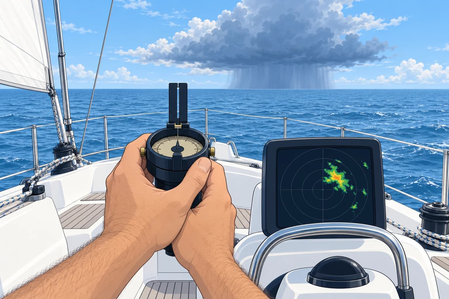
By day, look for a dark, hard-edged cloud base, rain shafts reaching the sea, a shelf cloud, and a dark, ruffled band on the water moving towards you. At night, lightning lights up the storms and shows where they are. Keep an all-round watch: storm movement can differ from the surface wind. Recheck every few minutes.
Bearing and range
Take compass bearings of the storm's centre and edges every few minutes. A steady bearing with decreasing range warns that it is approaching your position, as with a ship on a collision course. If bearings change steadily, it may pass to one side; keep checking both bearing and range. Note the times in the log.
Flash to bang
Light arrives at once; sound takes about 3 seconds per kilometre, or 5.4 seconds per nautical mile. Count from flash to thunder. A 12-second interval puts that discharge about 4 km (2.2 NM) away. A later 6-second interval puts that discharge about 2 km (1.1 NM) away. Flashes occur in different parts of a storm; confirm its movement with repeated bearings and radar ranges. If you hear thunder, you are within striking distance.
On your radar
Heavy rain often gives broad, fuzzy radar echoes. Track them with the EBL (electronic bearing line) and VRM (variable range marker). Rain echoes can mask boats; heavy rain can also weaken returns from beyond it. Rain-clutter suppression (sometimes called FTC) reduces rain echoes but can also remove small targets. Keep a careful lookout: a clear patch on the screen does not prove clear water.
Other tools
Near the coast, weather-radar and lightning-detection apps show storm cells and their movement, but they can lag by several minutes and need a phone signal. Forecasts warn with phrases such as risk of thunderstorms. GRIB files may include CAPE, a measure of instability: high values mean storms are possible, not certain.
Key figures
- Flash to bang (km)
- Seconds ÷ 3
- Flash to bang (nautical miles)
- Seconds ÷ about 5.4
- Worked example
- 12 s ≈ 4 km ≈ 2.2 NM; 6 s ≈ 2 km ≈ 1.1 NM
- Steady bearing, decreasing range
- Warns of an approaching storm
- Hear thunder
- You are within striking distance
Remember
- Take repeated bearings and ranges: a steady bearing with decreasing range warns of an approaching storm.
- Flash-to-bang: seconds ÷ 3 = km; seconds ÷ about 5.4 = nautical miles.
- Radar shows heavy rain as large, fuzzy echoes; track them with EBL and VRM.
- Rain and rain-clutter suppression can hide boats; a clear radar patch does not prove clear water.
- If you can hear thunder, you are close enough to be struck.
Common mistakes
Wrong: Turn the rain clutter control up until the screen is clear.
Right: Too much rain-clutter suppression can remove small targets. Use only enough to reduce rain echoes, and maintain a lookout.
Wrong: The thunder is far away, so lightning cannot reach us yet.
Right: If you can hear thunder you are within striking distance. Lightning can strike well away from the rain.
Worked case
At 0110, lightning west of you has a 15-second flash-to-bang interval. At 0125 it is 9 seconds. The same rain echo remains near 270° while its radar range falls from 3 NM to 2 NM. What can you conclude?
Show the answer
15 seconds is about 5 km (2.8 NM); 9 seconds is about 3 km (1.7 NM). The later discharge is nearer, but flashes can occur in different places. The same radar echo has a steady bearing and decreasing range, confirming approach towards your position. Treat it as a threat. Keep tracking with timed EBL and VRM observations and maintain a lookout for vessels.
Practice question
You count 9 seconds between flash and thunder. About how far away is the lightning?
- About 1 km
- About 3 km
- About 9 km
- About 18 km
Show the answer
Answer: B. Sound travels about 1 km in 3 seconds: 9 ÷ 3 = 3 km, about 1.7 nautical miles.
4 · Squall tactics
Squall tactics: reef early, keep sea room, choose your heading
When a squall is coming, reef early, keep clear water where the gust may push you, and choose your heading before it arrives.
Reef early
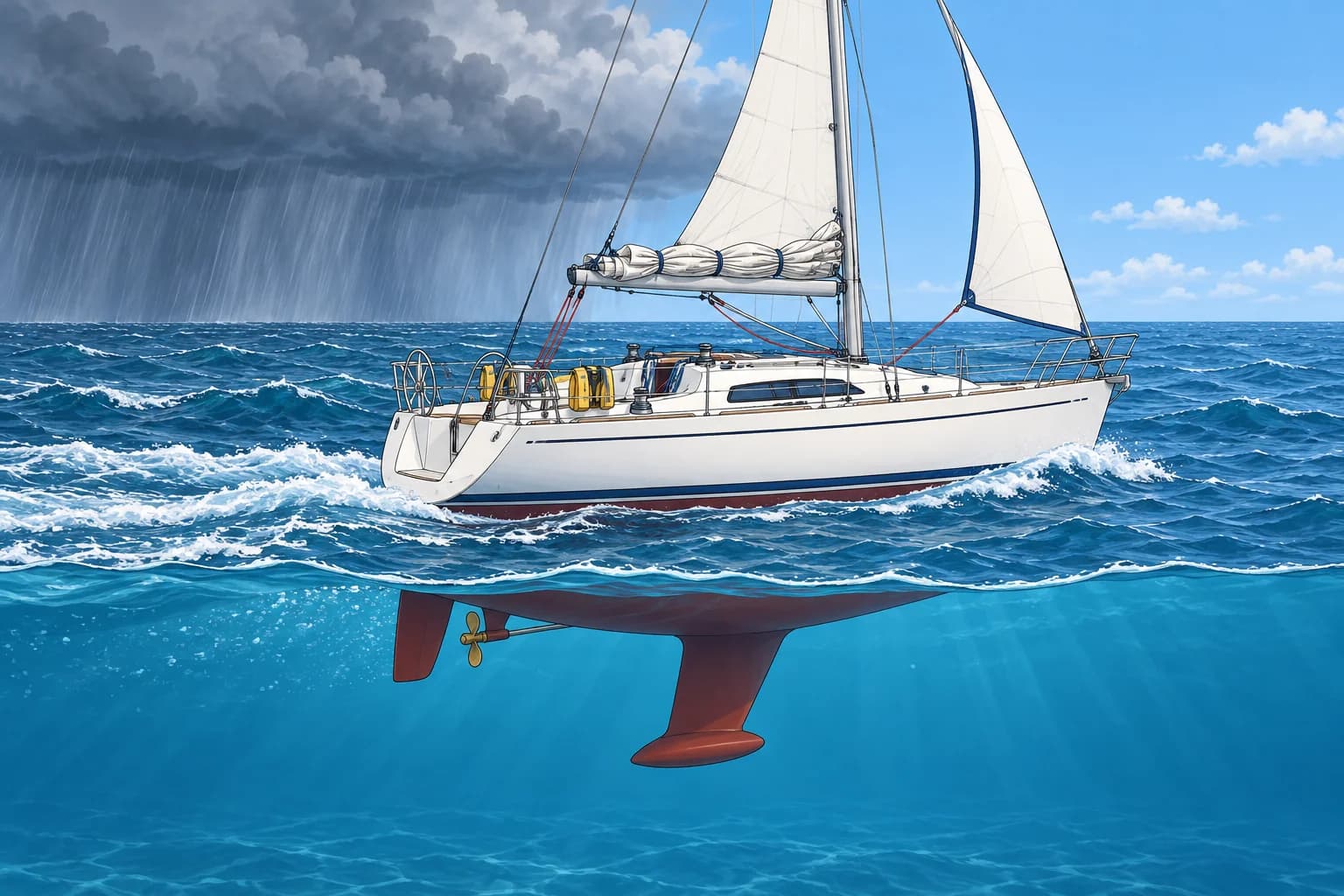
Reefing and rigging showed how to reef; here the point is timing. Reduce the whole sail plan for the expected gusts: reef or lower both mainsail and headsail as needed before the gust front arrives. Choose sail area for 30–50 knots, not the present breeze. At night, reef when you see storms building or when the forecast mentions thunder.
Prepare the boat
Close hatches and ports. Stow loose gear on deck and below. Everyone on deck wears a lifejacket and is clipped on. Start the engine in neutral to be ready. Fix your position and note it. Switch on navigation lights if visibility will drop. Brief the crew: who steers, who handles the sheets, what heading you will take.
Keep sea room
The gust can push you a long way in minutes, often from a new direction. Look at where the wind will blow you: usually away from the storm. Keep well clear of any coast, shoal or other boats on that side. Do not try to enter a narrow harbour or anchorage just as a squall arrives; stand off in open water instead.
Choose your heading
In open water with sea room, you can bear away (turn farther from the wind) under a small headsail. Alternatively, lower the sails and motor into wind if your engine can maintain steering control. Use enough power to hold the chosen heading; allow for waves and avoid beam-on exposure with too much sail. Choose before the gust arrives.
Dodge or wait
Once you know an isolated cell's movement, alter course early to increase separation and stay clear of its projected path. Choose clear water with safe sea room and keep tracking it. Do not count on sailing round a long, approaching squall line; prepare early. In heavy rain, restricted visibility rules apply: proceed at a safe speed, sound the appropriate fog signals and use radar if fitted. Shake reefs out only when the storm has clearly passed.
Key figures
- Reef for
- 30–50 kn gusts, before the gust front arrives
- Sea room
- Open water downwind of the storm
- Common headings
- Bear away under small sail, or motor into wind with steerage
- Isolated cell
- Alter early to increase separation and stay clear of its path
- Heavy rain
- Restricted visibility: safe speed, sound signals, radar
Squall coming: the five-minute drill
- Lifejackets on, everyone on deck clipped on; close hatches. — A sudden heel or knockdown can throw people and water about.
- Reduce the whole sail plan: reef or lower both mainsail and headsail as needed before the gust. — Reducing sail in a 40-knot gust is slow and dangerous.
- Start the engine in neutral and check lines are clear of the propeller. — You may need power to hold a heading or keep off a hazard.
- Fix and log your position; check sea room in the downwind direction. — The gust can drive you a long way quickly.
- Agree the heading and who does what. — Decisions made beforehand save seconds when the gust hits.
- Post a lookout and use radar as visibility drops. — Other vessels can vanish inside the rain.
Remember
- Reef before the gust front, for 30–50 knots.
- Close hatches, clip on and have the engine running in neutral.
- Keep sea room downwind of the storm; stay out of narrow entrances.
- Choose a heading you can control before the squall, with safe sea room.
- In heavy rain apply the restricted visibility rules.
Common mistakes
Wrong: Wait to reef until you see how strong the gust is.
Right: Once the gust hits it is too late to reef safely. Reef while the wind is still easy.
Wrong: Run for the harbour entrance to beat the squall.
Right: Arriving at a narrow entrance as the squall hits is very dangerous. Stand off in open water with sea room.
Wrong: Take the first gust beam-on with full sail to keep speed.
Right: Beam-on with full sail risks a knockdown. Reduce sail early and choose a heading you can control, with safe sea room.
Worked case
Two miles off a rocky coast to the east, you see a squall line approaching from the west in the late afternoon. You have full sail up in 12 knots. The harbour entrance is narrow, 4 miles to the north-east. What do you do?
Show the answer
Put on lifejackets and clip on before reducing sail. Lower sails, close hatches and start the engine. With rocks east and outflow expected from the west, motor west to gain sea room, then hold into the gust if conditions allow. Do not run east towards the rocks or race for the entrance. Keep a lookout and radar watch. Reassess entry after the line passes.
Practice question
When should you reef for an approaching squall?
- When the first gust hits you
- Before the gust front arrives
- Once the heavy rain starts
- After the wind has shifted round
Show the answer
Answer: B. Reef while the wind is still light. In the gust itself reefing is slow and dangerous.
5 · Lightning
Lightning safety on a yacht and checks after a strike
No place on a boat is truly safe from lightning. Reduce the risk to people, protect what you can, and check the boat thoroughly after a strike.
The risk
BoatUS insurance data show about 4 lightning claims per 1,000 monohull sailing yachts a year, about twice that for multihulls. Rates are higher in thunderstorm areas such as Florida. These are insurance claims, not a count of every strike. A lightning protection system can lead the current to the water and reduce damage, but it cannot guarantee safety.
Before the storm
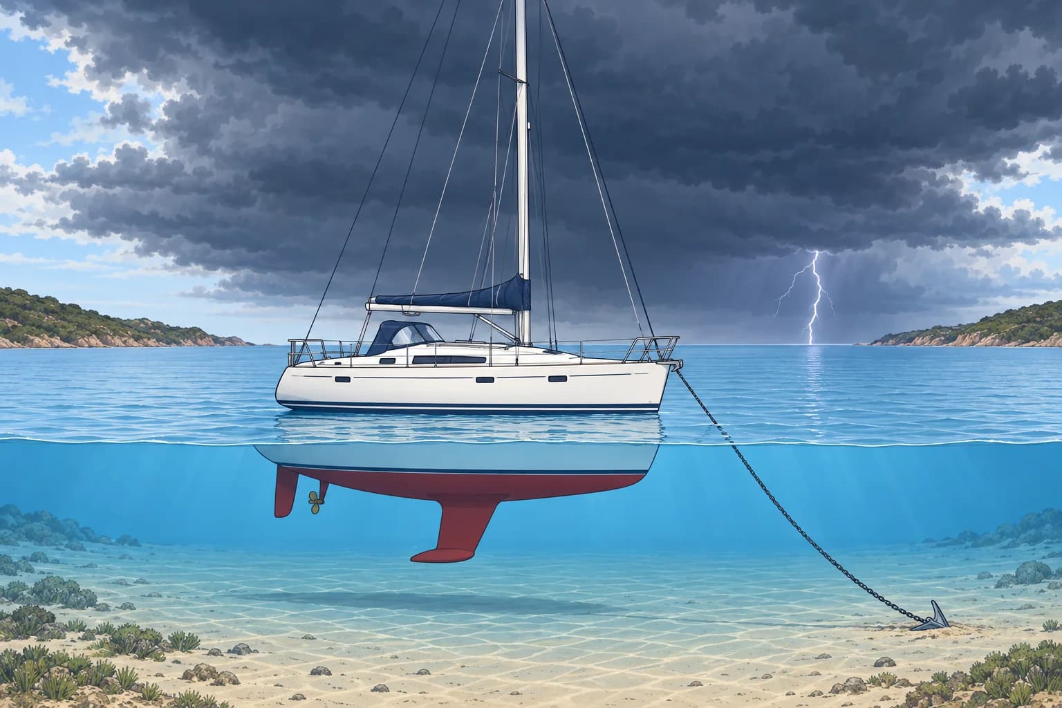
When thunderstorms threaten, stay in port or return before they arrive. If caught out, keep non-essential crew below, away from the mast, shrouds (mast-supporting wires), chainplates (their hull attachments) and other metal. Do not touch two metal parts at once. Those needed for navigation or urgent boat handling should keep low and avoid metal where safe. Keep a safe watch. Wait 30 minutes after the last thunder before resuming non-essential deck activity, whether or not the boat was struck.
Electronics
Lightning can destroy electronics even without a direct hit. Before the storm is close, switch off and disconnect non-essential equipment if safe. During nearby lightning, stay clear of cables and connectors. Keep a handheld VHF and GPS for emergencies. Some sailors put them in the oven or microwave as a makeshift Faraday cage, a metal box that shields its contents; it may help but gives no guarantee.
If someone is struck
A struck person carries no electric charge. If they are unresponsive and not breathing normally, start CPR and call for help; see First aid.
After a strike
Check people, then look for fire and leaks at through-hulls (pipe fittings through the hull), transducers (sensors fitted through the hull) and the keel. Check engine and steering. Have the compass checked for changed deviation (magnetic error caused by the boat). GPS course over ground is not heading. Expect electronics to fail. Have the hull lifted out and surveyed, even if it seems fine.
Key figures
- BoatUS claims (US)
- About 4 per 1,000 monohull sailing yachts a year
- Multihulls
- About twice as likely as monohulls to claim
- Aboard in a storm
- Below, away from mast, shrouds, chainplates, metal
- Struck person
- No charge remains; CPR if unresponsive and not breathing normally
- After a strike
- Fire, leaks, engine, steering, compass, electronics, haul out
- Non-essential deck activity
- Wait 30 minutes after the last thunder
Remember
- No place on a yacht is fully safe; the best plan is not to be out.
- Keep non-essential crew below, away from the mast, shrouds, chainplates and other metal; essential duties continue.
- A struck person carries no charge. If unresponsive and not breathing normally, start CPR.
- After a strike check for fire, leaks, steering and compass deviation.
- Lift the boat out for a hull survey even if no damage shows.
Common mistakes
Wrong: Our lightning protection system makes the boat safe.
Right: It reduces the risk of damage but cannot guarantee safety. Still stay below and away from metal.
Wrong: Do not touch a person struck by lightning: they are still charged.
Right: A struck person carries no charge. Help at once; start CPR if they are unresponsive and not breathing normally.
Wrong: The boat floats and the engine runs, so the strike did no harm.
Right: Damage to through-hulls, hull, rigging and electronics can show later. Haul out and survey.
Worked case
After a thunderstorm at anchor, you hear a bang and see a flash on the masthead. The VHF and plotter are dead. Nobody is hurt and there is no smoke. What do you check, and in what order?
Show the answer
Check people first, then look for fire, smoke and leaks at through-hulls, transducers, the keel joint and bilge. Check engine and steering. Have the compass checked for changed deviation; GPS course over ground is not heading. Use the handheld VHF for help if needed. Arrange a haul-out and survey, and tell your insurer.
Practice question
Where should crew without essential deck duties stay during a thunderstorm at sea?
- On deck, holding the shrouds
- Below, away from metal fittings
- At the mast, for an easy escape
- In the cockpit, by the steering
Show the answer
Answer: B. Non-essential crew should stay below, away from metal; essential helm, lookout and urgent boat-handling duties continue.
6 · Waterspouts
Waterspouts: fair-weather and tornadic
A waterspout is a spinning column of air over water. Some are tornadoes. Keep clear: choose the safe side at right angles to its track and increase separation.
Two kinds
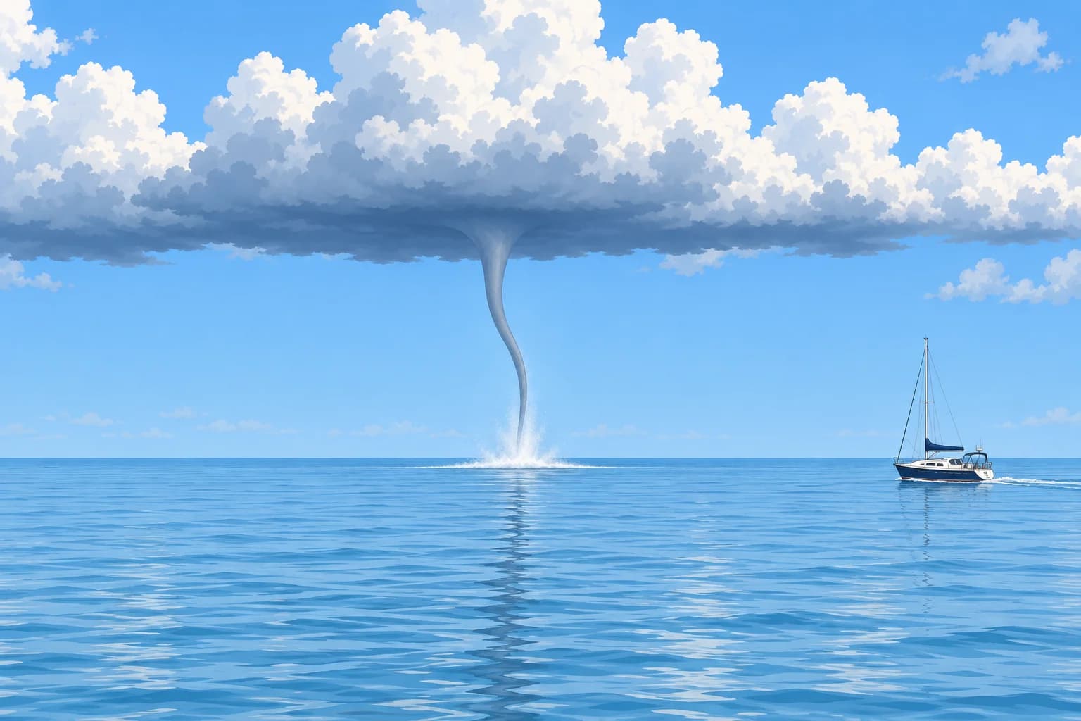
NOAA describes two kinds. A fair-weather waterspout forms at the sea surface under a line of growing cumulus, in light winds, and builds upwards. It is usually unassociated with thunderstorms and often moves very little. A tornadic waterspout is a tornado over water. It can form over water beneath a severe thunderstorm or move onto the sea from land, and can be as violent as a tornado ashore.
Stages of a fair-weather spout
Researchers describe five stages. A dark spot appears on the water. A spiral pattern of light and dark bands forms round it. A spray ring of swirling spray rises at its centre. In the mature vortex, the circulation is fully developed. Finally it decays, often within minutes. A funnel may appear before maturity; its visibility alone does not tell you the stage or strength. Never wait for a funnel before acting.
Where and when
Waterspouts are commonest over warm water: for example the Florida Keys in summer and the Mediterranean from late summer into autumn. Look for them under dark, flat-based lines of cumulus, near showers and along fronts. Tornadic spouts may accompany lightning, hail, heavy rain and rough seas; do not require these signs before taking action.
How dangerous
Even a weak spout can capsize a dinghy, damage sails and rig, and throw people overboard. A tornadic spout can destroy a yacht. Weather services issue marine warnings when spouts are likely or seen; listen for them. If one reaches land it is treated as a tornado.
Avoiding one
Increase separation immediately while tracking its movement. Choose the safe side at right angles to its observed track; never turn towards it. Use the engine if needed, reduce sail, close hatches, and get people below or clipped on low in the cockpit. Keep watching its movement and report it to the coastguard.
Key figures
- Fair-weather spout
- Forms at the surface, light winds, little movement
- Tornadic spout
- Tornado over water, from a severe thunderstorm
- Five stages
- Dark spot, spiral, spray ring, mature vortex, decay
- Avoidance (NOAA)
- At 90° to its track, choose the safe side; increase separation
Remember
- Fair-weather spouts grow up from the sea; tornadic ones are tornadoes over water, sometimes arriving from land.
- A dark spot and a spray ring on the water mean a spout is forming.
- Even a weak spout can damage a rig and throw people overboard.
- Move at right angles to its movement, choosing a safe course that increases separation. Never approach.
- Listen for marine warnings and report spouts you see.
Common mistakes
Wrong: Steer straight away from a waterspout, directly downwind of it.
Right: Choose the perpendicular direction that increases separation and keeps clear of hazards; keep watching its movement.
Wrong: Fair-weather waterspouts are harmless, so you can get close for a photo.
Right: Even a weak spout can damage a rig and injure people. Never approach any waterspout.
Worked case
Motor-sailing north off Mallorca, you see a dark patch and spray ring 1 NM north-east, moving west across your track. Open water lies south; shoals lie north. What do you do?
Show the answer
Turn south under engine now, at right angles to the spout's westward movement and away from its path. Reduce sail, close hatches, protect the crew and report it to the coastguard. Keep tracking its movement and watch for other spouts.
Practice question
How does a fair-weather waterspout form?
- Down from a supercell storm
- Up from the sea surface
- Out of a sea-fog bank
- From a land breeze at night
Show the answer
Answer: B. Fair-weather spouts form at the surface under growing cumulus and build upwards.