
Meteorology · Level R5 · 6 parts · about 17 min
Global winds, ocean weather and sea ice
6 short parts: Global circulation · Trades, doldrums · Westerlies · Monsoons · Sea ice, icebergs · Ice Patrol. Each part explains the idea, then gives the points to remember, the common mistakes, a worked case and a practice question; the Academy unit adds all 34 check questions.
1 · Global circulation
The global circulation: three cells and the pressure belts
The sun heats the tropics most, and Earth's rotation turns the moving air. The result is a pattern of pressure belts and wind belts you can plan an ocean passage on.
Why the air moves
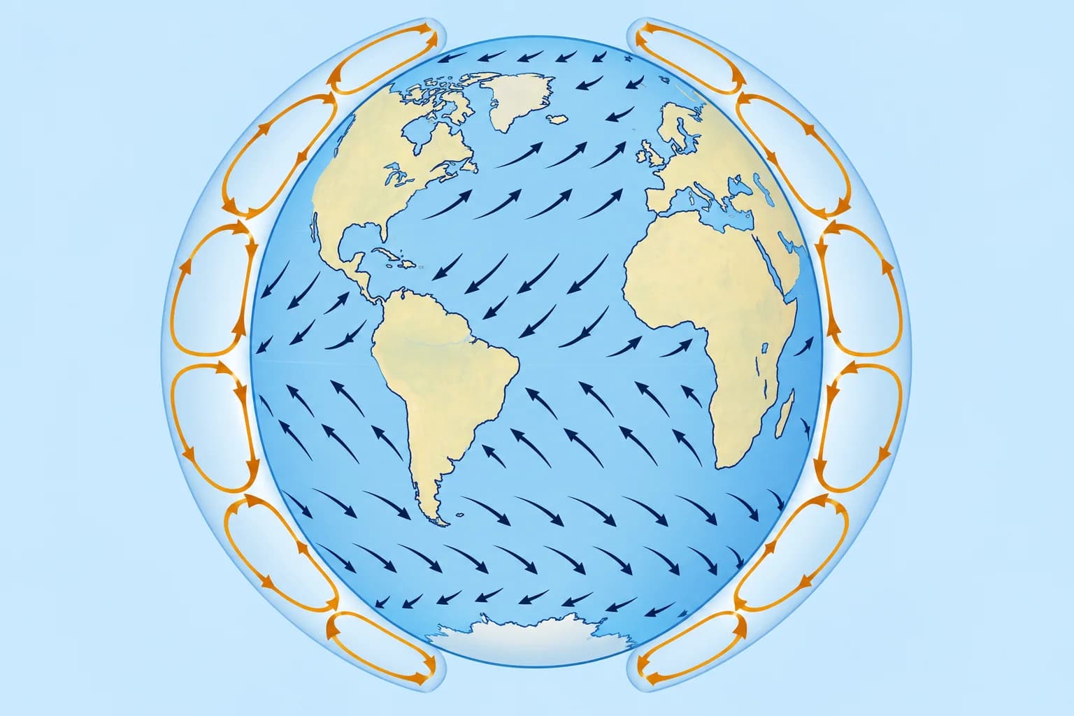
The sun heats the tropics far more than the poles. Warm air rises near the equator and flows poleward high up; cold air sinks near the poles. The Coriolis effect, the apparent turning caused by Earth's rotation, deflects moving air to the right in the northern hemisphere and to the left in the southern. So the flow breaks into three loops, or cells, in each hemisphere.
The three cells
In the Hadley cell (0°–30°), air rises near the equator, flows poleward aloft and sinks near 30°, returning equatorward at the surface. The Ferrel cell (30°–60°) has poleward surface flow, rising air near 60° and an equatorward return aloft. In the polar cell (60°–90°), air sinks over the pole, flows towards 60° at the surface, rises there and returns poleward aloft. These are simplified averages.
The pressure belts
Rising air leaves low pressure: the equatorial trough near the equator and the subpolar lows near 50°–60°. Sinking air builds high pressure: the subtropical highs near 30° and the polar highs. Over the oceans the subtropical belt breaks into large cells, such as the Azores High in the North Atlantic and the St Helena High in the South Atlantic.
The wind belts
Air flowing from the subtropical highs towards the equator, turned by Coriolis, makes the trade winds: north-east in the northern hemisphere, south-east in the southern. Air flowing poleward from the highs makes the westerlies of the middle latitudes. Near the poles blow the polar easterlies. Winds are named for where they come from.
The belts move with the seasons
The whole pattern shifts towards the summer hemisphere, lagging the sun by a month or two. In the northern summer the Azores High moves north and grows, the trades reach further north and the westerlies retreat. Land heats and cools faster than sea, which bends the belts further and drives the monsoons.
Key figures
- Hadley cell
- Equator to about 30°; rises at the equator, sinks near 30°
- Ferrel cell
- About 30° to 60°; westerlies at the surface
- Subtropical highs
- Near 30°, e.g. Azores High, St Helena High
- Subpolar lows
- Near 50°–60°, along the polar front
- Coriolis deflection
- Right in the northern hemisphere, left in the southern
- Seasonal shift
- Towards the summer hemisphere, lagging the sun
Remember
- Three cells in each hemisphere: Hadley, Ferrel and polar.
- Low pressure near the equator and near 50°–60°; high pressure near 30° and at the poles.
- Trades blow towards the equator: north-east in the north, south-east in the south.
- Westerlies blow on the poleward side of the subtropical highs.
- All the belts shift towards the summer hemisphere.
Common mistakes
Wrong: The trade winds blow from the west, as their westward-moving storms suggest.
Right: Trades blow from the north-east (north) or south-east (south). Storms move west because the trades carry them.
Wrong: The pressure belts stay at the same latitude all year.
Right: They shift towards the summer hemisphere, so the trades, calms and westerlies move with the season.
Worked case
A crew member treats 30° N as the fixed northern boundary of the trades and uses it to predict July winds. What assumption do you challenge?
Show the answer
The belts shift towards the summer hemisphere. In July they are generally farther north. Treat the textbook latitudes as averages and check the current position of the high.
Practice question
At about what latitude are the subtropical high-pressure belts found?
- About 30° north and south
- About 10° north and south
- About 60° north and south
- Right on the equator
Show the answer
Answer: A. Air sinking at the poleward end of the Hadley cell builds the subtropical highs near 30°.
2 · Trades, doldrums
Trade winds, the ITCZ, the doldrums and the horse latitudes
The trades are the ocean sailor's engine, the doldrums the place where it stops. Know where each belt lies in your month and how to cross the calms.
The trade winds
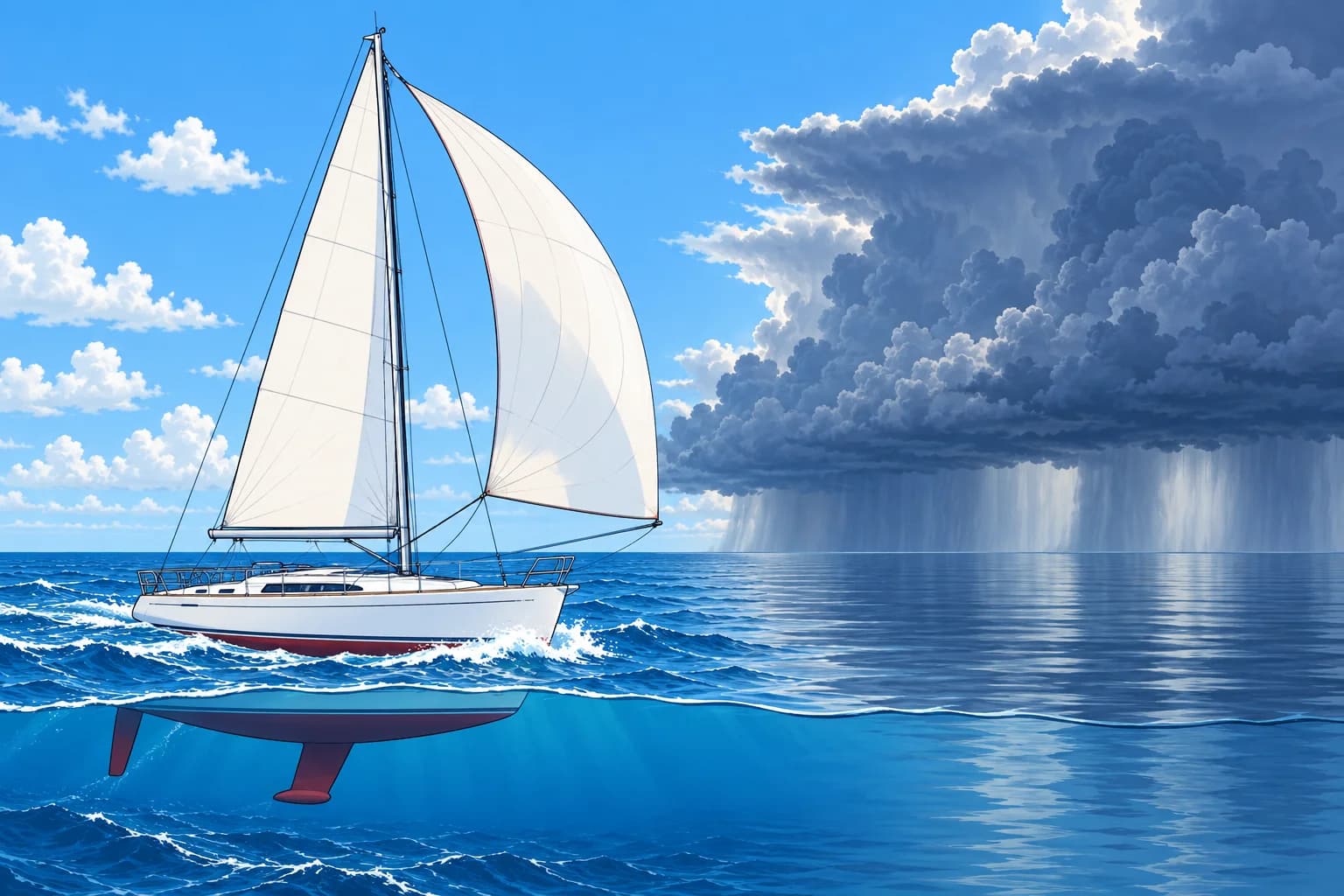
The trade winds blow steadily from the subtropical highs towards the equator, mostly force 3 to 5, with long fair-weather spells and small trade-wind cumulus. When the high is strong they become reinforced trades of force 6 or more for days, with big seas, as in the Caribbean in winter. Trade-wind squalls are common, especially at night; the Squalls unit covers them.
The ITCZ
Where the trades of the two hemispheres meet, the air rises along the Intertropical Convergence Zone (ITCZ), in the equatorial trough. In the Atlantic and eastern Pacific it stays mostly north of the equator, furthest north, around 10° N, in the northern late summer and closest to the equator in the northern late winter and spring. Over the Indian Ocean it swings much further with the monsoons.
The doldrums
The doldrums are the calm belt of the ITCZ: light, variable winds broken by squalls, heavy showers and thunderstorms. Their width changes from day to day and with longitude: a few miles in places, hundreds in others. Satellite images show the cloud band. The light-wind belt may be wider than its visible cloud band.
The horse latitudes
Near the centres of the subtropical highs, around 30°, sinking air gives light, variable winds and fair weather: the horse latitudes. The wind is weakest close to the centre of the high. When the high moves or stretches, a yacht can find days of calm there, so sail round the edge, where the isobars are closer and the wind steadier.
Key figures
- Trade winds
- Mostly force 3–5; reinforced trades force 6+ for days
- ITCZ (Atlantic, E Pacific)
- Mostly north of the equator; furthest north (~10° N) in late summer
- Doldrums
- Light, variable winds with squalls and thunderstorms
- Horse latitudes
- Calms near the centres of the subtropical highs, ~30°
- Spanish terms
- Alisios, ZCIT, calmas ecuatoriales, calmas tropicales
Remember
- The trades are steady, mostly force 3–5, with frequent squalls.
- The ITCZ is where the two trade systems meet; in the Atlantic it stays mostly north of the equator.
- The doldrums bring calms, squalls and thunderstorms; their width changes daily.
- The horse latitudes are the calms near the centre of a subtropical high.
Common mistakes
Wrong: The doldrums lie exactly on the equator all year.
Right: In the Atlantic and eastern Pacific they lie mostly north of the equator and move north and south with the season.
Wrong: The shortest route across a subtropical high is the fastest.
Right: Its centre is calm. Sail round the edge, where the wind is steadier, even if the distance is longer.
Wrong: Trade winds are always gentle.
Right: Reinforced trades can blow force 6 or more for days, with a big sea.
Worked case
You are sailing south from the Cape Verde Islands towards Brazil in October. The north-east trades are fading at 9° N, the sky to the south is a solid band of towering cloud and your fuel gives 300 miles of motoring. What conditions are likely, and does the fuel range alone establish whether you can motor across?
Show the answer
The fading trades and cloud band suggest the ITCZ. Expect variable winds, calms, squalls and heavy rain, then south-east trades beyond it. Check current forecasts and satellite images: the calm belt changes width, and the visible cloud band alone cannot show whether 300 miles of motoring range is enough.
Practice question
What is the ITCZ?
- Where the two trade systems meet
- The belt of westerlies near 40° south
- The edge of the polar sea ice in winter
- The centre of the North Atlantic high
Show the answer
Answer: A. The Intertropical Convergence Zone is where the north-east and south-east trades converge and the air rises.
3 · Westerlies
The westerlies and high-latitude ocean weather
Poleward of the subtropical highs, depressions march east one after another. In the south, with almost no land in the way, they make the Roaring Forties.
The westerly belt
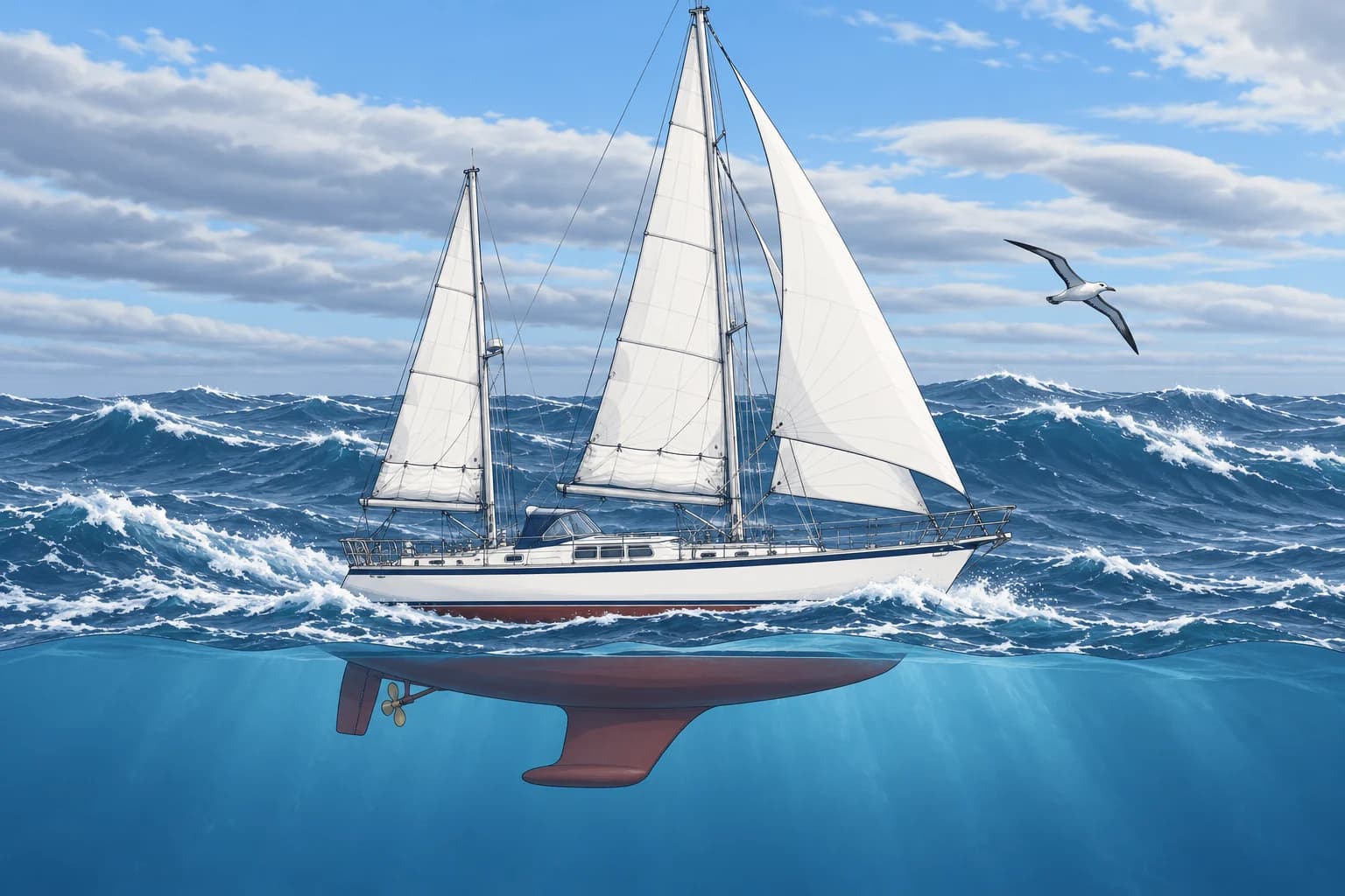
Between about 35° and 60° the prevailing wind is westerly, but rarely steady. Along the polar front, where cold polar air meets warm tropical air, depressions form and travel east, usually every few days. The wind changes direction and strength as each low and its fronts pass; the Pressure systems unit shows the sequence. Gales are far more frequent here than in the trades, especially in winter.
Northern hemisphere
In the North Atlantic most lows track north-east between Newfoundland and Iceland, past the British Isles and Norway. In winter they are deeper and further south; in summer they weaken and move north, while the Azores High expands.
Southern hemisphere
South of about 40° S there is almost no land to slow the wind or block the sea. The westerlies blow round the globe: the Roaring Forties, then the Furious Fifties and the Screaming Sixties. Lows follow each other quickly, with gales common in every season and a long, heavy swell from the west.
Cold-air hazards
At high latitude, cold air brings extra risks. Cold water can quickly incapacitate you, even when the air feels mild. Spray can freeze on deck and rigging: superstructure icing, which adds weight high up. Fog forms where warm air crosses cold water, as over the Grand Banks. Icebergs are covered later in this unit.
Key figures
- Westerly belt
- About 35°–60°; travelling depressions, gales common
- North Atlantic storm track
- North-east, Newfoundland – Iceland – Norway; further south in winter
- Roaring Forties
- 40°–50° S; Furious Fifties 50°–60° S
- Cold water
- Cold water can rapidly incapacitate; air temperature is no guide.
- Spanish terms
- Vientos del oeste, frente polar, cuarenta rugientes
Remember
- In the westerlies, depressions travel east along the polar front every few days.
- Northern storm tracks move south and deepen in winter, north in summer.
- South of 40° S nearly unbroken ocean gives the Roaring Forties and Furious Fifties.
- High latitude adds cold water, icing, fog and ice to the weather risk.
Common mistakes
Wrong: The westerlies blow as steadily as the trades.
Right: Travelling lows and fronts make winds shift and strengthen within the prevailing westerly circulation.
Wrong: The Roaring Forties blow only in the southern winter.
Right: Gales are common in every season there, with heavy swell from the west.
Worked case
You compare March and late May in the North Atlantic. How do the typical storm tracks, gale risk and Azores High differ?
Show the answer
In March, lows are generally deeper and track further south, bringing more frequent gales and heavy seas. By late May, the storm track is generally further north and the Azores High has expanded. Gales remain possible: these are seasonal tendencies, not a forecast.
Practice question
What commonly causes wind changes in the westerly belt?
- Steady outflow from the polar highs
- Sea breezes along the big continents
- Lows moving east along the polar front
- The ITCZ moving north every summer
Show the answer
Answer: C. Travelling lows and their fronts change wind direction and strength within the prevailing westerly circulation.
4 · Monsoons
Monsoons: seasonal winds that reverse
A monsoon is a seasonal wind that reverses direction between summer and winter. In the Indian Ocean it decides when you can sail and where.
What a monsoon is
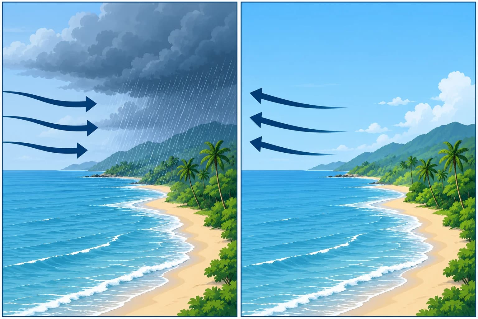
A monsoon is a large-scale seasonal wind that reverses direction between summer and winter. In summer the land heats faster than the sea: pressure falls over the continent and moist air flows in from the sea. In winter the land cools faster: pressure rises over it and dry air flows out to sea. The shift of the ITCZ with the seasons strengthens the effect.
The Indian Ocean
The clearest example is the north Indian Ocean. The south-west monsoon, roughly June to September, is strong and wet: force 6 to 7 is frequent in the Arabian Sea, with heavy seas, especially in July and August. The north-east monsoon, roughly November or December to March, is generally lighter and drier offshore, though some east-facing coasts have a wet winter monsoon. This reversal sets the sailing seasons in the region.
The transitions
Between the monsoons come the transition months, roughly April–May and October–November. Winds are often lighter and variable. Cyclone risk peaks around these transitions, when the sea is warm and vertical wind shear, the change in wind with height, is often weaker. Cyclones can also occur outside these months.
Other monsoons
Monsoon-like reversals also occur in South-East Asia and the South China Sea, off West Africa, and in northern Australia, where a north-westerly monsoon blows from about December to March. Each region's sailing directions describe the local timing and strength.
Planning
Most yachts cross the north Indian Ocean westbound in the north-east monsoon, roughly January to March. Routeing guides give the best months for each leg; the Ocean passage planning unit shows how to combine them with the main cyclone-risk periods.
Key figures
- Monsoon
- Seasonal wind that reverses between summer and winter
- South-west monsoon (N Indian Ocean)
- About June – September; strong, wet, force 6–7 frequent
- North-east monsoon
- About Nov/Dec–March; generally lighter and drier offshore
- Transition months
- About April–May and October–November; main cyclone-risk periods
- Spanish terms
- Monzón del suroeste, monzón del noreste
Remember
- A monsoon is a seasonal reversal of wind, driven by land heating and cooling.
- North Indian Ocean: strong south-west monsoon in summer, lighter north-east monsoon in winter.
- The transitions between monsoons are the north Indian Ocean's main cyclone-risk periods.
- Westbound yachts usually cross in the north-east monsoon, about January to March.
Common mistakes
Wrong: Monsoon just means heavy rain.
Right: It means a seasonal reversal of the wind. The summer monsoon is wet; the winter monsoon is often drier, depending on the region.
Wrong: The calm transition months are the safest time to cross.
Right: Light winds do not mean low cyclone risk: activity peaks around the transitions. Check current warnings.
Worked case
In Phuket in July, a skipper wants to sail west across the Bay of Bengal and the Arabian Sea to Oman as soon as possible. What do you advise about timing?
Show the answer
July is the height of the south-west monsoon: strong headwinds and heavy seas on that route. October–November brings lighter winds but is a main cyclone-risk period, especially in the Bay of Bengal. The usual choice is to wait for the established north-east monsoon, about January to March, which gives fair winds westbound.
Practice question
What defines a monsoon?
- Heavy rain from a passing front
- A local wind from the mountains
- A seasonal reversal of the wind
- A daily sea breeze on a hot coast
Show the answer
Answer: C. A monsoon is a large-scale seasonal wind that changes direction between summer and winter.
5 · Sea ice, icebergs
Sea ice and icebergs: terms, dangers and handling
Sea ice forms from frozen seawater; icebergs break off glaciers. Learn the international terms and why small pieces are the most dangerous to a yacht.
Two kinds of ice
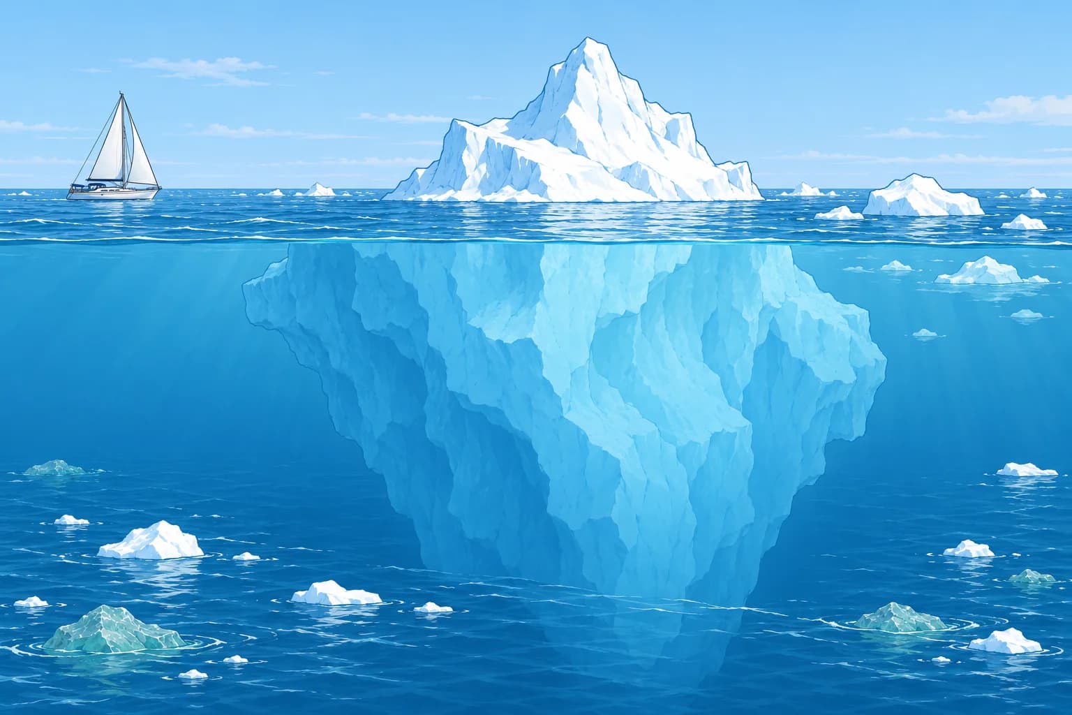
Sea ice is frozen seawater. Icebergs are pieces of glacier ice, of land origin, that have broken off, or calved, into the sea. Arctic sea ice usually reaches its maximum in March and minimum in September; Antarctic sea ice usually peaks in September and reaches its minimum in February. Most of an iceberg is under water, typically about nine-tenths of its mass, and it can extend far sideways below the surface.
Sea ice terms
The WMO sea-ice nomenclature is used in English in ice reports worldwide. Fast ice is sea ice attached to the shore. Pack ice is any sea ice other than fast ice, drifting with wind and current. An ice shelf is a floating sheet of glacier ice attached to the coast, ending in a high ice cliff. Bare ice has no snow on it. Ice concentration is given in tenths of the sea surface covered.
Iceberg sizes
An iceberg shows more than 5 m above the sea. A bergy bit shows about 1–5 m, with an area of about 100–300 m². A growler shows less than about 1 m, with an area of about 20 m²: often greenish or almost transparent, and hard to see.
Ice detection limits
Even large icebergs may give weak radar echoes. Small pieces are especially easy to miss in sea clutter, the echoes from waves. They float low, so you may see them only when close. A rising sea temperature or a falling one is no reliable warning. Keep a sharp lookout, slow down in ice areas at night or in fog, and give icebergs a wide berth.
Passing an iceberg
Pass to windward, the side facing the wind: wind and sea drive the bergy bits and growlers that break off it downwind. Keep well clear: underwater spurs reach out from the berg, and a melting berg can capsize or calve without warning. A yacht should not enter pack ice.
Key figures
- Iceberg
- More than 5 m above the sea
- Bergy bit
- About 1–5 m above the sea; about 100–300 m²
- Growler
- Less than about 1 m above the sea; about 20 m²
- Fast ice / pack ice
- Attached to the shore / any other sea ice, drifting
- Arctic sea ice
- Most in March, least in September
- Spanish terms
- Iceberg, témpano, banquisa (pack ice), hielo fijo (fast ice)
Remember
- Sea ice is frozen seawater; icebergs are glacier ice that has calved into the sea.
- Iceberg over 5 m high; bergy bit about 1–5 m; growler under about 1 m.
- Growlers and bergy bits are hard to see and can hide in radar sea clutter.
- Pass icebergs to windward and give them a wide berth.
- Sea temperature is no reliable warning of nearby ice.
Common mistakes
Wrong: Radar will always show an iceberg in time.
Right: Even a large berg may give a weak echo. Small pieces can hide in sea clutter. Keep a lookout and reduce speed.
Wrong: Pass an iceberg to leeward, on its downwind side.
Right: Pass to windward. Broken-off growlers and bergy bits drift downwind of the berg.
Wrong: Fast ice is sea ice moving fast with the current.
Right: Fast ice is fastened to the shore. Drifting sea ice is pack ice.
Worked case
Crossing south of Newfoundland in June, at night, in a moderate sea with patchy fog, the radar shows a large iceberg 4 miles ahead, fine on the bow. The wind is from the south-west. How do you pass it?
Show the answer
Alter early to pass it on its windward, south-west side, with a wide berth. Reduce speed: growlers and bergy bits from the berg may lie downwind of it, and they can hide in the radar clutter. Post an extra lookout forward, use the searchlight if needed and report the berg's position to the International Ice Patrol.
Practice question
What is a growler?
- A small piece of ice under about 1 m high
- A large tabular iceberg from an ice shelf
- Sea ice attached firmly to the shore
- The roar of pack ice moving in a gale
Show the answer
Answer: A. A growler shows less than about 1 m above the sea, with an area of about 20 m². It is very hard to see.
6 · Ice Patrol
The International Ice Patrol and iceberg warnings
Since the Titanic, the International Ice Patrol has warned ships of icebergs off Newfoundland. Know its season, its products and how to report ice.
Why it exists
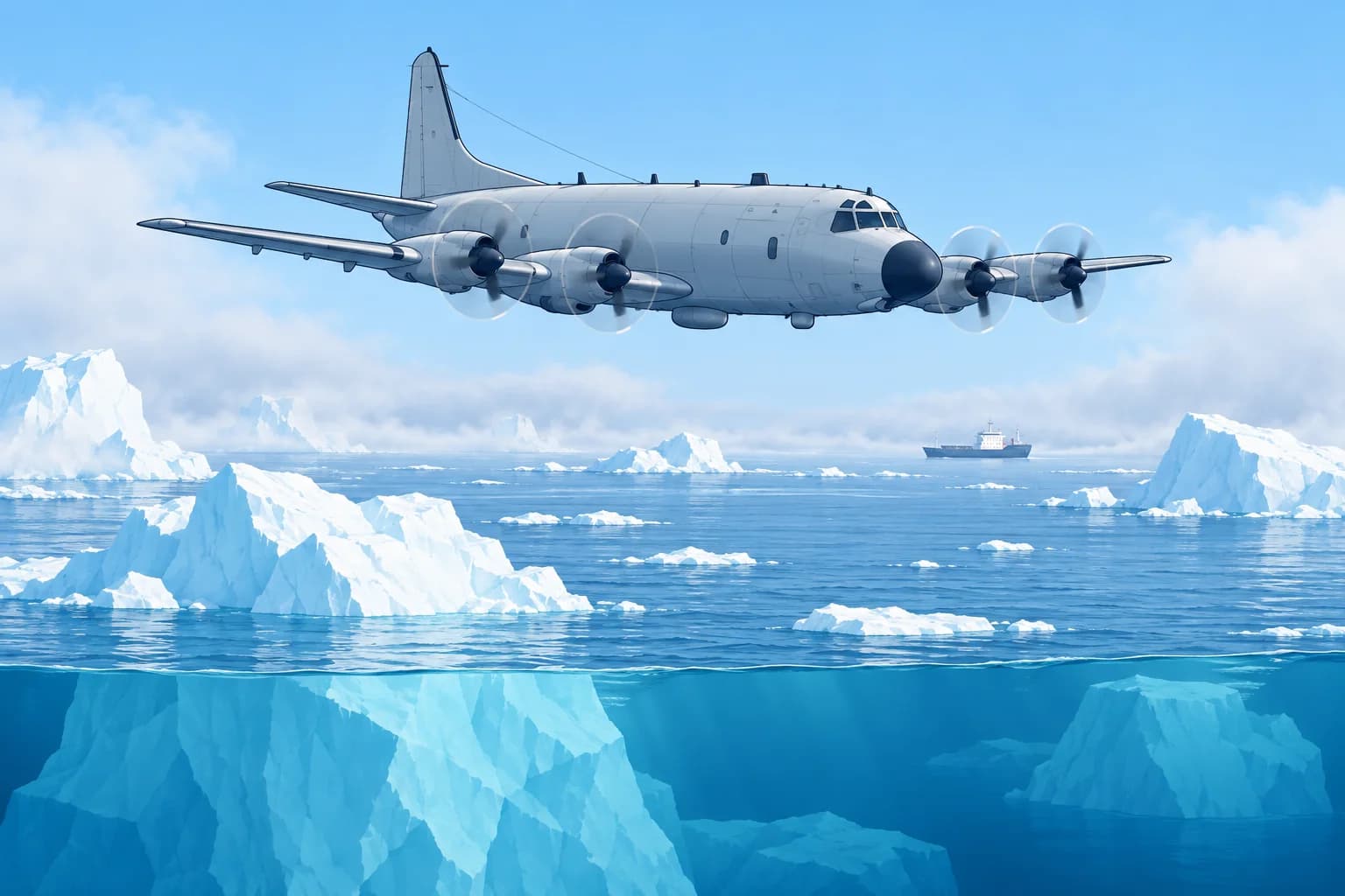
The International Ice Patrol (IIP) was formed after RMS Titanic sank on 15 April 1912, after striking an iceberg. Run by the US Coast Guard under SOLAS, the International Convention for the Safety of Life at Sea, it has monitored the iceberg danger around the Grand Banks of Newfoundland since 1913, except in wartime. The Labrador Current carries Greenland's icebergs south into the transatlantic shipping lanes there.
The iceberg season
IIP counts the icebergs that drift south of 48° N, about the latitude of St John's, Newfoundland. They usually threaten the shipping lanes from about February to August. IIP issues the warnings in that period; the Canadian Ice Service does so for the rest of the year. Both work together as the North American Ice Service (NAIS).
Severity
IIP grades a season by the number of icebergs south of 48° N: light up to 230, moderate 231–1,036, severe 1,037–1,398 and extreme above that. In the 2025 season, 250 icebergs drifted south of 48° N: a moderate season. That year IIP worked from satellites alone, without patrol aircraft, and found icebergs under 20 m long hard to detect.
The products
The Iceberg Limit estimates the limit of all known ice. The text bulletin is broadcast by Inmarsat SafetyNET in NAVAREA IV and NAVTEX. The chart is available by radiofax and online from the IIP website. Sightings and drift-and-melt modelling support both products. IIP strongly discourages navigating inside the limit using its products alone.
Reporting ice
Report every iceberg, or any stationary radar target that may be one, to IIP: position, time, size, shape and how you detected it. By Inmarsat-C, use special access code 42: the message is free. Southern Ocean ice has no equivalent patrol; check national ice services and current satellite ice reports.
Key figures
- IIP
- US Coast Guard under SOLAS; since 1913, after Titanic (1912)
- Area
- Grand Banks of Newfoundland; Labrador Current brings the bergs
- Season
- Icebergs south of 48° N, typically February – August
- 2025 season
- 250 icebergs south of 48° N: moderate
- Products
- Text: SafetyNET/NAVTEX; chart: radiofax/IIP website
- Reporting
- To IIP; Inmarsat-C code 42 is free
Remember
- IIP, run by the US Coast Guard under SOLAS, has watched for icebergs off Newfoundland since 1913.
- The iceberg season, icebergs south of 48° N, typically runs from February to August.
- The daily Iceberg Limit marks the estimated limit of all known ice.
- Do not navigate inside the limit relying on the warnings alone.
- Report icebergs to IIP; by Inmarsat-C, code 42 is free.
Common mistakes
Wrong: Outside the Iceberg Limit there cannot be any ice.
Right: The limit covers known ice only. Undetected icebergs can lie outside it, so keep a lookout anyway.
Wrong: The Ice Patrol covers the whole North Atlantic and the Southern Ocean.
Right: It covers the area around the Grand Banks. Elsewhere use national ice services and satellite reports.
Worked case
In May you plan a passage from Halifax towards the Azores. The IIP chart shows the Iceberg Limit reaching 42° N, 47° W, south-east of the Grand Banks. A crew member suggests cutting the corner inside the limit to save a day. What do you decide?
Show the answer
Route south of the Iceberg Limit with a margin, even if it costs time. The limit is drawn from model-estimated positions, and IIP strongly discourages navigating inside it on its products alone. Receive the bulletin by SafetyNET or NAVTEX; obtain the chart by radiofax or from the IIP website. Keep a strict lookout near the limit, and report any ice you see by Inmarsat-C code 42.
Practice question
Which organisation runs the International Ice Patrol?
- The Canadian Coast Guard
- The US Coast Guard
- The UK Hydrographic Office
- The Danish Navy
Show the answer
Answer: B. The US Coast Guard runs it under SOLAS, working with the Canadian Ice Service in the North American Ice Service.