
Emergencies at sea · Level P2 · 5 parts · about 16 min
Search and rescue near the coast: IAMSAR for small ships
5 short parts: IAMSAR and OSC · Datum and spacing · Search patterns · Radio on scene · Handing over. Each part explains the idea, then gives the points to remember, the common mistakes, a worked case and a practice question; the Academy unit adds all 33 check questions.
1 · IAMSAR and OSC
IAMSAR Volume III and the on-scene coordinator
Near the coast a small ship is often first on scene. Know what IAMSAR Volume III expects and how to coordinate until better-equipped help takes over.

The manual on your bridge
SOLAS chapter V, regulation 21, requires every ship to carry an up-to-date IAMSAR (International Aeronautical and Maritime Search and Rescue) Manual Volume III, the volume for mobile facilities: ships and aircraft. The current 2025 edition applies from 1 January 2026. Keep the printed book on the bridge. It explains how to respond to a distress alert, how to coordinate units on scene and how to handle emergencies on board, with checklists you can work through.
Who runs the rescue
In an RCC-coordinated SAR mission, the SAR mission coordinator (SMC) at the rescue coordination centre (RCC) plans the search and calls in units. Near the coast, help may include lifeboats, coastguard boats and helicopters. The basics of the system and how to raise the alarm are in Emergencies: search and rescue. This unit covers your part at the scene.
The on-scene coordinator
When two or more units work together at the scene, one of them is the on-scene coordinator (OSC). The SMC normally names the OSC. Until then, the first unit to arrive takes the role. A coastal ship may therefore coordinate for the first hour, then hand over to a coastguard unit or lifeboat with better sensors and training. The OSC coordinates, but each master stays responsible for the safety of their own ship.
What the OSC does
The OSC carries out the SMC's search plan, or makes a simple one if none has arrived. They give each unit a pattern or area, a track spacing (the distance between neighbouring search legs) and a radio channel. They keep a plot of what each unit has searched and send regular situation reports (SITREPs) to the RCC. They warn the SMC early when weather, fuel or daylight will change the plan.
On the way
Plan with your team as you approach the scene: lookouts posted high with binoculars, the rescue boat and recovery gear ready, the sheltered side chosen and a space ready for survivors. Tell the RCC your position, speed, estimated time of arrival (ETA) and what you can offer. Leading a large multi-unit SAR case is in Emergencies: emergency response; your own ship's distress response is in Emergencies: emergency organisation.
Key figures
- IAMSAR Volume III
- Mobile facilities; carriage required by SOLAS V/21
- Current edition
- 2025 edition, applies from 1 January 2026
- OSC
- Named by the SMC; until then, the first unit on scene
- Master's duty
- Responsibility for your own ship never passes to the OSC
- Reports
- OSC sends regular SITREPs to the RCC
Remember
- Carry the current IAMSAR Volume III (2025 edition, from 1 January 2026) in print on the bridge.
- The SMC at the RCC plans; the OSC coordinates the units at the scene.
- Until the SMC names one, the first unit on scene acts as OSC.
- As OSC you allocate patterns, spacing and channels and send SITREPs, but every master keeps command of their ship.
Common mistakes
Wrong: Wait at the scene until the RCC tells you who coordinates.
Right: If you arrive first and nobody has been named, act as OSC until the SMC appoints one.
Wrong: As OSC you can order another ship into danger.
Right: The OSC coordinates. Each master decides what is safe for their own ship and crew.
Wrong: The IAMSAR book can stay in the ship's office as a PDF.
Right: Keep the current printed Volume III on the bridge, ready to use in an emergency.
Worked case
Your 300 GT coastal cargo ship will reach the search area for two missing fishers first. A tanker follows 20 minutes later. No OSC has been named. The tanker’s draught prevents it searching the shallow western sector. What do you do?
Show the answer
While approaching, report your position, speed, ETA and capabilities to the RCC and prepare lookouts and recovery gear. Act as OSC until the SMC names one. Give the tanker a safe task outside the shallows, with a pattern, spacing and channel. Keep a plot and send SITREPs. Each master retains responsibility for their ship; tell the RCC about limits on coverage.
Practice question
Which IAMSAR volume must a ship carry on board?
- Volume I, organisation and management
- Volume II, mission coordination
- Volume III, mobile facilities
- Only the national SAR plan
Show the answer
Answer: C. SOLAS V/21 requires ships to carry an up-to-date Volume III, written for ships and aircraft at the scene.
2 · Datum and spacing
Datum, drift and track spacing
The casualty does not stay where it was last seen. Work out where it has drifted, then choose leg spacing that suits the object, visibility and sea.
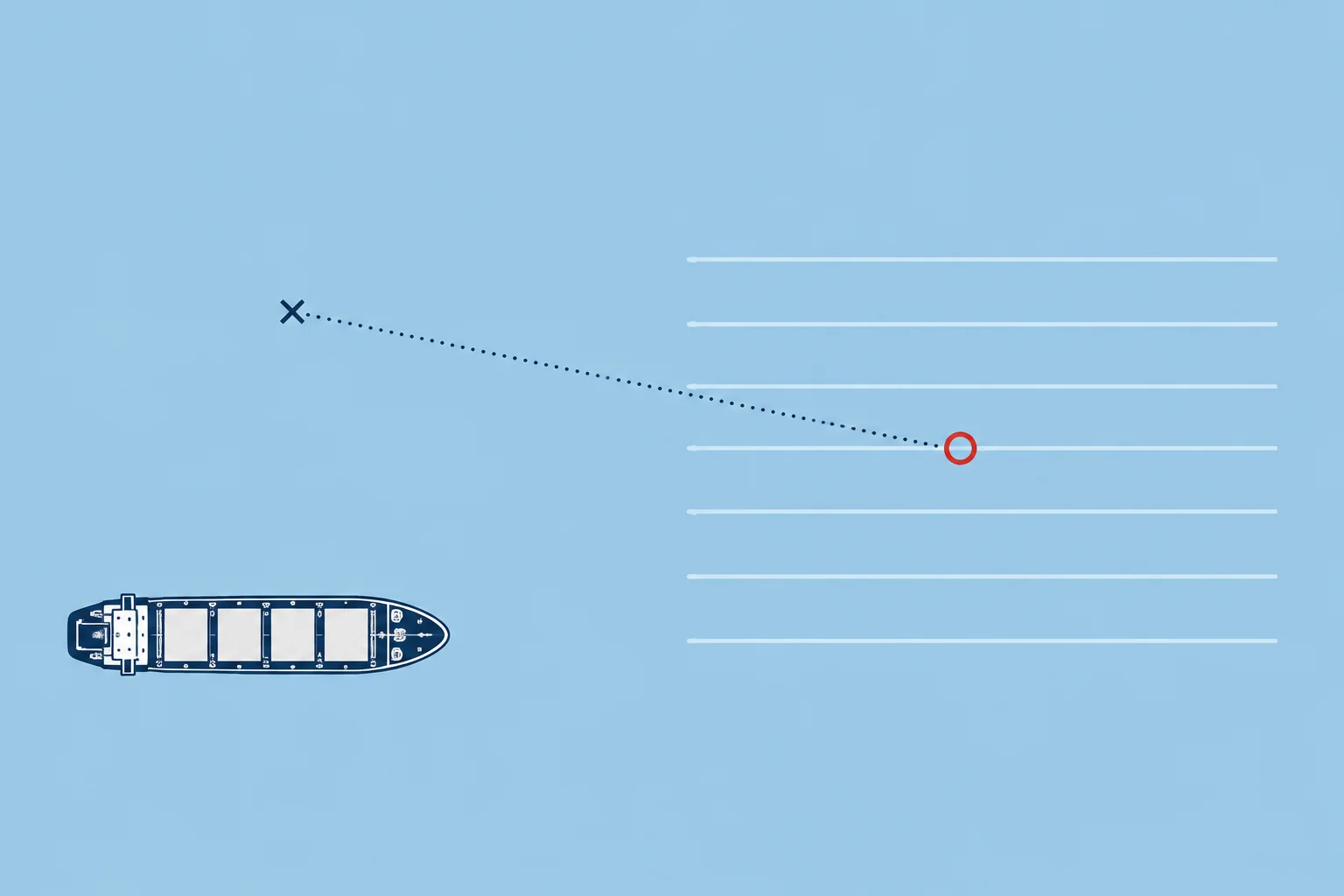
Datum
Datum is the most probable position of the search object at a given time. It starts from the last known position and moves with drift: the total water current (tidal, wind-driven and other background currents) and leeway, the push of the wind on the object itself. A person in the water has little leeway; a liferaft without its drogue (a small sea anchor) can blow quickly downwind. Near the coast, tidal streams change every few hours, so datum must be updated as time passes.
Search area
Positions and drift are never exact, so a search area is drawn around datum. The longer since the incident, the bigger it grows. If you are OSC with no plan from the RCC, IAMSAR Volume III shows how to make a simple one: work out datum, choose a pattern and start at the commence search point (CSP), where the first leg begins.
Sweep width and track spacing
Sweep width measures search effectiveness. Imagine finding every object inside a strip along your track and none outside. Sweep width is the strip width that gives the same overall detection performance as the real search. It is not a guaranteed sighting range. Track spacing (S) is the distance between neighbouring search legs. Use IAMSAR Volume III tables for the object and visibility, then apply the weather correction. A person in the water needs closer legs than a large boat.
Time against chance
Halving track spacing roughly doubles the time needed to cover the same area at the same speed. It raises the probability of detection (POD): the chance of finding the object if it is there. With limited time, closer legs cover less area. Agree the balance with the OSC rather than tightening spacing on your own.
Lookouts
Detection depends on people. Post lookouts high, on both bridge wings and forward, each with a sector to scan and binoculars. Change them often, because attention fades. At night use searchlights and keep deck lights from dazzling the lookouts.
Key figures
- Datum
- Most probable position of the object at a given time
- Drift
- Total water current plus leeway
- Track spacing (S)
- Distance between adjacent search legs
- Spacing depends on
- Object, visibility and a weather correction factor
- CSP
- Commence search point, where the first leg starts
- POD
- Chance of finding the object if it is in the area
Remember
- Datum is where the object most probably is now: last known position moved by drift.
- Drift is total water current plus leeway; near the coast, tidal streams change it every few hours.
- Track spacing comes from IAMSAR tables by object and visibility, reduced for weather.
- Closer legs take longer but raise the probability of detection.
Common mistakes
Wrong: Search around the position given in the distress alert.
Right: Search around datum: the last known position moved by drift for the time that has passed.
Wrong: Use the same track spacing for a person in the water as for a fishing boat.
Right: A person in the water is hard to see; IAMSAR tables give much closer spacing for small objects.
Wrong: Keep the table spacing in a rough sea.
Right: Apply the weather correction: wind and waves hide small objects, so legs must be closer.
Worked case
A crewman fell overboard 3 hours ago. The stream has run east at 1.5 knots, but is now turning. Wind is light. Another ship proposes keeping datum fixed at the position calculated for your arrival. You are OSC. What do you decide?
Show the answer
Estimate datum about 4.5 NM east of the last known position for your arrival time; leeway is small in light wind. Do not freeze it there or keep projecting the old stream eastward. Update datum as the stream changes and report it to the RCC and searching units. Choose spacing for a person in the water using the visibility table and weather correction. Agree the CSP and post lookouts.
Practice question
What is datum in a search?
- The position given in the first distress alert
- The most probable position of the object now
- The position of the on-scene coordinator
- The point where the RCC is located
Show the answer
Answer: B. Datum is the last known position corrected for drift: where the object most probably is at a given time.
3 · Search patterns
Expanding square, sector, track line and parallel sweep
Pick the pattern that suits what you know: a close position, a known route or a large uncertain area, then run it accurately and report it.
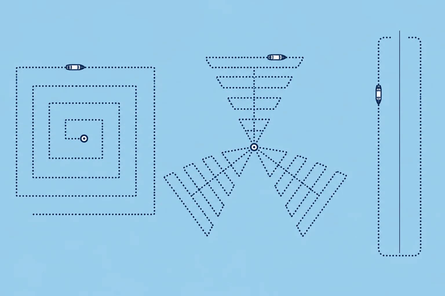
Expanding square (SS)
Use it when the object's position is known within close limits and it has little leeway, such as a person in the water. Start at datum. The first two legs are one track spacing long, the next two are 2S, then 3S, and so on, turning 90° the same way after every leg. Run the first leg into the wind where you can, to reduce navigation errors. It needs accurate navigation, so plot every leg. Only one ship runs it at a time.
Sector search (VS)
Use it when the position is accurate and the area small. Mark datum with a smoke float or suitable marker. Ships usually use a radius of 2 to 5 NM, where safe. Run three triangles, each starting and ending at datum. Turn 120° to starboard only at the outer points. Continue straight through datum between triangles. After three triangles, you finish at datum. If nothing is found, repeat the pattern rotated 30°.
Track line search (TS)
For a craft missing on a known route, use a track line search. TSR (return) searches one side outbound and the other back, finishing near the start. TSN (non-return) searches the route itself, returns along one side, then searches outbound along the other, finishing near the far end. Non-return describes where the search finishes; it does not mean that no leg runs back along the route.
Parallel sweep (PS)
For a large area where the position is uncertain, units search on parallel legs at the track spacing apart, often several ships abreast. The SMC or OSC sets the legs and the commence search point. Planning large coordinated searches belongs to Emergencies: emergency response.
Choose and report
Good position, small area: expanding square or sector. Known route: track line. Large area, several units: parallel sweep. Whatever the pattern, tell the OSC when you start, each leg completed and anything sighted, with its position and time.
Key figures
- Expanding square
- Start at datum; legs S, S, 2S, 2S, 3S…; 90° turns, same way
- Sector search, ships
- Radius usually 2–5 NM where safe; 120° starboard turns at outer points
- Second sector search
- Rotate the pattern 30°
- Track line
- TSR finishes near the start; TSN at the far end
- Parallel sweep
- Large uncertain area; parallel legs, often ships abreast
Running a sector search from a ship
- Update datum for drift and mark it with a smoke float or suitable marker. — A visible centre helps you navigate the pattern. Keep checking its position as drift changes.
- Agree a safe radius, R, and the first heading with the OSC; check every leg and turn against the chart. — Keep clear of land and shoals and allow safe turning room. Other units must know your plan.
- From datum, run R; turn 120° to starboard and run R. — The first leg reaches an outer point; the next runs across to another outer point.
- Turn 120° to starboard and run 2R through datum. Turn 120° to starboard and run R. — Crossing datum completes the first triangle and starts the second. The next leg joins its outer points.
- Turn 120° to starboard and run 2R through datum. Turn 120° to starboard and run R. Turn 120° to starboard and run R back to datum. — The second datum crossing starts the third triangle. Finish at datum.
- If nothing is found, rotate the pattern 30° and run it again. — The new legs fall halfway between the first and cover the gaps.
Remember
- Expanding square: from datum, legs S, S, 2S, 2S, 3S…, 90° turns the same way, first leg into the wind.
- Sector search: 120° turns at outer points; straight through datum; radius usually 2–5 NM; repeat rotated 30°.
- Track line: TSR searches both sides and finishes near the start; TSN searches the route and both sides, ending at the far end.
- Parallel sweep for large areas; report start, legs and sightings to the OSC.
Common mistakes
Wrong: Run an expanding square with two ships in the same small area.
Right: Only one ship runs a square or sector in a given area; more units would risk collision and gaps.
Wrong: Start a sector search from where you happen to be.
Right: Mark datum and start there. Turn only at outer points; continue straight through datum between triangles, then finish at datum.
Wrong: Use a parallel sweep for a person seen in the water a few minutes ago.
Right: When the position is good and the area small, a sector or expanding square finds the person faster.
Worked case
A yacht reports a crew member in the water 1 NM off a headland, seen ten minutes ago. Visibility is good, wind light. You are the only ship nearby; a lifeboat is 25 minutes away.
Show the answer
Update datum for drift since the sighting. Check the chart and choose a sector radius and headings that keep every leg and turn clear of the headland and shoals; 2 NM may be unsafe here. Mark datum, post lookouts and report your plan and start to the RCC. Report coverage and sightings at once. Coordinate with the lifeboat before it joins; hand over only when a new OSC is designated.
Practice question
In an expanding square search, how long are the first two legs?
- One track spacing each
- Two track spacings each
- Half a track spacing each
- One radius of the area each
Show the answer
Answer: A. The legs run S, S, 2S, 2S, 3S, and so on, growing by one track spacing every two legs.
4 · Radio on scene
Communications on scene: VHF, DSC and aircraft
Alert on DSC, talk on voice. Keep watch on the on-scene channel the coordinator names, and know which frequencies reach a rescue aircraft.
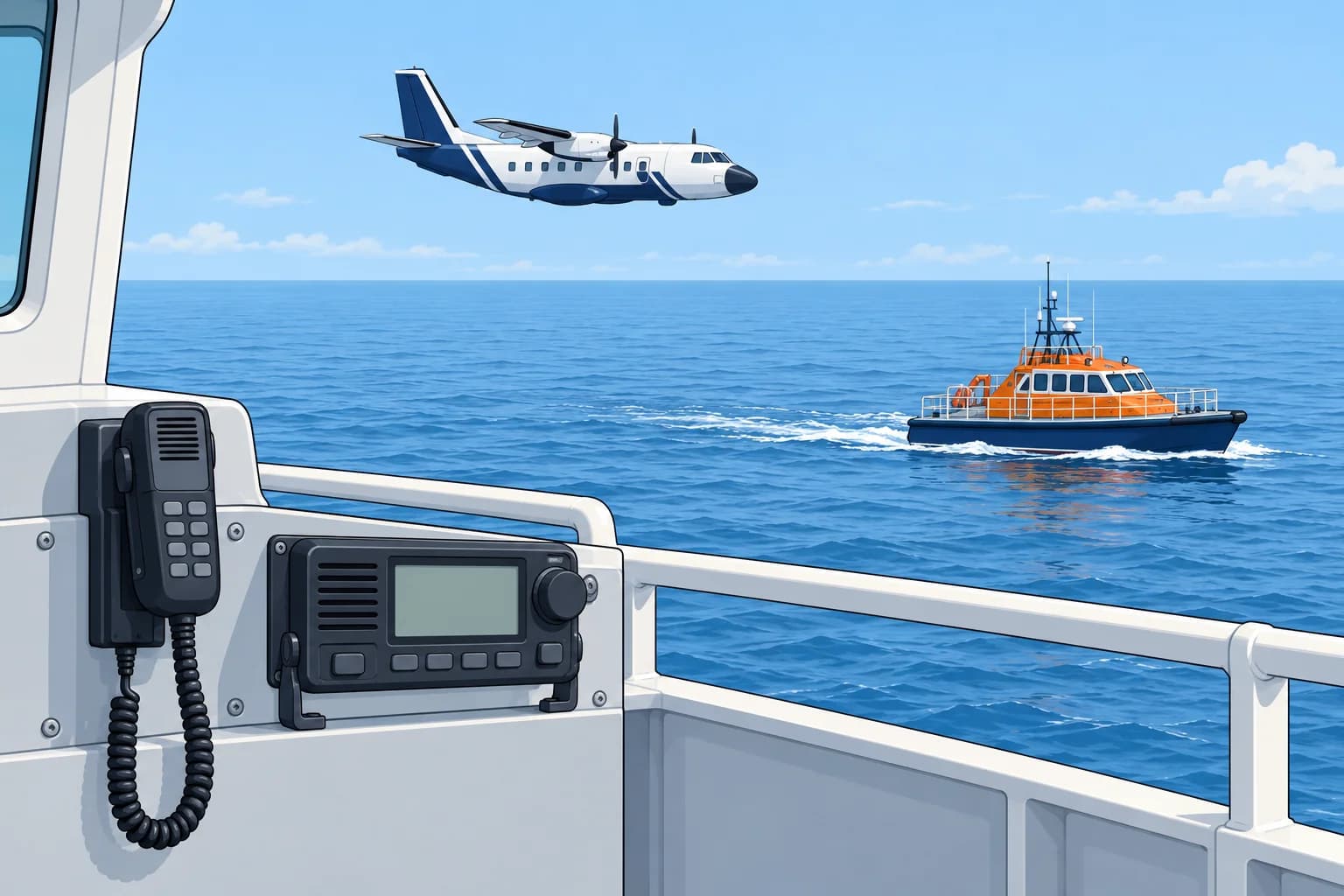
DSC and voice
DSC (digital selective calling) uses VHF channel 70 for digital calls, including distress alerts; it carries no voice. Distress voice traffic uses channel 16 (156.8 MHz). On MF (medium frequency), distress voice uses 2182 kHz.
The on-scene channel
The SMC or OSC names the on-scene frequency, and every unit keeps continuous watch on it. On VHF this is usually channel 16 or an assigned working channel. Maintain channel 16 listening watch when practicable. VHF channel 06 (156.3 MHz) is the ship–aircraft channel for SAR, and many rescue aircraft can use it.
Aircraft frequencies
Aircraft work on aeronautical VHF. 121.5 MHz is the aeronautical emergency frequency and 123.1 MHz the aeronautical on-scene frequency. You need aeronautical VHF equipment to use these frequencies. Otherwise, use channel 06 if the aircraft supports marine VHF, or relay through the RCC. A helicopter briefing on deck is in Emergencies: helicopter and flares.
Say it clearly
Use plain English and SMCP phrases (Standard Marine Communication Phrases). Give positions as latitude and longitude, or as bearing and distance from datum. Repeat key figures. Report every sighting at once: what, where and when. Keep one person on the radio and log every message with its time.
SITREPs
A SITREP (situation report) keeps the RCC up to date. At least, it says who you are, where you are, what has happened, how many people are involved, what has been done and what help is needed. Send one on arrival, then at the interval the SMC sets, and at once when something important changes.
Key figures
- DSC, VHF channel 70
- DSC signalling; no voice
- Voice distress, VHF
- Channel 16, 156.8 MHz
- Ship–aircraft SAR, VHF
- Channel 06, 156.3 MHz
- Aeronautical
- 121.5 MHz emergency; 123.1 MHz on-scene
- MF voice distress
- 2182 kHz
- On-scene frequency
- Named by the SMC or OSC; all units keep watch
Remember
- Channel 70: DSC signalling; no voice. Distress voice uses channel 16.
- Keep continuous watch on the assigned on-scene channel, and channel 16 listening watch when practicable.
- Channel 06 links ships and SAR aircraft on marine VHF; aircraft also use 121.5 and 123.1 MHz.
- Report sightings at once and send SITREPs on arrival, at set intervals and on every big change.
Common mistakes
Wrong: Call the other ships on channel 70 to coordinate the search.
Right: Channel 70 carries DSC signalling; no voice. Coordinate by voice on 16 or the working channel named.
Wrong: A cargo ship can always talk to a SAR aircraft on 123.1 MHz.
Right: You need aeronautical VHF; otherwise use channel 06 if the aircraft supports marine VHF, or relay through the RCC.
Wrong: Wait until the search ends to report a sighting.
Right: Report every sighting at once with position and time; it may change the whole plan.
Worked case
You are OSC for two ships searching for a missing dinghy. A coastguard aircraft is coming. Your ship has no aeronautical VHF. The RCC says the aircraft can work marine VHF.
Show the answer
Keep the ships on the assigned search channel with continuous watch, and maintain channel 16 listening watch when practicable. Contact the aircraft on channel 06 using a separate voice set if available; otherwise ask the RCC to relay or agree a common channel while maintaining the search watch. Brief the aircraft on datum, coverage and sightings, and agree its task. Send the RCC an updated SITREP.
Practice question
What is VHF channel 70 used for?
- Ship-to-ship search talk
- Digital selective calling
- Weather broadcasts
- Talking to aircraft
Show the answer
Answer: B. Channel 70 carries DSC signalling, including distress alerts, but no voice. Distress voice uses channel 16.
5 · Handing over
Handing over, survivors and ending the search
Pass search coverage and sightings to the new OSC. Report survivors to the RCC. Only the SMC ends or suspends the search.
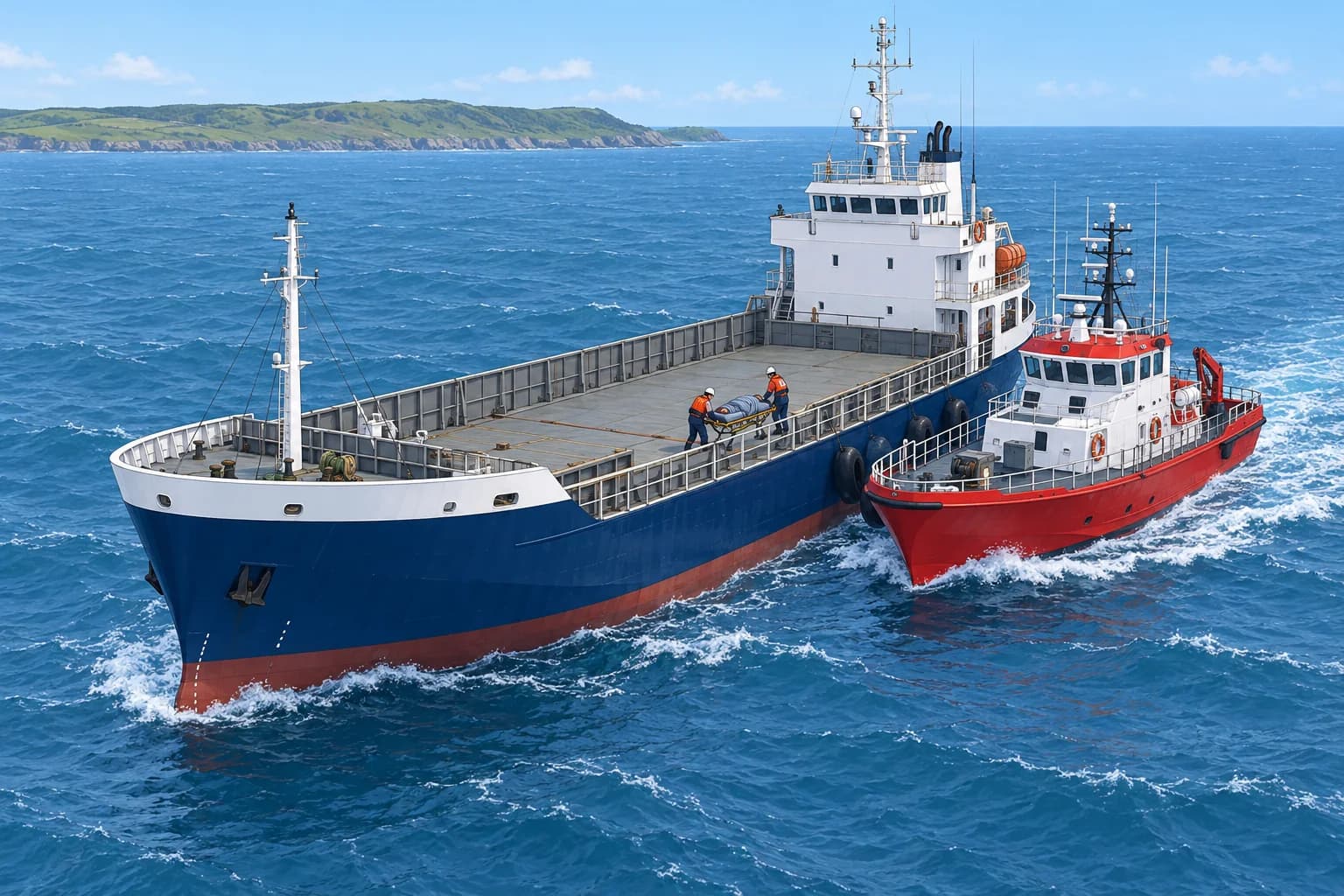
When better help arrives
A coastguard cutter, lifeboat or aircraft with better sensors may arrive, and the SMC may name it as the new OSC. Hand over in a short radio briefing: what has happened, datum and drift, areas searched with times and track spacing, sightings, survivors recovered, units on scene and their channels, and the weather. Confirm clearly who is now OSC, tell the RCC, then follow the new coordinator's instructions.
Survivors
Report recovered survivors to the OSC and RCC: number, condition, where and when found. A place of safety is somewhere survivors are no longer in danger and can receive basic care and shelter. Ask the RCC to arrange it and any medical support needed. For survivor care, see Emergencies: survival in water and Medical.
Ending or suspending
Only the SMC ends or suspends a search, after weighing the chance that anyone is still alive in the area. Arrange release with the OSC or RCC before leaving for fuel, weather or safety. If immediate danger requires withdrawal, act for safety and inform the OSC/RCC as soon as possible. Your duty to help does not end because the search is tiring or slow.
Record and debrief
Log every event with its time: positions, legs run, sightings, messages and survivors. The record supports the RCC, any inquiry and your own company. Afterwards, check and replace the equipment you used, debrief the crew and look after those who saw distressing scenes.
Key figures
- Handover content
- Datum, sightings, survivors, units, channels and weather
- Ends a search
- Only the SMC
- Place of safety
- Arranged through the RCC for landing survivors
- Survivor report
- Number, condition, where and when found
- Search coverage
- Areas, times and track spacing
Remember
- Hand over datum, areas, spacing and times, sightings, survivors, units, channels and weather.
- Confirm who the new OSC is and tell the RCC.
- Report every survivor; the RCC arranges a place of safety for landing them.
- Only the SMC ends or suspends the search; log every event.
Common mistakes
Wrong: Leave the scene as soon as the lifeboat arrives.
Right: Arrange release before leaving; if immediate danger requires withdrawal, act for safety and inform the OSC/RCC as soon as possible.
Wrong: Hand over by saying that you have searched the area.
Right: Give the areas, times and track spacing used, so the new OSC knows what has really been covered.
Wrong: Steam for the nearest port with survivors without telling anyone.
Right: Agree the place of safety with the RCC, which coordinates landing and medical care.
Worked case
You have been OSC for 50 minutes, searching for two people from a capsized boat. You recovered one, cold but conscious. A coastguard cutter arrives and the MRCC names it OSC.
Show the answer
Brief the cutter: two people sought, one recovered, one still missing; recovery position, time and survivor condition; datum and drift; areas, legs, spacing and times searched; sightings; units, channels and weather. Confirm the cutter is OSC and tell the MRCC. Ask the RCC to arrange medical support and a place of safety. While safe to remain, keep searching as directed until released.
Practice question
Who decides to end or suspend a search?
- The OSC on scene
- The SMC at the RCC
- The searching master
- The casualty's owner
Show the answer
Answer: B. Only the SMC can end or suspend a search, after assessing the chance of survival.