
Navigation · Level R4 · 4 parts · about 13 min
Compass error by the Pole Star, and time: UT, zone time and legal time
4 short parts: The Pole Star · Compass error · UT and zones · Legal time. Each part explains the idea, then gives the points to remember, the common mistakes, a worked case and a practice question; the Academy unit adds all 25 check questions.
1 · The Pole Star
Polaris: a true-north mark in the sky
Polaris lies about 0.6° from the north celestial pole. At mid-latitudes its bearing stays close to north; use the almanac for its true azimuth.
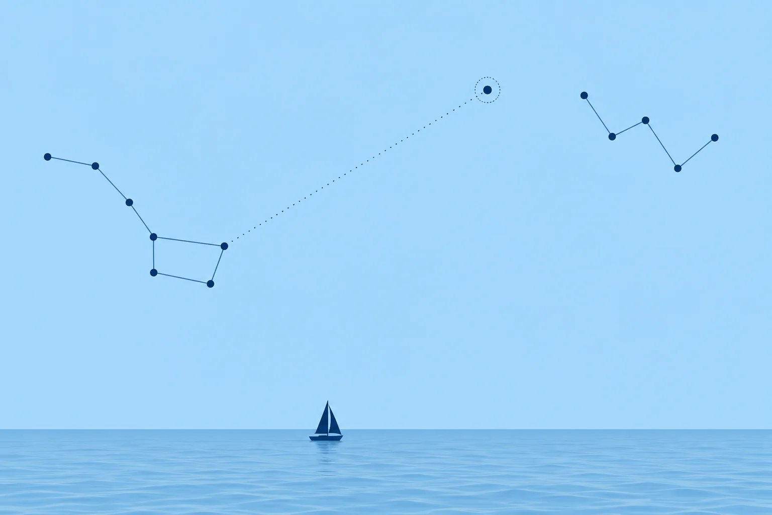
Why Polaris
Polaris, the Pole Star, is the bright star almost exactly above the Earth's North Pole. Its distance from the celestial pole, its polar distance, is about 0.62° in 2026, roughly 37′, and still shrinking slowly until about 2100. As the Earth turns, Polaris circles the pole in that tiny circle once a day. At mid-latitudes, its true azimuth, or true bearing, stays close to 000°.
How far from north
The azimuth's largest swing depends on your latitude: sin (largest azimuth) = sin (polar distance) ÷ cos (latitude). In 2026 that is about 0.6° at the equator, 0.8° at 40°N, 1.0° at 50°N and 1.2° at 60°N. So taking Polaris as exactly north can give an error of up to about a degree at Spanish latitudes; fine for a rough check, not for a deviation card.
Finding it
Polaris is a medium-bright star, not the brightest in the sky. Find the Plough (Big Dipper), a seven-star ladle shape. Follow the bowl's outer edge from its base through its rim, then continue about five star-separations to Polaris. These two stars are the pointers. Its altitude (angle above the horizon) is almost your northern latitude: about 40° off Valencia, low near the equator. Polaris is normally unavailable for navigation south of the equator.
The exact azimuth
The Nautical Almanac gives Polaris's true azimuth using your latitude and LHA Aries, the local hour angle of Aries. Aries is a reference point on the celestial equator. GHA Aries, its Greenwich hour angle, measures its angle west from Greenwich; LHA measures it west from your meridian. Take GHA Aries for the bearing's UT (Universal Time). Add east longitude or subtract west longitude. Add or subtract 360° if needed to keep LHA from 000° up to, but not including, 360°.
Latitude, in one line
The same tables also correct Polaris's altitude, measured with a sextant, into your latitude; the celestial units explain the method.
Key figures
- Polar distance (2026)
- About 0.62°, roughly 37′
- Largest azimuth swing
- sin Z = sin p ÷ cos lat: about 0.8° at 40°N
- Altitude
- Almost equal to your latitude
- LHA Aries
- GHA Aries + east longitude − west longitude; wrap to 000°–<360°
- Almanac table
- Polaris azimuth by LHA Aries and latitude
- Spanish terms
- Estrella Polar, azimut verdadero, horario de Aries
Remember
- Polaris is about 0.6° from the celestial pole; its azimuth is close to 000° at mid-latitudes.
- The swing grows with latitude: about 0.8° at 40°N, 1.2° at 60°N.
- Its altitude is almost your northern latitude; it is normally unavailable for navigation south of the equator.
- For an exact true azimuth, enter the almanac's Polaris table with LHA Aries and latitude.
Common mistakes
Wrong: Polaris is exactly at true north.
Right: It circles the pole at about 0.6°. Its azimuth swings up to about a degree either side at mid-latitudes.
Wrong: Polaris is the brightest star in the sky.
Right: It is only medium-bright. Find it from the Plough's pointers or from Cassiopeia.
Wrong: Enter the Polaris table with your longitude.
Right: Enter it with the LHA of Aries, worked out from the almanac's GHA Aries and your longitude, and with your latitude.
Worked case
Off the coast at 41°N, a crew member suggests checking the steering compass by taking Polaris as due north, 000°T. How large an error could that cause, and how do you avoid it?
Show the answer
At 41°N Polaris's azimuth can be up to about 0.8° either side of north, depending on the time. Taking it as 000° could put that much error into your compass check. Note the UT of the bearing, find LHA Aries from the almanac and your longitude, and read the true azimuth from the Polaris table.
Practice question
About how far is Polaris from the north celestial pole in 2026?
- About 0.6°
- About 2.5°
- About 6°
- Exactly 0°
Show the answer
Answer: A. Its polar distance is about 37′, roughly 0.62°, and slowly shrinking until about 2100.
2 · Compass error
Compass error and deviation from Polaris, worked
Take a compass bearing of Polaris, compare it with its true azimuth from the almanac, and you have the compass error. Remove variation to get deviation.
Compass error
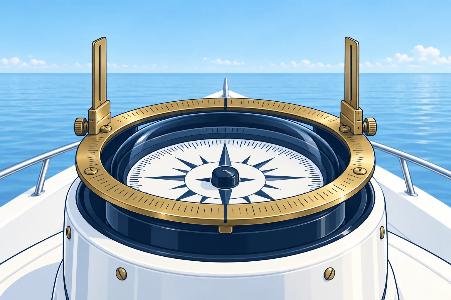
Compass error is the total difference between a compass reading and true: error = true bearing − compass bearing. Across 000°, add 360° to the smaller bearing before subtracting. A positive result is named east, a negative one west. It is the sum of variation and deviation (Compass basics). Spanish courses call it the corrección total (Ct): Ct = azimut verdadero (Zv) − azimut de aguja (Za).
Taking the bearing
To check the steering compass, steady the boat on the heading you want to test and take Polaris's bearing over the compass, using an azimuth mirror or another sight designed for that altitude. Note the heading and the exact UT. A hand-bearing compass checks only itself. Its deviation can change with your position aboard and the boat's heading; it does not give the steering compass's deviation.
Worked example
At 41°N, on a heading of 090°C, Polaris bears 002.0°C. With the UT of the bearing you find LHA Aries, and the Polaris table gives a true azimuth of 359.4°T. Treat 002.0° as 362.0°: error = 359.4 − 362.0 = −2.6°, so 2.6°W.
Deviation
The chart's compass rose, updated to this year, gives a variation of 0.5°E (+0.5). Deviation = error − variation = −2.6 − (+0.5) = −3.1°: 3.1°W on a heading of 090°C. Write it on the deviation card for that heading. Spanish books write it the same way: desvío = Ct − declinación magnética (dm).
Make it count
One bearing gives the error on one heading only, because deviation changes with heading. Repeat on several headings, about every 45°, to check a whole card. At about 40° elevation, you may need an azimuth-mirror attachment; check that your compass's sight can observe that high. An ordinary bearing ring may not allow it.
Key figures
- Compass error
- True − compass, wrapped to −180°–+180°; + = E, − = W
- Deviation
- Compass error − variation (east +, west −)
- Worked error
- 359.4 − 362.0 = −2.6°: 2.6°W
- Worked deviation
- −2.6 − (+0.5) = 3.1°W on 090°C
- Spanish terms
- Ct = Zv − Za; desvío = Ct − dm
Compass error from Polaris
- Steady on the heading to check and note it. — Deviation belongs to the boat's heading, not to the bearing direction.
- Take Polaris's compass bearing and note the UT to the minute. — The true azimuth depends on the time through LHA Aries.
- Find LHA Aries: GHA Aries for that UT ± your longitude. — It is the entry, with latitude, to the Polaris azimuth table.
- Read the true azimuth from the almanac's Polaris table. — Polaris is up to about a degree off north at mid-latitudes.
- Subtract compass from true. If above +180°, subtract 360°; if below −180°, add 360°. Positive is E; negative is W. — This is the total correction, variation plus deviation.
- Deviation = error − variation, for that heading. — Variation comes from the chart; what remains is the boat's own error.
Remember
- Compass error = true − compass: wrap across 000° if needed; positive east, negative west.
- Deviation = compass error − variation, for the heading you were on.
- Check the steering compass on the heading you are testing, with the exact UT.
- Repeat on several headings: one bearing gives one heading's deviation.
Common mistakes
Wrong: Compass error = compass bearing − true bearing.
Right: Error = true − compass. Treat 002.0° as 362.0°: 359.4 − 362.0 = −2.6°, so 2.6°W.
Wrong: Record the deviation against the bearing of Polaris, about north.
Right: Deviation depends on the boat's heading. Record it against the heading you were steering, here 090°C.
Wrong: Use a hand-bearing compass to find the steering compass's deviation.
Right: Each compass has its own deviation. Take the bearing over the compass you are checking.
Worked case
On heading 200°C at 38°N, Polaris bears 358.5°C over the steering compass; its true azimuth is 000.7°T. Variation is 1.0°W. A crew member wants to record the deviation against 000°C. Calculate the error and deviation, and decide where to record it.
Show the answer
Error = true − compass = 000.7 − 358.5. Treat 000.7 as 360.7: 360.7 − 358.5 = +2.2°, so 2.2°E. Deviation = error − variation = +2.2 − (−1.0) = +3.2°, so 3.2°E on a heading of 200°C. Record 3.2°E against 200°C, not 000°C: deviation belongs to the boat's heading.
Practice question
Polaris's true azimuth is 359.4°T and it bears 002.0°C. What is the compass error?
- 2.6°E
- 2.6°W
- 1.4°E
- 1.4°W
Show the answer
Answer: B. Treat 002.0° as 362.0°: 359.4 − 362.0 = −2.6°, so 2.6°W.
3 · UT and zones
UT, zone time and the zone description
For nautical zone time, UT = ZT + ZD. The zone description (ZD) is positive west and negative east of zone 0. Ships may keep UT instead.
Universal Time
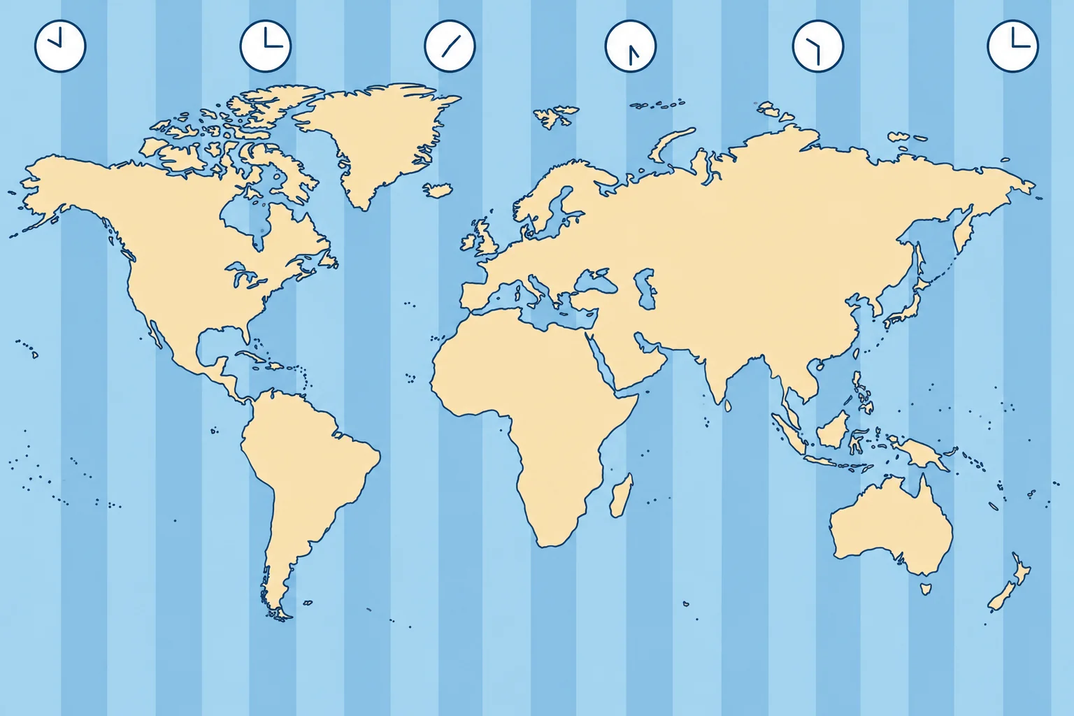
Universal Time (UT) follows Earth's rotation and is referenced to Greenwich. The almanac's tables use it. Your satellite navigator and radio time signals give UTC (Coordinated Universal Time). Occasional leap seconds keep UTC within 0.9 s of UT1, the rotation-based time scale. For this compass check, treat UTC as UT. GMT is the older name you may hear.
Time zones
At sea the world is divided into 24 time zones, each 15° of longitude wide, centred on multiples of 15°. Zone 0 runs from 7.5°W to 7.5°E. Each zone keeps the time of its central meridian: zone time (ZT). Divide your longitude by 15 and round to the nearest whole number to get your zone.
The zone description
The zone description (ZD) is the number of hours you add to zone time to get UT: UT = ZT + ZD. West of Greenwich clocks are behind UT, so ZD is plus; east of it they are ahead, so ZD is minus. A zone at 30°W is +2; one at 135°E is −9. Turn the rule round for the other way: ZT = UT − ZD.
Worked examples
At 024°20′W, 24.3 ÷ 15 = 1.6, so ZD is +2. Zone time 2215 on 3 March gives UT 2215 + 2 h = 0015 on 4 March: watch the date. At 140°E the ZD is −9: ZT 0800 on 5 June gives UT 2300 on 4 June. Log the UT of every bearing you will work with the almanac.
Changing zones
If your ship keeps nautical zone time, put clocks back an hour when moving one zone west, or forward when moving one zone east. The master decides when, often at night or a change of watch. Many ocean sailors keep the log in UT throughout to avoid mistakes.
Key figures
- UT
- Time at Greenwich; UTC from radio and GNSS, within 0.9 s
- Zone width
- 15° of longitude; zone 0 from 7.5°W to 7.5°E
- Rule
- UT = ZT + ZD; ZT = UT − ZD
- Sign of ZD
- West longitude +, east longitude −
- Example
- 024°20′W: ZD +2; ZT 2215 → UT 0015 next day
- Spanish terms
- Tiempo universal (TU), huso horario, hora del huso
Remember
- The almanac runs on UT; GNSS and time signals give UTC, close enough for navigation.
- Each zone is 15° wide; zone = longitude ÷ 15, rounded.
- UT = ZT + ZD: ZD is plus in west longitude, minus in east.
- Check the date whenever adding the ZD passes midnight.
Common mistakes
Wrong: East longitude zones have a positive zone description.
Right: East of Greenwich, clocks are ahead of UT, so you subtract: ZD is minus.
Wrong: Change the hour but not the date when converting near midnight.
Right: 2215 ZT on 3 March with ZD +2 is 0015 UT on 4 March.
Wrong: Use the zone time of a bearing to enter the almanac.
Right: Convert to UT first. The almanac's tables are in UT.
Worked case
At 038°10′W, your watch reads 2230 ZT on 10 August. A crew member labels the Polaris bearing 0130 UT, 10 August. Can you use that almanac entry? Explain.
Show the answer
No. 38°10′ ÷ 15 rounds to ZD +3. UT = 2230 + 3 h = 0130 on 11 August. The hour is right but the date is wrong. Correct the date before using the almanac.
Practice question
What is the zone description of a ship keeping zone time at 052°W?
- −3
- +4
- +3
- −4
Show the answer
Answer: C. 52 ÷ 15 ≈ 3.47, rounding to zone 3 (zone 3 spans 37.5°W to 52.5°W). West, so +3.
4 · Legal time
Legal time, summer time and the date line
Legal time is set by the country and may differ from nautical zone time. Check summer time, the time basis of tide tables, and date changes at sea.
Legal time
Your legal or official time is the time set by the country, including summer time when it applies. Standard time is the time without that summer adjustment. Most of mainland Spain lies in nautical zone 0 but keeps Central European Time (CET), UT + 1, in winter. Spanish textbooks call nautical zone time hora del huso and official time hora oficial.
Spain and the Canaries
Mainland Spain, the Balearics, Ceuta and Melilla keep Central European Time (CET), UT + 1, or Central European Summer Time (CEST), UT + 2. The Canaries keep Western European Time (WET), UT + 0, or Western European Summer Time (WEST), UT + 1. They are always one hour behind the mainland. So 1000 summer time in Valencia is 0800 UT and 0900 in Las Palmas.
Summer time
Across the EU, summer time runs from 01:00 UT on the last Sunday of March to 01:00 UT on the last Sunday of October (Directive 2000/84/EC). Spain has asked the EU to end the twice-yearly change, but as of October 2026 no decision has been taken, so the change continues. Tide tables state their time basis: add one hour only when converting local standard time to local summer time.
Zone and shore together
Off western Galicia, west of 7.5°W, a boat keeping zone time is in zone +1 while the shore keeps UT + 2 in summer: three hours apart. At 0600 ZT there, UT is 0700 and Spanish clocks read 0900. Keep the log in one stated time, and give times by radio in UTC or say which local time you mean.
The date line
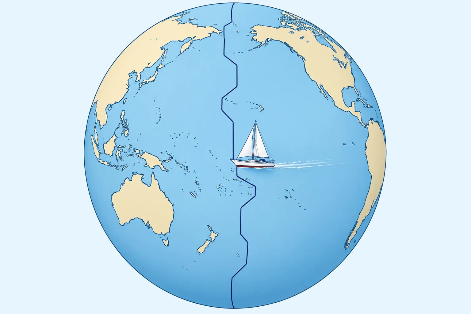
Nautical zone 12 is split at 180°: 172.5°E–180° has ZD −12; 180°–172.5°W has ZD +12. Across this split, clock time is unchanged but dates differ by a day. Crossing westward, add a day; eastward, subtract a day. The International Date Line bends around island states. Do not assume its bends follow the nautical-zone split or that official clock times stay unchanged.
Key figures
- Mainland Spain, Balearics
- CET UT + 1; CEST UT + 2 in summer
- Canary Islands
- WET UT + 0; WEST UT + 1 in summer
- EU summer time
- Last Sunday March to last Sunday October, 01:00 UT
- Date line westward
- Add a day: Monday becomes Tuesday
- Date line eastward
- Go back a day: the date repeats
- Spanish terms
- Hora del huso, hora oficial, línea de cambio de fecha
Remember
- Legal time is set by each state and may not match the nautical zone.
- Mainland Spain: UT + 1, UT + 2 in summer; the Canaries one hour less.
- Check the table's time basis; add one hour only to convert local standard time to local summer time.
- Crossing the date line westward add a day; eastward subtract one.
Common mistakes
Wrong: Mainland Spain keeps zone time 0 because it lies near Greenwich.
Right: Mainland Spain keeps CET, UT + 1, or CEST, UT + 2. That is one or two hours ahead of nautical zone 0, but two or three ahead of zone +1.
Wrong: The Canaries keep the same time as Madrid.
Right: The Canaries are one hour behind the mainland all year: UT + 0 in winter, UT + 1 in summer.
Wrong: Crossing the date line, change the clocks by 24 hours.
Right: At the nautical 180° split, change the date by one day; zone time stays the same on either side.
Worked case
Heading west at 179°W, ZD +12, it is 1000 ZT on Monday 12 October. Two hours later you cross 180° into ZD −12. A crew member logs 1200 Monday. Is that entry correct? Give the correct time and date.
Show the answer
No—the date must advance. Two hours later it is 1200 ZT Monday, which is 0000 UT on Tuesday 13 October. West of the line, ZT = UT − ZD = 0000 + 12 h = 1200. Same clock time, but you crossed westward, so the date advances: 1200 on Tuesday 13 October.
Practice question
What is mainland Spain's legal time in summer?
- UT + 1
- UT + 0
- UT + 2
- UT − 1
Show the answer
Answer: C. Mainland Spain keeps CET, UT + 1, and CEST, UT + 2, in summer.