
Navigation · Level R4 · 5 parts · about 15 min
Rhumb-line sailing by calculation
5 short parts: d.lat and dep · The formulas · Course, distance · Arrival position · Limits. Each part explains the idea, then gives the points to remember, the common mistakes, a worked case and a practice question; the Academy unit adds all 30 check questions.
1 · d.lat and dep
Difference of latitude, difference of longitude and departure
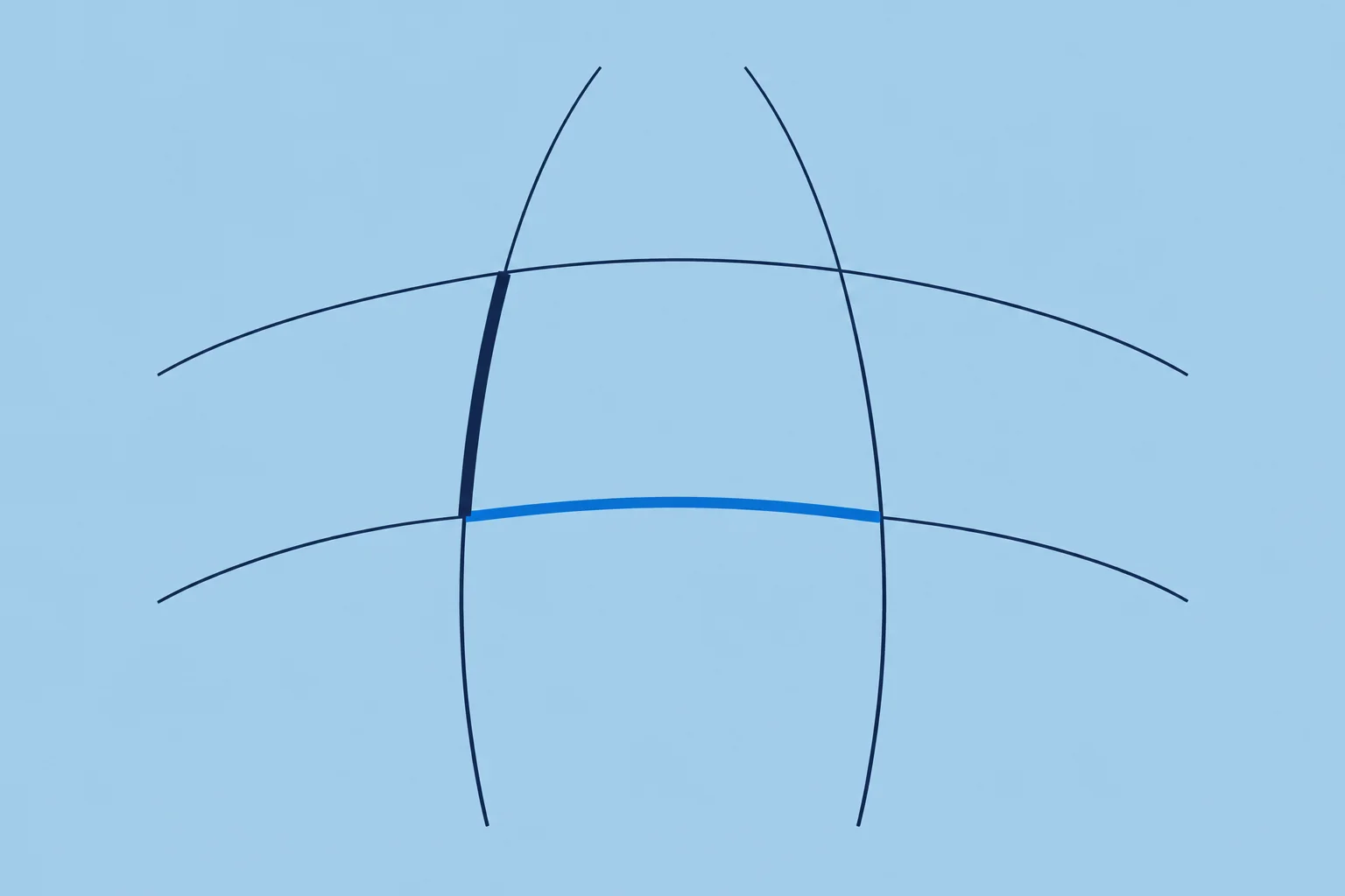
Calculating a rhumb line needs three quantities: d.lat and departure in miles, and d.long in minutes of arc. Name each one N, S, E or W.
Why calculate
On a chart you lay off a rhumb line with a ruler (Chart basics). Across several charts or on a small-scale chart, calculation can be quicker. Its accuracy depends on the method you use. Spanish courses call this estima analítica, the analytical solution of the derrota loxodrómica. A rhumb line crosses every meridian at the same angle, so it is one steady course. It is also how you check the DR of a long run (Dead reckoning unit).
d.lat and d.long
Difference of latitude (d.lat) is the arc of a meridian between two parallels, in minutes; each minute is one nautical mile. Difference of longitude (d.long) is the arc of the equator between two meridians, also in minutes of arc. But a minute of d.long is a mile only at the equator. Name both by the direction you travel: d.lat N or S, d.long E or W.
Departure
Departure (dep) is the distance you make east or west, in nautical miles. Along a parallel, dep = d.long × cos latitude: at 60° a minute of longitude is only half a mile. Departure is a distance, d.long an angle, so never add one to the other or put one in place of the other. Spanish: apartamiento.
Same and opposite names
When both latitudes have the same name, both N for example, d.lat is their difference; with opposite names, one N and one S, add them. Do the same with longitudes on either side of Greenwich. If d.long comes out over 180°, take it from 360° and reverse its name: the short way crosses the 180° meridian.
Naming the course
Formulas give a course angle from 0° to 90°, measured from north or south. Write it in quadrant form first, such as S 66° W, then convert to three figures: N x E = x; S x E = 180 − x; S x W = 180 + x; N x W = 360 − x. So S 66° W is 246°. Spanish courses call the quadrant form the rumbo cuadrantal.
Key figures
- d.lat
- Minutes of latitude = miles; named N or S
- d.long
- Minutes of arc of longitude; named E or W
- Departure
- Along a parallel: dep = d.long × cos lat
- Quadrant to three figures
- N x E = x; S x E = 180 − x; S x W = 180 + x; N x W = 360 − x
- Over 180° of d.long
- Use 360° − d.long and reverse its name
- Spanish terms
- Diferencia de latitud y de longitud, apartamiento, latitud media
Remember
- d.lat in minutes equals miles; d.long is an angle, not a distance.
- Departure is east–west distance. Along a parallel: dep = d.long × cos latitude.
- Same names subtract, opposite names add; over 180° of d.long, go the other way.
- Name the course by quadrant first, then convert to three figures.
Common mistakes
Wrong: Treat d.long in minutes as miles.
Right: Only d.lat minutes are miles. Along a parallel, convert d.long to departure with the cosine of the latitude.
Wrong: Subtract the latitudes when one is N and the other S.
Right: With opposite names, add them: from 5°N to 3°S, d.lat is 8° S.
Wrong: Write a quadrant course S 30° E as 210°.
Right: S x E = 180 − x: S 30° E is 150°. S 30° W would be 210°.
Worked case
You leave 2°10′N 178°40′E for 1°50′S 177°20′W. A crew member proposes d.lat 4° S and d.long 356° W. Would you use both?
Show the answer
No. Use d.lat 4° S, but d.long 4° E. Latitudes have opposite names: 2°10′ + 1°50′ = 4°00′ S, 240′ S. Longitudes also have opposite names: 178°40′ + 177°20′ = 356°00′. Over 180°, use 360° − 356° = 4°00′ and reverse W to E: 240′ E. The short way crosses the 180° meridian.
Practice question
How long is one minute of d.lat?
- One nautical mile everywhere
- One nautical mile at the equator only
- One kilometre at mid-latitudes
- Half a mile at latitude 60°
Show the answer
Answer: A. A minute of latitude is one nautical mile anywhere. It is minutes of longitude that shrink towards the poles.
2 · The formulas
Plane, parallel and mid-latitude sailing
Plane sailing links course, distance, d.lat and departure in one right-angled triangle. Mean latitude turns the departure into d.long.
Plane sailing
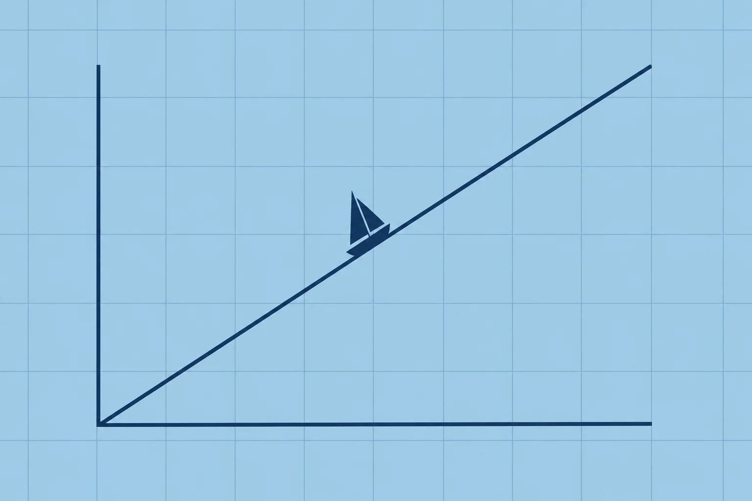
Over a short run, treat the Earth's surface as flat. Course C, distance d, d.lat and departure form a right-angled triangle: d.lat = d × cos C and dep = d × sin C. To find C, use C = tan⁻¹(dep ÷ d.lat), the calculator’s inverse-tangent function. Then d = d.lat ÷ cos C. For this magnitude-and-name routine, use the quadrant angle (0–90°), and set the calculator to degrees.
Parallel sailing
Sailing due east or west along one parallel, d.lat is zero and the whole distance is departure: d.long = dep ÷ cos lat. Example: 120 M due east along 45°N gives d.long = 120 ÷ cos 45° = 169.7′ = 2°49.7′ E. At 60°N the same 120 M would give 4°00′ of longitude.
Mid-latitude sailing
On a slanting course the latitude changes, so which latitude turns departure into d.long? Use the mean latitude, halfway between start and finish: d.long = dep ÷ cos (mean lat), and dep = d.long × cos (mean lat) going the other way. Spanish courses call it latitud media. This joins plane sailing, which works in miles, to positions in latitude and longitude.
When cos C misleads
For a course near 090° or 270°, cos C is small, and dividing a small d.lat by it can magnify rounding errors. Then find the distance as d = dep ÷ sin C instead. For a course near north or south, departure is small and the choice of latitude hardly matters.
A fixed routine
For equal latitudes, use parallel sailing directly. Otherwise, between two positions: find named d.lat and d.long, mean latitude, departure, then course and distance. For an arrival position: find d.lat and departure from course and distance, then arrival latitude, mean latitude, d.long and arrival longitude. Set your calculator to degrees. Keep full precision until the final answer; round course to 0.1° or 1° and distance to 0.1 M.
Key figures
- Plane sailing
- d.lat = d cos C; dep = d sin C
- Course and distance
- tan C = dep ÷ d.lat; d = d.lat ÷ cos C
- Near east or west
- d = dep ÷ sin C
- Parallel sailing
- d.long = dep ÷ cos lat
- Mid-latitude sailing
- d.long = dep ÷ cos (mean lat)
- Example
- 120 M east along 45°N → d.long 2°49.7′ E
Remember
- Plane sailing: d.lat = d cos C, dep = d sin C.
- Parallel sailing: d.long = dep ÷ cos lat, when you sail along one parallel.
- Mid-latitude sailing uses the mean latitude to convert between dep and d.long.
- Near east or west, take the distance from dep ÷ sin C.
Common mistakes
Wrong: Use 246° as the quadrant angle for S 66° W.
Right: The quadrant angle is 66°. Use it in this routine, then name d.lat S and departure W.
Wrong: Use the starting latitude to convert departure on a long slanting leg.
Right: Use the mean latitude, halfway between the start and arrival latitudes.
Wrong: Use rounded d.lat in d.lat ÷ cos C near east or west.
Right: Prefer dep ÷ sin C here: dividing by a small cosine can magnify rounding errors.
Worked case
You sail 90 M due west along 38°20′N from 038°10′W. A crew member gives arrival longitude 039°40′W. Accept it?
Show the answer
No. Convert departure to d.long first. This is parallel sailing: all 90 M is departure. d.long = 90 ÷ cos 38°20′ ≈ 114.7′ = 1°54.7′ W. Arrival longitude = 038°10.0′W + 1°54.7′ = 040°04.7′W, still at 38°20′N.
Practice question
Course N 60° E, distance 40 M. What is the d.lat?
- 34.6′ N
- 40.0′ N
- 23.1′ N
- 20.0′ N
Show the answer
Answer: D. d.lat = d cos C = 40 × cos 60° = 40 × 0.5 = 20.0′, named N.
3 · Course, distance
Worked: course and distance between two positions
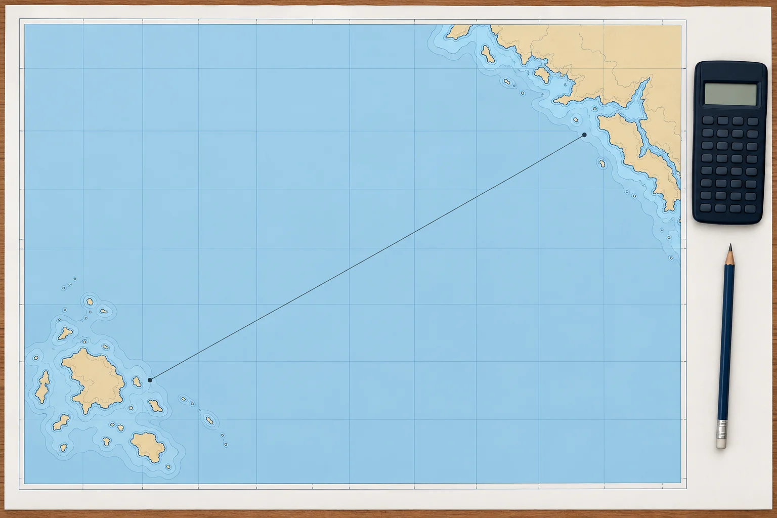
Given where you are and where you are going, find d.lat, d.long and the mean latitude, then departure, then the course and the distance.
The method
Write both positions. Find and name d.lat and d.long. For equal latitudes, use parallel sailing: course 090° or 270° and distance = departure. Otherwise find mean latitude, then dep = d.long × cos(mean lat). Use C = arctan(dep ÷ d.lat), taking magnitudes. Name its quadrant from d.lat and d.long. Find distance = d.lat ÷ cos C, or dep ÷ sin C near east or west. Keep full calculator precision until rounding the final answers.
Example 1, the data
From 39°30.0′N 002°35.0′E, off Palma, to 40°00.0′N 003°50.0′E, off Ciutadella. d.lat = 30.0′ N. d.long = 1°15.0′ = 75.0′ E. Mean latitude = 39°45.0′N.
Example 1, the answer
Departure = 75.0 × cos 39°45′ = 75.0 × 0.7688 = 57.7 M E. Using unrounded departure, tan C = 1.9221, so C = N 62.5° E: course 062.5°. Distance = 30.0 ÷ cos 62.5° = 30.0 ÷ 0.4617 = 65.0 M. A quick check: 65 M at about 6 kn is about 11 hours.
Example 2, the data
From 36°30.0′N 006°20.0′W, off Cádiz, to 32°38.0′N 016°54.0′W, off Funchal. d.lat = 3°52.0′ = 232.0′ S. d.long = 10°34.0′ = 634.0′ W. Mean latitude = 34°34.0′N.
Example 2, the answer
Departure ≈ 522.1 M W. Keeping full calculator precision, C ≈ S 66.0° W, giving course 246° to the nearest degree and distance about 571 M. Spherical Mercator sailing gives 246.03° and 571.1 M for the same leg. The results are close, but mid-latitude sailing remains an approximation.
Key figures
- Order
- d.lat, d.long, mean lat → dep → course → distance
- Example 1
- Palma → Ciutadella: 062.5°, 65.0 M
- Example 2 working
- d.lat 232′ S, d.long 634′ W, dep 522.1 M W
- Example 2
- Cádiz → Funchal: S 66.0° W = 246°, about 571 M
- Mercator check (Example 2)
- Spherical Mercator check: 246.03°, 571.1 M
Remember
- Departure comes from d.long and the mean latitude.
- The course angle is named by the names of d.lat and d.long: S and W give S x W.
- Distance = d.lat ÷ cos C, or dep ÷ sin C near east or west.
- Check the answer for sense on a small-scale chart or plotter.
Common mistakes
Wrong: Divide d.long by d.lat to find the course.
Right: Convert d.long to departure first: tan C = dep ÷ d.lat.
Wrong: Name the course from the larger of d.lat and departure.
Right: The quadrant comes from both names: d.lat S and d.long W always give S x W, a course between 180° and 270°.
Worked case
From 43°00.0′N 009°30.0′W to 42°00.0′N 010°30.0′W, a crew member obtains 036.4°, 74.5 M. Accept it?
Show the answer
No. The distance is right, but the course must be southwest. d.lat = 60.0′ S; d.long = 60.0′ W; mean latitude 42°30′N. Departure = 60.0 × cos 42°30′ ≈ 44.2 M W. tan C = dep ÷ 60.0, so C ≈ S 36.4° W: course 216.4°. Using the unrounded angle, distance = 60.0 ÷ cos C ≈ 74.5 M.
Practice question
d.lat 30.0′ N, d.long 75.0′ E, mean latitude 39°45′. What is the departure?
- 97.6 M E
- 75.0 M E
- 57.7 M E
- 48.0 M E
Show the answer
Answer: C. dep = 75.0 × cos 39°45′ = 75.0 × 0.769 ≈ 57.7 M E.
4 · Arrival position
Worked: arrival position from course and distance
Given a start, a course and a distance, find d.lat and departure, then the arrival latitude, the mean latitude, d.long and the arrival longitude.
The method
Turn the course into its quadrant angle. d.lat = d × cos C and dep = d × sin C, named from the quadrant. Apply d.lat to the start latitude: that gives the arrival latitude. Mean latitude = halfway between the two. d.long = dep ÷ cos (mean lat). Apply it to the start longitude. Spanish exams call this the situación de estima de llegada. Both examples are notional arithmetic exercises; their starts and straight tracks must not be used as navigable routes.
Example 3, the data
From 43°20.0′N 008°30.0′W, near A Coruña, you estimate a true course over the ground of 315° for 48.0 M. 315° is N 45° W. d.lat = 48.0 × cos 45° = 33.9′ N. Departure = 48.0 × sin 45° = 33.9 M W.
Example 3, the answer
Arrival latitude = 43°20.0′ + 33.94′ = 43°53.9′N. Mean latitude ≈ 43°37.0′N. Using unrounded values, d.long = dep ÷ cos(mean lat) = 46.88′ W, giving 009°16.9′W. Notice that 33.9 M of departure became 46.9′ of longitude: at this latitude a minute of longitude is only about 0.72 M.
Example 4, the data
From 28°05.0′N 015°25.0′W, near Las Palmas, you estimate a true course over the ground of 240° for 300 M. 240° is S 60° W. d.lat = 300 × cos 60° = 150.0′ S = 2°30.0′ S. Departure = 300 × sin 60° = 259.8 M W.
Example 4, the answer
Arrival latitude = 28°05.0′ − 2°30.0′ = 25°35.0′N. Mean latitude = 26°50.0′N. d.long = 259.8 ÷ cos 26°50′ = 259.8 ÷ 0.8923 = 291.2′ W = 4°51.2′ W. Arrival longitude = 015°25.0′ + 4°51.2′ = 020°16.2′W. The Las Palmas exercise track crosses Gran Canaria. These estimated ground inputs give an EP, not a fix. For a DR, use the inputs defined in the DR/EP unit.
Key figures
- Order
- d.lat and dep → arrival lat → mean lat → d.long → arrival long
- Example 3
- 315°, 48 M from 43°20′N 008°30′W → 43°53.9′N 009°16.9′W
- Example 4 working
- d.lat 150.0′ S, dep 259.8 M W, mean lat 26°50′N
- Example 4
- 240°, 300 M from 28°05′N 015°25′W → 25°35.0′N 020°16.2′W
- Spanish term
- Situación de estima de llegada
Remember
- Find the arrival latitude first: you need it for the mean latitude.
- With non-zero departure and mean latitude away from 0°, d.long in minutes exceeds departure in miles.
- Name d.lat and departure from the quadrant of the course.
- This calculated position is an estimate: confirm it with a fix.
Common mistakes
Wrong: Add the departure in miles straight onto the longitude.
Right: Convert first: d.long = dep ÷ cos(mean latitude). At mean latitude 43°37′N, departure 33.94 M gives about 46.9′ of longitude.
Wrong: Use the start latitude instead of the mean latitude for a long run.
Right: Find the arrival latitude, then use the latitude halfway between start and arrival.
Wrong: Apply a west d.long to an east longitude by adding.
Right: Going west from an east longitude, the longitude decreases; past 0°, it becomes west.
Worked case
From 37°10.0′N 000°20.0′E, you estimate a ground course of 220° for 50 M. A crew member calls the result a fix at 36°31.7′N 000°20.2′E. Accept it?
Show the answer
No. It is an EP, and the longitude is west. 220° is S 40° W. d.lat = 50 cos 40° ≈ 38.3′ S; dep = 50 sin 40° ≈ 32.1 M W. Arrival latitude ≈ 36°31.7′N; mean latitude ≈ 36°50.8′N. Using unrounded values, d.long = 40.16′ W. From 000°20.0′E, this crosses Greenwich to 000°20.2′W. Confirm the estimate with a fix.
Practice question
You make good 315° for 48.0 M. What are d.lat and departure?
- 33.9′ S and 33.9 M E
- 48.0′ N and 48.0 M W
- 33.9′ N and 33.9 M W
- 24.0′ N and 41.6 M W
Show the answer
Answer: C. 315° is N 45° W: d.lat = 48 cos 45° = 33.9′ N, dep = 48 sin 45° = 33.9 M W.
5 · Limits
Limits of the method, and Mercator sailing
Mid-latitude sailing is often adequate for a few hundred miles. Check its accuracy; use Mercator sailing for exact rhumb-line work on a spherical Earth model.
Distance
Plane and mid-latitude sailing treat a curved surface as flat. Bowditch notes that plane sailing is not meant for more than a few hundred miles. In ordinary latitudes, this approximation is often adequate for runs of a few hundred miles; check whether its accuracy suits your task. Over longer passages, split the route into legs or use Mercator sailing.
Crossing the equator
For an equator-crossing calculation, work one leg to the equator and another beyond it. A mean latitude of 0° does not mean the whole route follows the equator. Bowditch gives the same separate-leg advice. Corrected-mean-latitude tables exist, but Bowditch warns they can add as much error as they remove.
High latitudes
Near a pole, the same latitude span produces a larger fractional change in cos latitude. Using one mean latitude can therefore give a larger longitude error on a slanting leg. Check the latitude span and accuracy required; there is no universal 60° cutoff. Prefer Mercator sailing when the approximation is inadequate.
Mercator sailing
Mercator sailing gives the exact rhumb-line result on a spherical Earth model. Meridional parts give the chart distance from the equator to a latitude, in units of one longitude minute at the equator. DMP means difference of meridional parts. With d.long in minutes, tan C = d.long ÷ DMP, then d = d.lat ÷ cos C. Use magnitudes and name the quadrant from d.lat and d.long. For due east–west courses, use parallel sailing instead.
Rhumb line or great circle
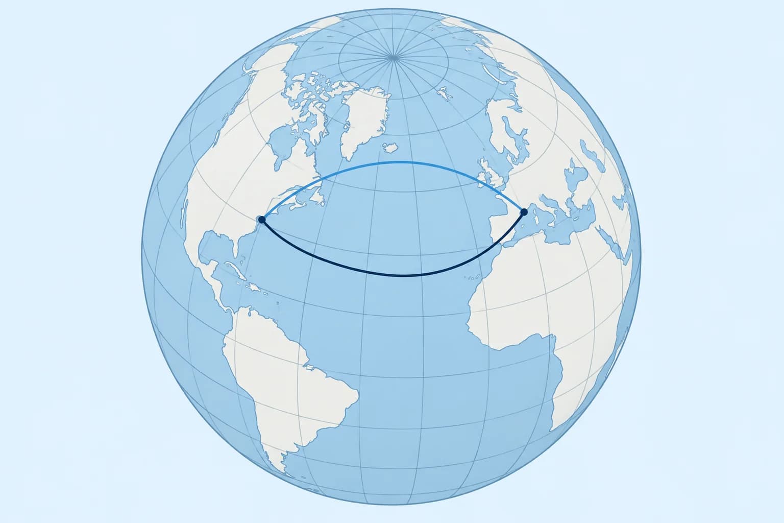
A rhumb line keeps a constant true course. A great-circle arc is the shortest path on a sphere; the routes coincide along a meridian or the equator. See the great-circle unit.
Key figures
- Plane and mid-latitude sailing
- Up to a few hundred miles, ordinary latitudes
- Crossing the equator
- Work each side as a separate leg
- Mercator sailing
- tan C = d.long ÷ DMP; d = d.lat ÷ cos C; E–W: parallel sailing
- Meridional parts
- Use spherical meridional parts with the formulas shown here
- Shortest route
- Great-circle arc; a rhumb line can coincide with it
Remember
- Mid-latitude sailing is often adequate for a few hundred miles; check the accuracy you need.
- Split a rhumb line that crosses the equator into two legs.
- Mercator sailing with meridional parts gives the exact rhumb line on a spherical Earth model.
- A great-circle arc is shortest; a rhumb line coincides along a meridian or the equator.
Common mistakes
Wrong: Use a mean latitude of 0° for a leg from 5°N to 5°S.
Right: Split the leg at the equator, or use Mercator sailing.
Wrong: Assume the rhumb line is the shortest route.
Right: A great-circle arc is never longer; the routes coincide along a meridian or the equator.
Wrong: Divide d.long by d.lat in Mercator sailing.
Right: Use tan C = d.long ÷ DMP, where DMP means difference of meridional parts.
Worked case
You plan a rhumb-line passage of about 1,142 M from 50°N 005°W to 41°N 029°W. A crew member uses one mid-latitude calculation. What do you advise?
Show the answer
Use Mercator sailing, or divide the same rhumb line into shorter legs. One mid-latitude calculation is an approximation over this distance. Choose the method against the accuracy you need. For a comparison with the shortest route, see the great-circle unit.
Practice question
A rhumb line runs from 4°N to 6°S. How should you solve it by mid-latitude sailing?
- Use a mean latitude of 1°S for the whole leg
- Split it into two legs at the equator
- Use the starting latitude for the whole leg
- Average the two longitudes instead
Show the answer
Answer: B. Use separate legs on each side of the equator, or use Mercator sailing.