
Navigation · Level R5 · 5 parts · about 15 min
Ocean passage planning: routeing charts and seasons
5 short parts: Routeing charts · Route guides · Atlantic circuit · Storm seasons · Self-sufficiency. Each part explains the idea, then gives the points to remember, the common mistakes, a worked case and a practice question; the Academy unit adds all 28 check questions.
1 · Routeing charts
Routeing charts and pilot charts: the climate of an ocean, month by month
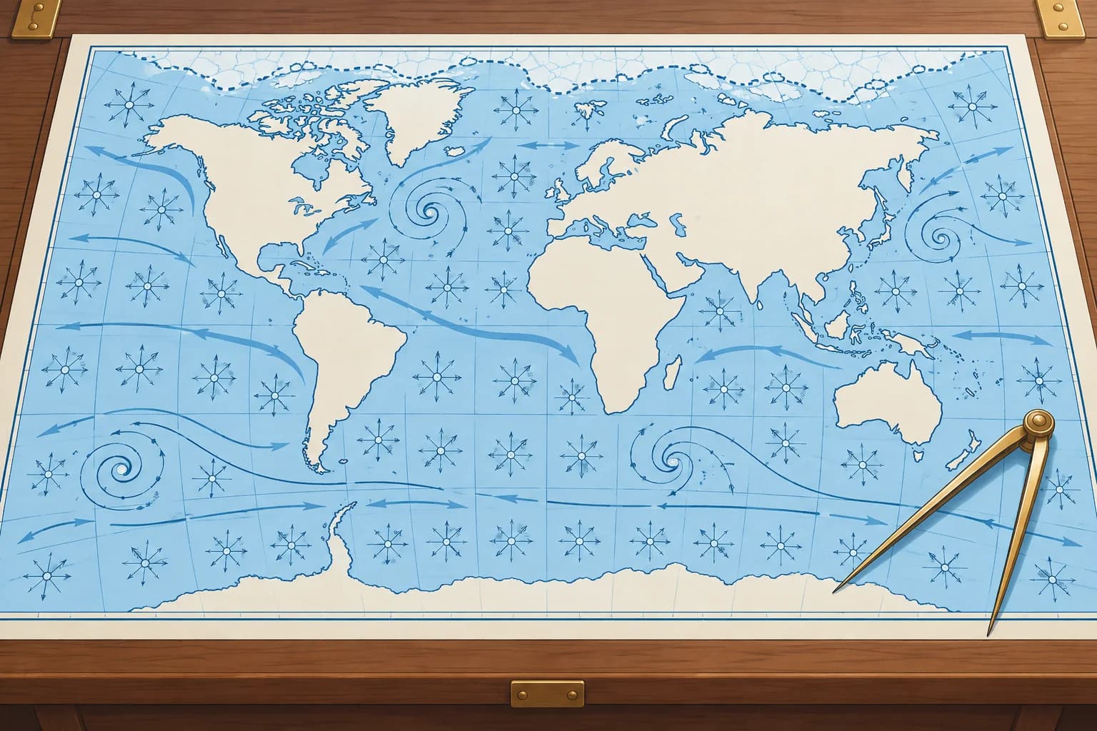
Routeing and pilot charts show the average winds, currents, gales and ice for each month. Use them to choose the season and the route, not to navigate.
Climate, not forecast
An ocean passage starts with climatology: what usually happens in that place and month. Two families of charts give it. ADMIRALTY Routeing Charts from the UK Hydrographic Office cover each ocean with one chart per month; chart 5124 is the North Atlantic. The US NGA Atlas of Pilot Charts does the same in five volumes, Pubs. 105–109; Pub. 106 covers the North Atlantic. Both are for planning only, never for navigation.
What they show
Each monthly chart shows wind roses at regular intervals, average ocean currents with their direction and rate, ice limits, recommended ship routes and distances, and the tracks of tropical and extratropical storms. Panels or insets add the frequency of gales, sea and air temperature, pressure, visibility and, on pilot charts, how often waves exceed about 12 feet (3.7 m). Routeing charts also show the load line zones that apply to ships.
Reading a wind rose
A wind rose summarises the wind in one square of ocean for that month. Each arrow flies with the wind towards the centre of the rose, from the direction the wind comes from. Its length shows frequency on the chart scale. On NGA charts, above 29 %, the shaft is broken and a number gives the percentage; read the legend. Its feathers show the average Beaufort force. The number in the centre circle gives the percentage of calms.
Currents and ice
Current arrows show the set, the direction the water flows towards, and a figure gives the average rate in knots. Ice limits show the mean and the extreme extent of icebergs and sea ice for the month. The Ocean currents unit explains the main currents; the Global winds unit explains why the wind belts sit where they do.
Averages hide extremes
North-east winds on 70 % of observations, averaging force 4, still allow stronger or weaker north-east winds, other directions and calms. Use the charts to pick the month with the best odds, then plan for the worst you could reasonably meet and check real forecasts before and during the passage.
Key figures
- ADMIRALTY Routeing Charts
- UKHO, one chart per month per ocean; 5124 = North Atlantic
- Atlas of Pilot Charts
- NGA, five ocean volumes; Pub. 106 = North Atlantic
- Wind rose arrow length
- Unbroken length = frequency; NGA above 29 %: broken shaft + number
- Wind rose feathers
- Average Beaufort force from that direction
- Centre of the rose
- Percentage of calms
- Current arrow
- Set (direction towards) and average rate in knots
Remember
- Routeing and pilot charts give monthly averages of wind, current, gales, ice and storm tracks.
- Use them to choose the month and route, never to navigate.
- Wind rose: unbroken length gives frequency (NGA above 29 %: number), feathers force, centre calms. Read the legend.
- A current arrow gives the set, where the water goes, and the rate.
- Averages hide extremes: check forecasts before and during the passage.
Common mistakes
Wrong: A long wind-rose arrow means strong wind from that direction.
Right: Unbroken length shows frequency; on NGA charts, above 29 %, a number gives it on a broken shaft. Feathers show average force.
Wrong: A pilot chart can stand in for the weather forecast.
Right: It shows climate, the averages of many years. Weather on the day can be very different.
Wrong: Name a current like a wind: an arrow pointing west is an easterly current.
Right: Currents are named for where they go: an arrow pointing west shows a current setting west.
Worked case
Suppose the pilot charts at 20° N, 30° W show north-east winds on 55 % of observations in November, averaging force 4, with 6 % calms. December has 70 % north-east winds, averaging force 5, with 2 % calms. Which month offers better odds, and what else do you check?
Show the answer
December offers more frequent north-east winds and fewer calms, but a higher average force. Strength varies within the north-east winds: they can be stronger or weaker than force 5. The remaining 30 % includes other directions and calms. Check storm tracks, gale frequency and currents along the route, your boat and crew’s limits, and current forecasts before choosing.
Practice question
On a pilot chart wind rose, what does the length of an unbroken arrow show?
- The average force from that direction
- How often the wind blows from there
- The strongest gust ever recorded
- The direction of the ocean current
Show the answer
Answer: B. Unbroken length shows frequency on the chart scale. On NGA charts, above 29 %, a broken shaft and number give the percentage. Feathers show average Beaufort force; read the legend.
2 · Route guides
Ocean Passages for the World and cruising route guides
Ocean route guides turn the climate charts into recommended routes for each month. Read the official one for ships and a yachting guide for small craft.
Ocean Passages for the World
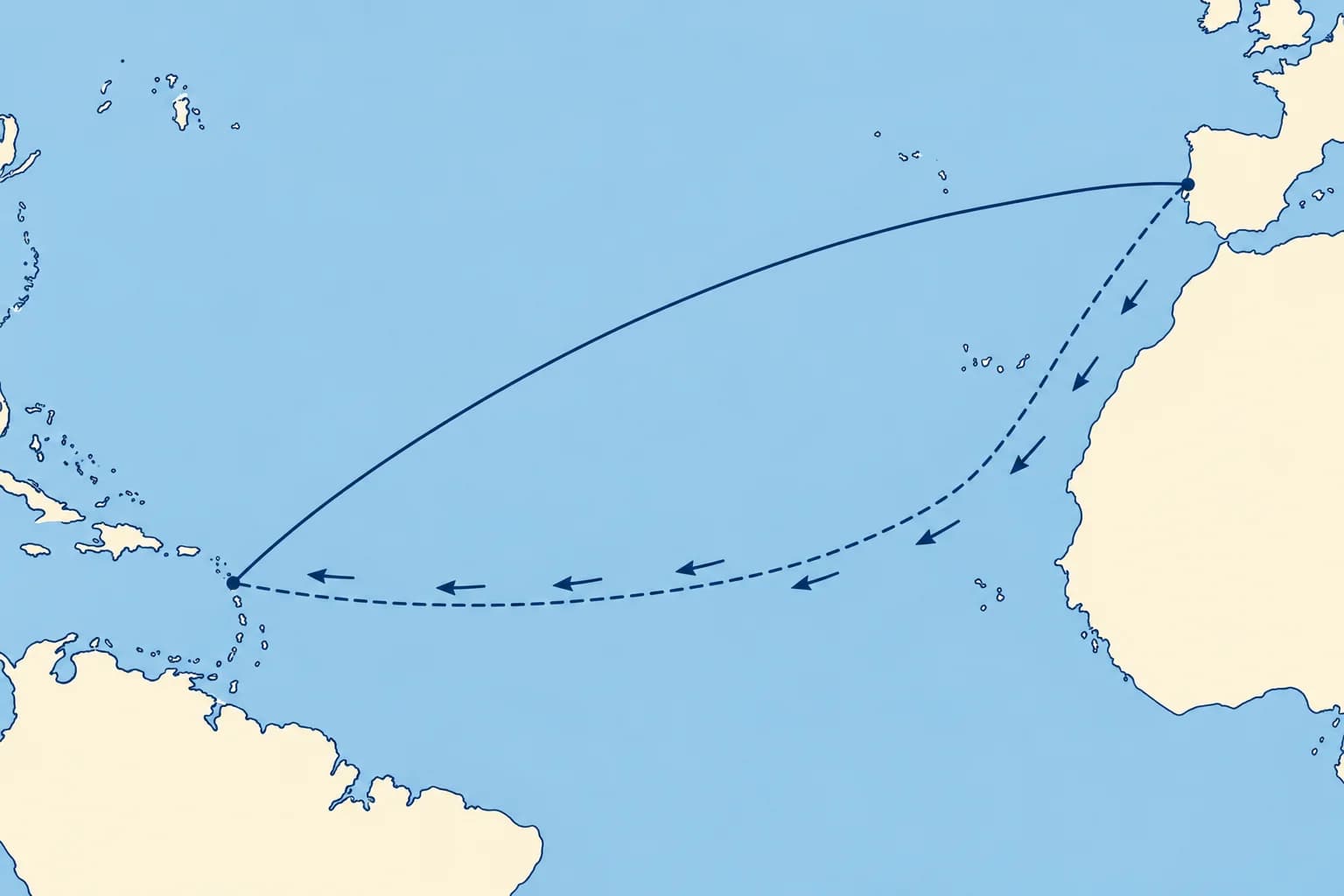
NP136 Ocean Passages for the World, from the UK Hydrographic Office, is the standard guide for planning deep-sea voyages. It now comes in two volumes: the Atlantic, and the Indian and Pacific Oceans. For each ocean, it describes climate, winds, currents, swell, seasons and ice. It also gives recommended routes, distances and route diagrams, plus small charts of climate, wave heights and load line zones. Weekly Notices to Mariners keep it up to date.
Guides for yachts
NP136 is written for ships, which can motor through calms and head seas. Yachts need routes that follow the wind. World Cruising Routes by Jimmy Cornell gives hundreds of yacht routes with the best times, waypoints and dangers; regional pilot books add harbours and local detail. Check the edition date: seasons and services change.
Shortest is not quickest
The shortest route across an ocean is the great circle; the Great-circle sailing unit shows how to work it. A sailing route often goes far from it, to find fair winds and currents and avoid storms, calms and ice. The trade-wind route from the Canaries to the Caribbean runs south-west first, then west: longer than the great circle, but usually faster and more comfortable.
Building the route
Start from the guide's recommended route for your month. Check it on the routeing or pilot chart for that month. Mark the hazards: storm tracks and seasons, ice limits, calm belts, strong currents. Then add your own waypoints, alternative ports and decision points where you will check forecasts and choose between options.
Official sources first
Use NP136, the routeing charts and official sailing directions as your reference, and private guides for yacht detail. Where they disagree, the more cautious one wins until you have checked why. The Nautical publications unit covers sailing directions and keeping them corrected.
Key figures
- NP136
- Ocean Passages for the World (UKHO), two volumes
- NP136 contents
- Climate, currents, ice, routes, distances, load line zones
- Updates
- Weekly ADMIRALTY Notices to Mariners
- Yacht route guide
- World Cruising Routes (Cornell): yacht routes and best months
Remember
- NP136 Ocean Passages for the World gives ocean climate and recommended routes and distances.
- Ship routes assume power; yacht routes follow the wind, so add a yachting guide.
- The great circle is shortest, but a sailing route may be faster.
- Build the route from the guide, check it on the monthly chart, then add waypoints and decision points.
Common mistakes
Wrong: The great-circle route is always the best ocean route for a yacht.
Right: Wind, current, storms and ice decide. A longer route in fair winds is often faster and safer.
Wrong: Any edition of a route guide will do: oceans don't change.
Right: Seasons, services, regulations and recommended routes are revised. Check the edition and the corrections.
Worked case
You want to sail from Gibraltar to Antigua in December. The great-circle distance is about 3,200 miles; the route via the Canaries and the trade winds is about 3,500 miles as sailed. Which do you choose?
Show the answer
Usually the trade-wind route. The great circle crosses the Azores High and the westerlies, with headwinds, calms and winter gales. The route south-west to the Canaries and then west in the north-east trades is about 300 miles longer, but normally gives fair winds and current, so it is faster and more comfortable. Confirm with NP136, a yacht guide and the December pilot chart.
Practice question
A ship route crosses a calm belt, but your yacht has limited motoring range. What helps you reassess it?
- A current yacht route guide for that month
- The same ship route with fewer waypoints
- An older ship guide with a shorter route
- The direct great circle in every season
Show the answer
Answer: A. Compare a yacht route guide with the monthly chart: your fuel range may make a ship’s route unsuitable.
3 · Atlantic circuit
Seasons and the trade-wind route: the Atlantic circuit and the ARC
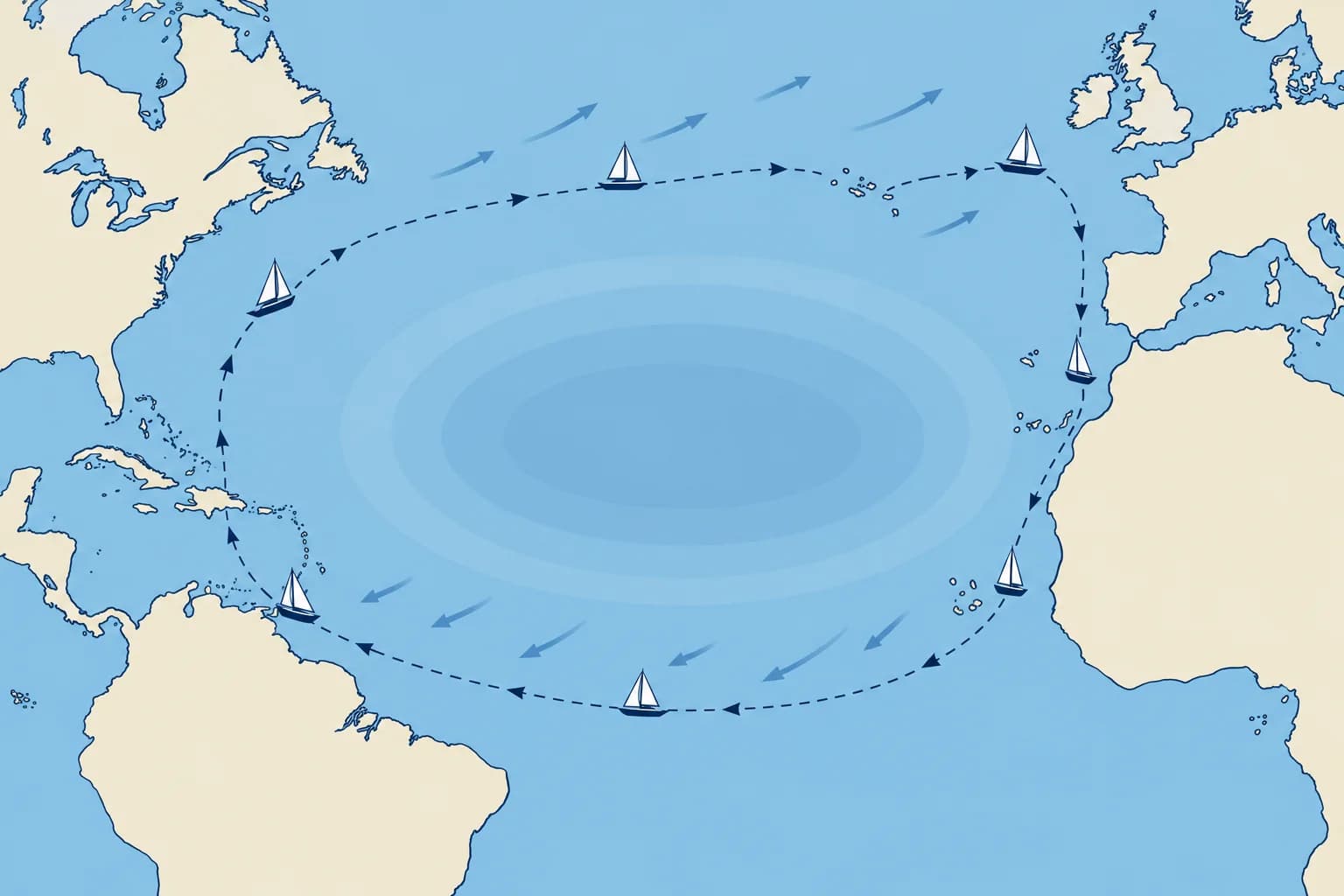
The Atlantic circuit follows the seasons: south in autumn, west as hurricane risk usually declines, then home via Bermuda or the Azores in spring.
The circuit
The classic Atlantic circuit is a clockwise loop round the Azores High. Leave northern Europe in late summer for Portugal, Madeira and the Canaries by October. Cross to the Caribbean with the north-east trades from late November, as hurricane risk usually declines. Leave the Caribbean in April–May, sailing north towards Bermuda or directly towards the Azores, then east to Europe for arrival in May–June.
The trade-wind crossing
From the Canaries, head south-west to find the steady trades, often near 20° N, before turning west towards the Caribbean. The ARC (Atlantic Rally for Cruisers), run by World Cruising Club, follows this route from Las Palmas de Gran Canaria to Rodney Bay, Saint Lucia: about 2,700 miles, which takes an average yacht about 18 to 21 days.
Why late November
Late November often brings more established trades and lower hurricane risk, but late storms remain possible. An ARC departure date is not a weather clearance; check current forecasts and insurance conditions. The ARC 2026 starts on Sunday 22 November. ARC+ leaves Las Palmas about two weeks earlier, stops in the Cape Verde Islands and finishes in Grenada.
The way home
Leave the Caribbean in April or May, before hurricane risk rises again. From the eastern Caribbean, head generally north or north-west towards Bermuda, then east towards the Azores; alternatively, plan a direct Azores passage around the high. Seek the westerlies north of the Azores High; the Westerlies unit explains why. The Azores to mainland Europe completes the loop in June. Early-season storms and late winter gales remain risks.
Other ocean seasons
The same logic applies elsewhere. The westbound South Pacific cruising route leaves Panama or the Galápagos in about February to May. Reach New Zealand or Australian ports south of the tropical cyclone belt before the local cyclone season begins, using local passage windows. Check route guides for local windows.
Key figures
- Europe → Canaries
- Late summer; in the Canaries by about October
- Canaries → Caribbean
- From late November, as hurricane risk usually declines
- ARC route
- Las Palmas – Rodney Bay, Saint Lucia: about 2,700 nm
- ARC start 2026
- Sunday 22 November; average yacht about 18–21 days
- Caribbean → Europe
- Leave April–May; reach Europe May–June via Bermuda/Azores
- South Pacific
- Cross February–May; leave the cyclone belt before its season
Remember
- The Atlantic circuit runs clockwise round the Azores High, following the winds.
- Cross west with the north-east trades from late November, as hurricane risk usually declines.
- Sail south-west from the Canaries to find the trades before turning west.
- Return in spring via Bermuda or the Azores, north of the high, in the westerlies.
- Every ocean has seasonal windows set by its winds and storm season.
Common mistakes
Wrong: Leave the Canaries in October to reach the Caribbean early.
Right: October can still bring tropical storms. Late November often offers better odds, but forecasts and insurance conditions decide departure.
Wrong: Return from the Caribbean the way you came, against the trades.
Right: Sail north to the westerlies, via Bermuda or the Azores, and come home with them in spring.
Worked case
A couple in Lagos want Antigua for Christmas and Europe next summer. In late November, forecasts show a possible tropical system on their crossing route. Should they leave to keep their schedule?
Show the answer
Delay and reassess; Christmas is a target, not a departure criterion. The usual plan is Madeira/Canaries in autumn, then south-west to the trades and west when conditions allow. Leave the Caribbean in April–May via Bermuda or the Azores; reach Europe in May–June, allowing time for weather delays.
Practice question
In which direction does the classic Atlantic circuit go round the Azores High?
- Anticlockwise around the high
- Clockwise around the high
- Straight through its centre
- Twice around it every year
Show the answer
Answer: B. You sail south on the high’s eastern side, west with the trades to its south, then north and east into the westerlies: clockwise.
4 · Storm seasons
Planning around the hurricane season
The storm season decides where your boat should be and when. Plan to be out of the storm belt, or in a safe place, for the whole season.
The planning rule
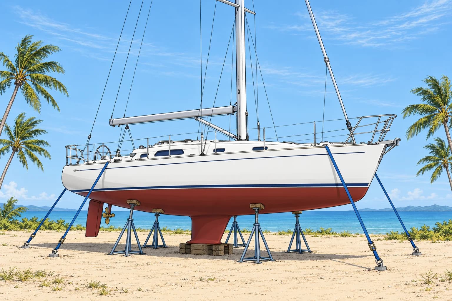
Plan the voyage so that you are not in a tropical storm area during its season, and that your boat is somewhere suitable if she stays there. The Tropical storms unit gives the dates by basin and how to avoid a storm at sea; here the question is where to be and when. North Atlantic: 1 June to 30 November. South-west Pacific: late October to early May.
Where to be
Choose a destination with lower seasonal exposure and acceptable insurance cover. Some crews return to Europe or cruise farther north; others choose Trinidad or the ABC islands (Aruba, Bonaire and Curaçao), where risk is lower but not zero. Simply reaching the US does not remove hurricane exposure. You can also store the boat ashore in a suitable yard that ties boats down. A hurricane hole is a sheltered anchorage: a last resort, not protection from a direct hit.
Insurance
Most yacht insurers set a named-storm or hurricane box: an area and dates in which the boat is not covered, or only with conditions such as being ashore. Read the policy before you plan the route. The box often defines the plan as much as the weather does.
Early and late storms
The official dates frame the usual season, not the possible one. Atlantic storms sometimes form in May or December, mostly west of 50° W. Check NHC (National Hurricane Center) information daily. The Tropical Weather Outlook gives 2- and 7-day cyclone-formation chances; outside its routine publication season, check for special outlooks.
Across the oceans
Reach New Zealand or Australian ports south of the tropical cyclone belt before the local cyclone season begins, using local passage windows. In the north Indian Ocean, choose a route-specific window: the north-east monsoon overlaps the post-monsoon cyclone period, so monsoon winds alone do not establish a safe departure. The same principle holds everywhere: season first, then route.
Key figures
- North Atlantic season
- 1 June – 30 November
- South-west Pacific season
- Late October – early May
- Hurricane hole
- Well-sheltered anchorage: a last resort
- Insurance
- Named-storm box: area and dates with no or limited cover
- NHC Tropical Weather Outlook
- Chance of formation within 2 and 7 days
Remember
- Season first, then route: avoid the storm belt during its season.
- Options: leave the area, go south of the usual tracks, or store ashore well secured.
- Insurance policies set a named-storm box of areas and dates: check yours.
- Storms can form outside the official dates: keep checking the outlook.
Common mistakes
Wrong: A hurricane hole makes it safe to stay in the Caribbean all season.
Right: It is a last resort against a storm, not protection from a direct hit. Plan to be elsewhere or ashore.
Wrong: Insurance covers the boat anywhere if you keep a storm watch.
Right: Most policies exclude or restrict cover inside a named-storm box. Read the policy before planning.
Worked case
You reach the Caribbean in December and want to keep cruising the islands until July. Your insurer's named-storm box covers the area from 1 June to 30 November. What options do you consider?
Show the answer
Choose a plan before 1 June: leave the box for Europe via Bermuda or the Azores in April–May; move outside it to a lower-risk destination; or haul out in a suitable yard if your insurer accepts this. Confirm cover and any conditions in writing. Finish the move or haul-out before the restriction begins, allow time for delays and keep checking the NHC outlook.
Practice question
What is the first planning rule for an ocean voyage in a storm region?
- Carry storm sails and a drogue
- Avoid being there in the season
- Sail only in the navigable semicircle
- Keep to the great-circle route
Show the answer
Answer: B. Avoiding the usual storm season reduces cyclone risk. Storms can still form outside those dates, so keep checking current forecasts.
5 · Self-sufficiency
Provisioning and self-sufficiency on an ocean passage
Far from help, you need supplies and repair options for weeks. Plan water, food, fuel, energy, spares, medical care and communications with a margin.
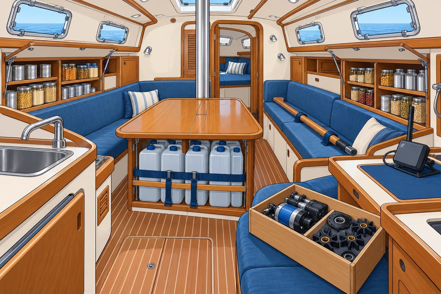
Plan the time
Start with the time at sea. Divide the distance by a realistic day's run, not the best one. Add a margin for calms, headwinds and repairs: 25 % or more is common. The Offshore planning unit covers watch systems and fatigue; World Sailing's Category 0 and 1 regulations set a benchmark for equipment.
Water
Water is the first item. World Cruising Club's planning guidance is at least 5 litres per person per day. Split it between tanks and separate sealed containers, so one leak or contamination cannot lose it all. A watermaker, which makes fresh water from seawater, is a bonus, not the only source. Keep emergency water in the grab bag.
Food, fuel and energy
Plan meals for the whole time plus the margin, with food that keeps without a fridge. Carry fuel for calms such as the doldrums, for charging and for the final approach. Make an energy budget: the daily use of every device, against what the engine, solar panels and generators can supply.
Spares and repairs
Far from repair services, you must handle essential repairs yourself. Carry spares and tools for the engine, steering, rig, sails, pumps, toilet and watermaker, plus a way to steer if the rudder fails. Inspect the rig and steering before leaving and at sea. A medical kit and a plan for radio medical advice belong here too; the Medical module covers them.
Communications
Plan how you will receive forecasts, call for help and send reports offshore. Agree report times with someone ashore and what they should do if a report is missed. The GMDSS ocean communications unit covers equipment choices.
Key figures
- Passage time
- Distance ÷ realistic day’s run, plus a suitable delay margin
- Water
- At least 5 L per person per day (WCC planning guidance)
- Storage
- Split between tanks and separate sealed containers
- Watermaker
- A bonus, never the only water source
- Energy budget
- Daily use of each device vs. charging sources
Remember
- Estimate passage time from a realistic day’s run, then add a margin for expected delays.
- Water first: plan at least 5 litres per person per day, split between tanks and containers.
- Carry fuel for calms, charging and the approach; balance an energy budget.
- Carry spares and tools for every vital system, plus emergency steering.
- Plan offshore communications and agree report times with a contact ashore.
Common mistakes
Wrong: With a watermaker you only need a small water reserve.
Right: Watermakers fail. Carry enough water for the passage without it, split between tanks and containers.
Wrong: Plan provisions on your fastest day's run.
Right: Plan on a realistic average and add a margin for calms, headwinds and repairs.
Worked case
Four crew plan the 2,700-mile crossing from Las Palmas to Saint Lucia in a 12 m yacht that averages 5.6 knots. Only 400 litres are stored, but the watermaker works. Are you ready?
Show the answer
At 5.6 knots, your day’s run is 134.4 nautical miles. The crossing takes about 20.1 days; adding 25 % gives about 25.1 days. Round up to 26 days for provisioning. Four crew need at least 4 × 5 × 26 = 520 litres of stored water. The 400 litres falls short. Add water and split it between tanks and separate sealed containers; do not count on the watermaker.
Practice question
A yacht averages 6 knots on a 2,880-mile passage. How many days should you plan, with a 25 % margin?
- 20 days
- 25 days
- 16 days
- 30 days
Show the answer
Answer: B. 6 × 24 = 144 miles a day; 2,880 ÷ 144 = 20 days; plus 25 % = 25 days.