
Navigation · Level R3 · 5 parts · about 15 min
Dead reckoning and estimated position
5 short parts: Dead reckoning · Leeway · Estimated position · Worked example · Accuracy. Each part explains the idea, then gives the points to remember, the common mistakes, a worked case and a practice question; the Academy unit adds all 27 check questions.
1 · Dead reckoning
Dead reckoning: position from heading and distance
Dead reckoning works out your position from where you started, the heading you steered and the distance the log shows you have run.
What DR is
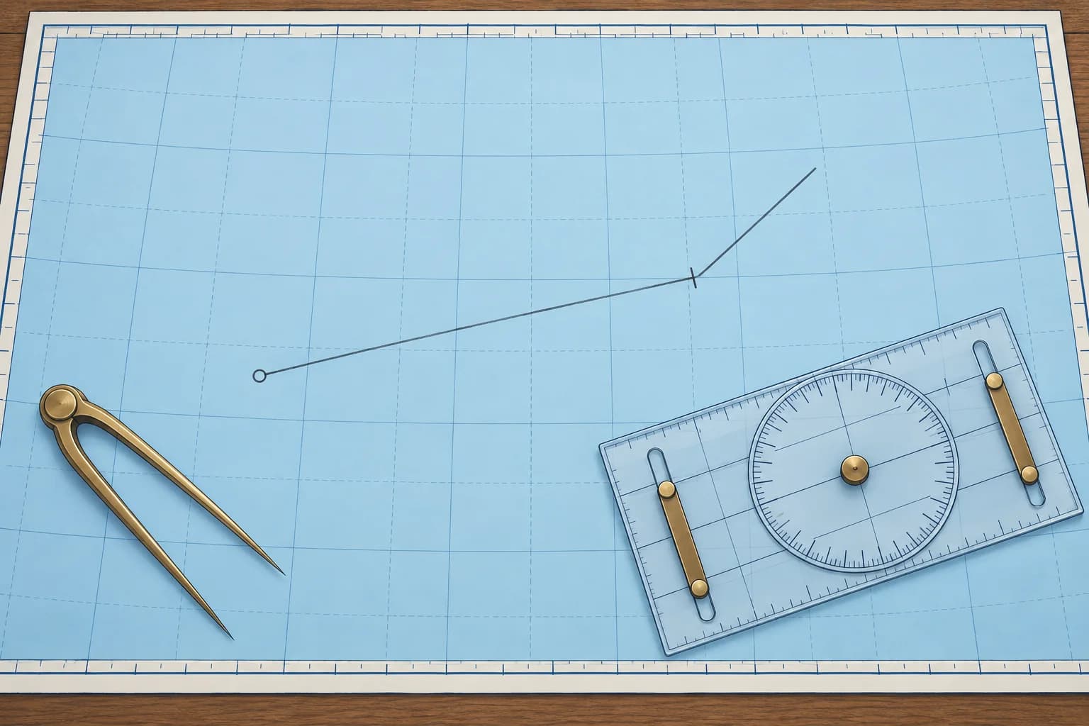
Dead reckoning (DR) estimates your position from a known start, heading and distance through the water. Lay off the direction you steered and the distance you ran. The result is a DR position. It leaves out the tidal stream (the horizontal flow of water caused by the tide), so it is only a first step.
What you need
Start with a position and time, ideally a fix (a position established from observations or a reliable position source). You need the heading (where the bow points) and distance through the water from the log, the boat's speed and distance instrument. Subtract the earlier log reading from the later one. Plot headings in degrees true (°T), measured from true north; see Compass course. M means nautical miles; kn means nautical miles per hour.
Plotting it
From the start, lay off the true heading with the plotter and mark the distance along it with the dividers. Apply leeway first if your course includes it in DR. Mark the end with the DR symbol and the time. Many UK courses use a short line across the track; Bowditch uses a semicircle. If you changed heading, plot each part in turn, each starting where the last one ended.
Leeway or not
Wind also pushes a boat sideways; that is leeway, in the next part. Courses differ on whether the DR line already allows for it: RYA courses apply leeway to the DR line, while Bowditch's DR uses the course steered only. All agree that a DR position never includes the tidal stream.
Limits of DR
A short DR run can stay close to your actual position when leeway and all currents are negligible. Weak tides do not guarantee weak currents: wind-driven and other currents also occur in the Mediterranean. Check your position whenever possible. Spanish PER chart exercises work the estima without wind or current; Patrón de Yate adds both.
Key figures
- DR from
- Start, true heading, log distance; leeway depends on convention
- Distance run
- Later log reading − earlier log reading
- Leaves out
- The tidal stream, always
- Spanish terms
- Estima (DR), corredera (log), rumbo verdadero (true heading)
Remember
- DR uses a start position, true heading and log distance; some schools include leeway.
- Distance run is the difference between two log readings.
- A DR position never includes the tidal stream.
- When you alter course, plot each heading and distance in turn.
Common mistakes
Wrong: Use satellite-navigation ground speed to work out the DR distance.
Right: DR uses distance through the water, from the log. Speed over the ground already includes the stream.
Wrong: A DR position is a reliable position.
Right: It leaves out the stream, and its errors grow with time. Treat it as a first step towards an estimated position.
Worked case
At 09:00 you fix your position; the log reads 31.4. You steer 135°T until 09:30 (log 34.4), then 090°T until 10:00 (log 37.2). A crewmate plots all 5.8 M on 090°T. Do you accept that DR?
Show the answer
No. The first 3.0 M were on 135°T, so one line on the final heading loses that leg. From the 09:00 fix, lay off 135°T for 34.4 − 31.4 = 3.0 M. From that endpoint, lay off 090°T for 37.2 − 34.4 = 2.8 M. The second endpoint is your 10:00 DR. Mark it with the DR symbol and time, and write it in the log.
Practice question
Which of these does a DR position never include?
- The heading steered
- The log distance
- The tidal stream
- The start position
Show the answer
Answer: C. DR leaves out the tidal stream. Whether it includes leeway depends on the convention your course uses.
2 · Leeway
Leeway: from heading to water track
Wind pushes the boat sideways, so it moves through the water at an angle to its heading. That angle is leeway; the boat's path is the water track.
What leeway is
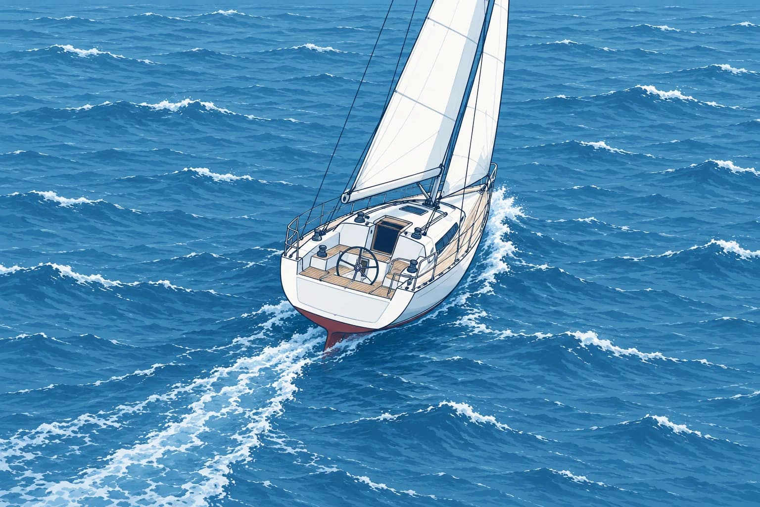
Wind on the sails, hull and superstructure pushes a boat to leeward (downwind) as it moves ahead. The angle between the heading and the boat's actual path through the water is leeway. That path is the water track. Leeway comes from the wind only; the tidal stream is dealt with separately.
How much
Leeway depends on the boat, its angle to the wind and the wind strength. A deep-keeled yacht close-hauled (sailing as near the wind as you can) in a moderate breeze may make about 5°. A boat with little depth below the water, a motorboat with high sides above the water, or any boat in a strong wind may make 10° or more. Running downwind there is almost none. Leeway also grows as the boat slows.
Estimating it
Hold a steady, straight course and inspect the wake behind the boat. Estimate its angle to the boat's centreline. For a compass check, take a hand-bearing compass bearing along the straight, recent wake and reverse it by 180°. Compare that direction with your heading, using the same north reference for both. Allow for compass errors as taught in Compass course. Repeat in steady conditions and record estimates for your boat in different conditions.
Applying it
Leeway always moves the track downwind of the heading; a small wind arrow drawn on the chart shows which way. Port is left and starboard is right when you face the bow. Wind on the port side pushes you to starboard: add the leeway to the heading. Wind on the starboard side pushes you to port: subtract it. Heading 100°T, wind from the north on the port side, 5° leeway: water track 105°T.
Arrows and words
RYA-style plots mark the water track with one arrowhead, the ground track with two and the tidal stream with three. Spanish courses call leeway abatimiento and the water track rumbo de superficie.
Key figures
- Wind on port side
- Water track = heading + leeway
- Wind on starboard side
- Water track = heading − leeway
- Typical close-hauled
- About 5°; 10° or more in a strong wind
- RYA arrowheads
- Water track one, ground track two, stream three
- Spanish terms
- Abatimiento (leeway), rumbo de superficie (water track)
Remember
- Leeway is the angle between heading and water track, caused by the wind.
- It always moves the track downwind: draw a wind arrow to check.
- Wind on the port side: add leeway. On the starboard side: subtract it.
- Estimate leeway from the angle of the wake.
Common mistakes
Wrong: Leeway includes the effect of the tidal stream.
Right: Leeway is wind only. The stream is added as a separate line.
Wrong: Add leeway whichever side the wind is on.
Right: Wind on the port side: add. Wind on the starboard side: subtract. The track always moves downwind.
Worked case
Heading 040°T with wind on the starboard side, you estimate 8° leeway from the wake. A crewmate plots 048°T. Do you accept it?
Show the answer
No. The wind pushes you to port, so the water track must lie downwind of the heading. Subtract: 040 − 8 = 032°T. The proposed 048°T puts the track towards the wind. Plot 032°T with one arrowhead and lay the log distance along it.
Practice question
Heading 210°T, wind on the port side, 6° leeway. What is the water track?
- 204°T
- 210°T
- 030°T
- 216°T
Show the answer
Answer: D. Wind on the port side pushes you to starboard, so add: 210 + 6 = 216°T.
3 · Estimated position
The estimated position: adding the tidal stream
An estimated position takes your water track and log distance and adds the tidal stream. It is your best position when you have no fix.
What an EP is
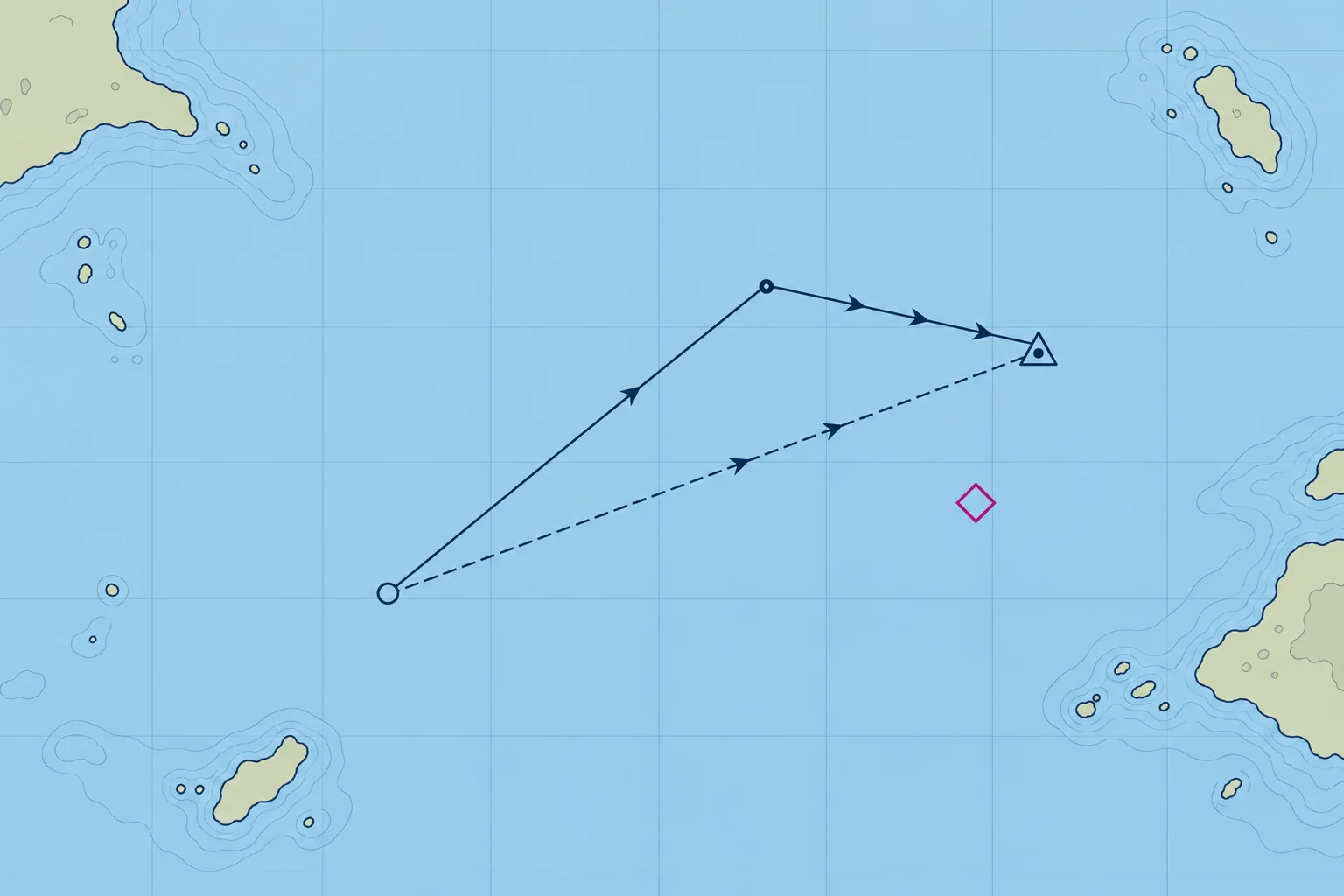
An estimated position (EP) is the best position you can work out without a fix. It starts like DR, along the water track for the log distance, and then adds the tidal stream: how far the water itself has carried the boat over the same time.
Set, rate and drift
A tidal stream has a set, the direction it flows towards, and a rate, its speed in knots. The distance it carries you in a given time is the drift: rate × time. You read set and rate from a tidal diamond on the chart or a tidal stream atlas for that hour of the tide (Tidal streams unit). A stream setting 090°T at 2 kn carries everything in the water 2 M east each hour.
Plotting it
From the start, plot the water track and log distance: one arrowhead. Add the stream set and drift for the same period: three arrowheads. Mark the EP with a triangle and time. Join the start to the EP: two arrowheads show the overall ground track; its length is distance made good. For a steady leg, divide this distance by elapsed hours for estimated speed over the ground (SOG). For changing tracks, calculate each leg separately.
Longer runs
Use the predicted stream for each hour and estimated location. You can add all water-track and stream lines to find the final EP, but the start-to-end line shows only net movement. If the track changes, plot each leg or hour separately. Add those ground distances before dividing by total hours for average SOG. For part of an hour, scale the drift: 30 minutes at 1.6 kn gives 0.8 M.
The opposite question
The EP answers "where am I now?" The reverse question, "which heading do I steer to make good a track?", needs a course to steer, taught in the Set and drift unit.
Key figures
- EP
- Water track and log distance + stream for the same time
- Set
- Direction the stream flows towards (°T)
- Drift
- Rate (kn) × time (h)
- EP symbol (RYA)
- Triangle round a dot, with the time
- Ground track
- Start to EP; two arrowheads
Remember
- EP = water track and log distance, plus the tidal stream for the same time.
- Set is where the stream flows towards; drift is rate × time.
- The line from the start to the EP shows the overall ground track and distance made good.
- Add the stream hour by hour, each from the right diamond or atlas page.
Common mistakes
Wrong: Plot the stream from the direction it comes from, as with wind.
Right: Set is the direction the stream flows towards. A stream setting 090°T carries you east.
Wrong: Use a full hour of stream for a 40-minute run.
Right: Scale it to the time: 40 minutes is two-thirds of the hourly drift.
Wrong: An EP is as good as a fix.
Right: It is built from several estimates. Fix as soon as you can.
Worked case
From a 15:00 fix you sail for 30 minutes along a water track of 260°T at 6.0 kn through the water. The stream sets 350°T at 1.6 kn. A crewmate adds 1.6 M of stream and reports the resulting distance as SOG. What needs correcting?
Show the answer
The run lasted half an hour: plot 3.0 M on 260°T, then 0.8 M on 350°T. The EP is about 3.1 M from the fix on 275°T. That is ground distance, not speed: estimated average SOG is 3.1 ÷ 0.5 ≈ 6.2 kn. Mark the EP and 15:30.
Practice question
A stream sets 045°T at 2.0 kn. Where does it carry you in one hour?
- 2.0 M to the south-west
- 2.0 M to the north-east
- 4.5 M to the north-east
- 2.0 M to the north-west
Show the answer
Answer: B. Set is the direction the water flows towards: 045°T is north-east.
4 · Worked example
A worked estimated position, step by step
One hour of a real passage: magnetic heading, variation, leeway, log distance and tidal stream, taken in order to give an EP.
The data
At 10:00 you fix your position; the log reads 12.0. You steer 100°M. Variation is 2°W, and the deviation card shows none on this heading. The wind is from the north, and you estimate 5° of leeway. At 11:00 the log reads 18.0. The tidal diamond for that hour gives a set of 180°T and a rate of 1.5 kn.
Heading to water track
Convert to true: 100°M with 2°W variation is 098°T, because you subtract west going from magnetic to true. The north wind is on the port side, so it pushes you to starboard: add the leeway, 098 + 5 = 103°T. That is the water track. Distance through the water: 18.0 − 12.0 = 6.0 M.
Adding the stream
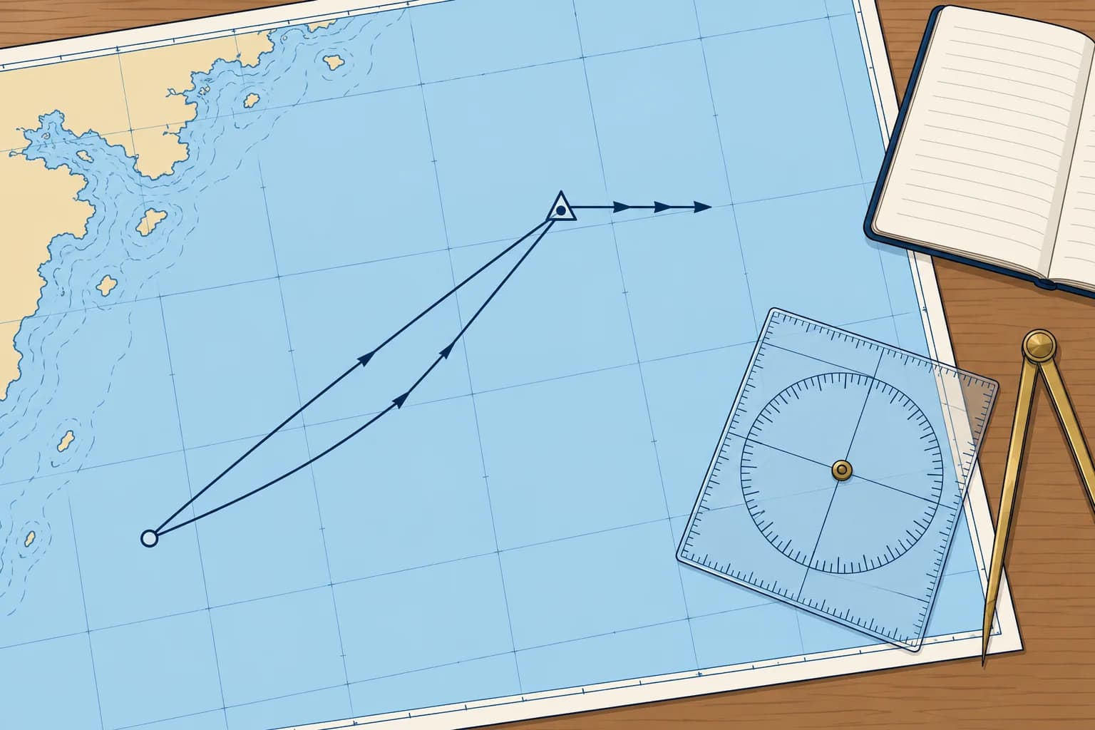
From the 10:00 fix, lay off 103°T and mark 6.0 M: one arrowhead. From that point, lay off 180°T and mark 1.5 kn × 1 h = 1.5 M: three arrowheads. The end of that line is the 11:00 EP. Draw the triangle and write 11:00 beside it.
Reading the result
Join the fix to the EP: the ground track is about 116°T and about 6.5 M long, so you made about 6.5 kn over the ground. The stream has carried you about 13° south of your water track. Log the EP with its time and log reading, then take a fix to check it.
Check the signs
Ask three questions every time. Did I apply variation the right way? Did leeway move the track downwind? Did I plot the stream towards its set, not from it? Most EP errors come from one of these.
Key figures
- Magnetic to true
- 100°M with 2°W variation = 098°T
- Leeway (wind on port)
- 098°T + 5° = 103°T water track
- Log distance
- 18.0 − 12.0 = 6.0 M
- Stream
- 180°T, 1.5 kn × 1 h = 1.5 M
- Result
- Ground track ≈ 116°T, ≈ 6.5 M in the hour
Remember
- Order: magnetic to true, then leeway, then log distance, then stream.
- From magnetic to true, subtract west variation and add east.
- Leeway moves the water track downwind; the stream is plotted towards its set.
- The fix-to-EP line gives ground track and distance; divide distance by elapsed hours for estimated SOG.
Common mistakes
Wrong: Add the 2°W variation to get true.
Right: From magnetic to true, subtract west: 100°M becomes 098°T, not 102°T.
Wrong: Plot the stream from 180°T, the direction it comes from.
Right: Plot it towards 180°T: a stream setting 180°T carries you south.
Worked case
On another day the data are the same, except that a southerly wind is on your starboard side, still with 5° leeway. A crewmate says the EP stays unchanged because the stream is unchanged. Do you agree?
Show the answer
No. The wind changes the water track to 093°T even though the stream stays the same. Wind on the starboard side pushes you to port: 098 − 5 = 093°T. Lay off 6.0 M along 093°T, then the stream 1.5 M towards 180°T. The EP falls about 1 M north of the first one, and the ground track is about 107°T, 6.3 M long.
Practice question
Heading 100°M, variation 2°W. What is the true heading?
- 102°T
- 100°T
- 098°T
- 096°T
Show the answer
Answer: C. From magnetic to true, subtract west variation: 100 − 2 = 098°T.
5 · Accuracy
How accurate is an estimated position?
Every input to an EP is an estimate, and the errors add up with time. Calibrate the log, keep runs short and fix as soon as you can.
Errors add up
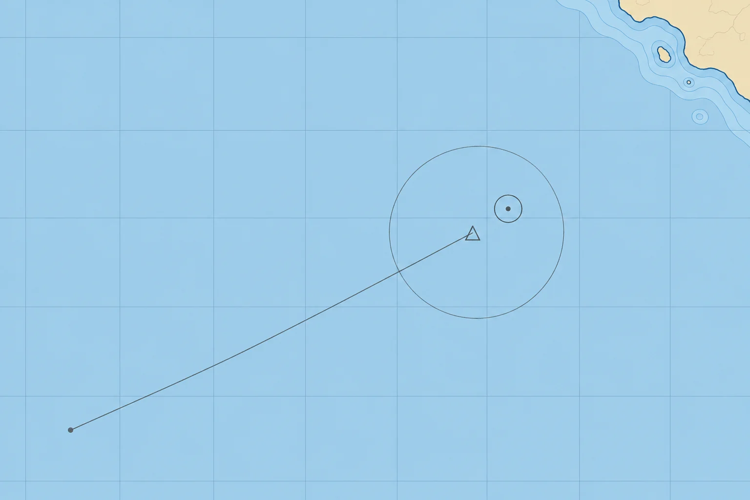
An EP rests on estimates: how well the helm held the heading, the leeway angle, the accuracy of the log, and a predicted tidal stream. Each error grows with time and distance. The 1 in 60 rule gives a feel for it: a 1° direction error puts you about 1 M off for every 60 M you run, so a 5° error over 12 M puts you about 1 M off.
The log
A log measures speed through the water with a small paddlewheel or an ultrasonic sensor. Weed, fouling and poor calibration make it read high or low. Calibrate it: run a known distance between charted marks both ways (reciprocal runs) near slack water, when the tidal stream is negligible, keeping your speed steady. Compare the readings. If it shows 2.2 M over a true 2.0 M, multiply future readings by 2.0 ÷ 2.2 ≈ 0.91. Spanish courses call this factor the coeficiente de corredera.
The stream
Stream predictions describe the expected tidal flow. Wind, air pressure and local eddies change the real stream, especially off headlands and in channels, and the stream close inshore can differ from the diamond further out. EP uncertainty grows when the actual stream differs from your estimate, especially over a long run.
Showing the doubt
Treat an EP as the centre of an area, not a point, and that area grows the longer you run without a fix. Many navigators sketch a rough circle of uncertainty around it. Keep further from danger than that circle.
Fix soon
A good fix resets the errors. Fix as soon as you can and compare the fix with your EP for the same time: the gap shows the combined error of your estimates. A repeated offset suggests a systematic error in heading, log distance, leeway, stream or fixing; check each input.
Key figures
- 1 in 60 rule
- 1° error ≈ 1 M off track per 60 M run
- Example
- 5° error over 12 M ≈ 1 M off
- Log factor
- True distance ÷ log distance over a known run
- Calibrate
- Known distance, both ways, at slack water
Remember
- EP errors grow with time and distance: treat an EP as an area, not a point.
- 1 in 60 rule: a 1° error puts you about 1 M off for every 60 M run.
- Calibrate the log over a known distance, both ways, at slack water.
- Fix as soon as you can and compare the fix with the EP.
Common mistakes
Wrong: A carefully plotted EP is as good as a fix.
Right: Its inputs are estimates. Keep a margin from danger and fix as soon as you can.
Wrong: Calibrate the log by running in one direction only.
Right: Run both ways near slack water, with negligible stream. Compare the readings and repeat if they disagree.
Worked case
Your EP lies 0.4 M from a shoal. You estimate position uncertainty at 0.6 M, and no good fix is available. Does the plotted point confirm safe clearance?
Show the answer
No. Your estimated area of uncertainty reaches the shoal, so the EP point does not establish clearance. Keep a larger margin from danger and obtain a reliable fix as soon as possible. Compare that fix with the EP before relying on the next estimate.
Practice question
By the 1 in 60 rule, how far off does a 3° steering error put you after 20 M?
- About 3 M
- About 1 M
- About 0.3 M
- About 6 M
Show the answer
Answer: B. 20 × 3 ÷ 60 = 1 M.