
Navigation · Level R4 · 6 parts · about 19 min
Radar on a small vessel: range, bearing, clutter and echoes
6 short parts: How it works · Range & bearing · Display modes · Gain & clutter · False echoes · Target tracking. Each part explains the idea, then gives the points to remember, the common mistakes, a worked case and a practice question; the Academy unit adds all 33 check questions.
1 · How it works
How a small-boat radar sees, and how far
Radar uses microwave echoes to measure range and bearing. Range is usually more precise; detection depends on height, reflection and conditions.
Echo timing
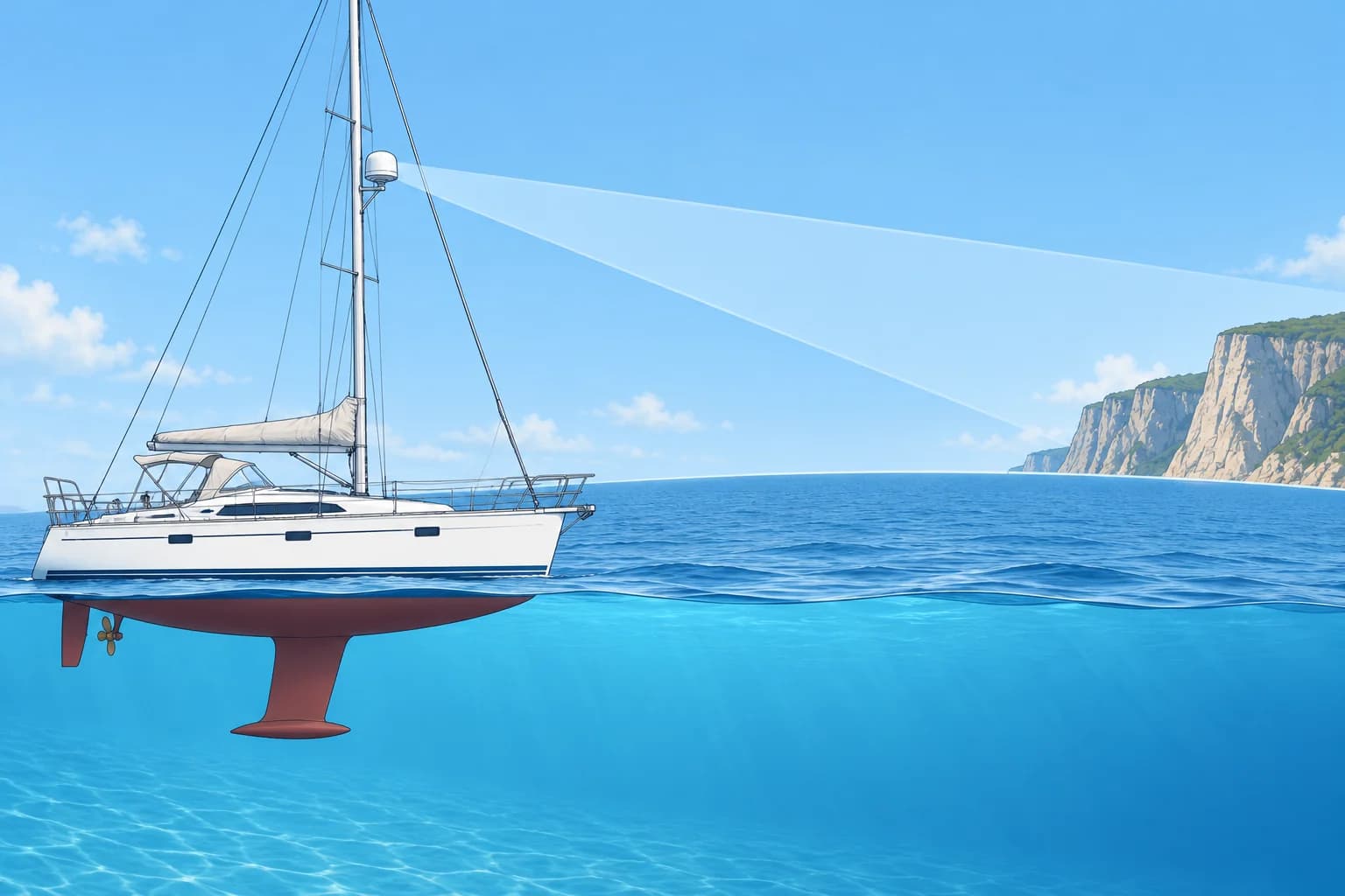
A radar sends microwave energy from a rotating aerial, the scanner, and listens for echoes. Radio waves travel at the speed of light, so the time an echo takes to return gives the range, the distance to the target. The direction the scanner points at that moment gives its bearing. Small-boat radars work in the X-band, around 9 GHz. Ships also carry S-band radars, around 3 GHz, which see better through rain but have bigger aerials.
Three kinds of set
A pulse radar (magnetron) sends short, powerful pulses. A broadband or FMCW radar (frequency-modulated continuous wave) sends a weak, continuous signal whose frequency sweeps up; it shows very close targets well and starts instantly. A solid-state pulse-compression radar sends longer, low-power coded pulses, then processes the echoes to separate targets close together in range. Many newer sets add Doppler colouring: echoes closing on you show in one colour, those opening in another.
Beam width and smear
The beam is narrow across but tall, so the boat can roll without losing the picture. Its horizontal beam width depends on aerial length: often about 4–5° for a 45 cm dome and about 2° for a 1.2 m open array. Each echo is smeared sideways by about the beam width, so bearings are less precise than ranges. Two boats close together at the same range can merge into one echo.
The radar horizon
Radar waves bend slightly with the atmosphere, so a radar sees a little beyond the visible horizon. The radar horizon in nautical miles (NM) is about 2.21 × √h, with h the aerial height in metres. A target is detectable out to about 2.21 × (√aerial height + √target height), if it reflects well. Unusual atmospheres change this: super-refraction stretches range, sub-refraction shortens it.
Worked example
Your scanner is 4 m above the sea. Your radar horizon is 2.21 × √4 = 2.21 × 2 = about 4.4 NM. A cliff 25 m high can show from about 2.21 × (2 + 5) = 15.5 NM. A low, smooth sandy shore in front of the cliff may give no clear echo until you are much closer.
Key figures
- Radar horizon
- About 2.21 × √h NM (h = aerial height in metres)
- Detection range
- About 2.21 × (√h aerial + √h target) NM, if it reflects well
- Small-boat band
- X-band, about 9 GHz (3 cm wavelength)
- Beam width
- About 4–5° for a small dome; about 2° for a 1.2 m open array
- Spanish terms
- Radar de impulsos, banda X, horizonte radar, eco
Remember
- Range comes from echo time and is accurate; bearing comes from the scanner and is smeared by the beam width.
- Pulse, FMCW broadband and solid-state sets all show echoes, with different strengths close in and far out.
- Radar horizon ≈ 2.21 × √h NM; a high target is seen further than a low one.
- Higher ground inland may produce the first echo while the low shoreline remains invisible.
Common mistakes
Wrong: Radar sees anything within its selected range.
Right: The selected scale does not guarantee detection. Height, obstructions, reflection and atmospheric conditions limit what you see.
Wrong: Radar bearings are as accurate as radar ranges.
Right: The beam smears each echo sideways. Use radar ranges with visual bearings for the best fix.
Wrong: The first echo of land is the charted coastline.
Right: The first echo is often higher ground inland. Check heights on the chart before using a range.
Worked case
At night, your chart shows a low beach 9 NM away and a 25 m hill 2 NM inland on the same bearing. A land echo appears at 11 NM. Your scanner is 4 m above the sea. Can you treat that echo as the shoreline?
Show the answer
No. The echo is consistent with the hill, within the combined radar horizon of about 15.5 NM. The low beach may return little or no echo. Confirm the bearing and shape before identifying the feature. Do not treat 11 NM as your distance from the beach. Use a radar range for navigation only after identifying the charted feature that produced it.
Practice question
Which radar measurement is normally the most accurate?
- The bearing of a small target
- The heading of a target vessel
- The true size of a distant echo
- The range of a well-defined target
Show the answer
Answer: D. Range comes from echo time and is precise. Bearing is smeared by the horizontal beam width.
2 · Range & bearing
Range rings, VRM and EBL: measuring with radar
Range rings give a rough distance. The VRM measures range and the EBL measures bearing. Know whether the bearing is relative or true.
Range scale and rings
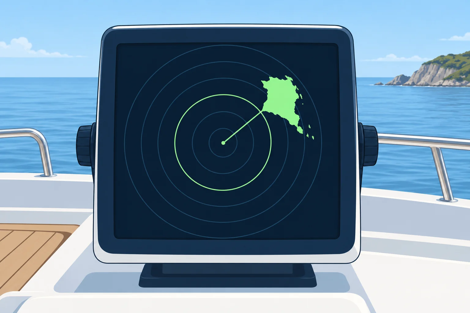
The range scale is the distance from the centre of the screen to its edge, for example 3 NM. Range rings are fixed circles at set steps, such as every 0.5 NM on that scale. They give a quick estimate. Choose a scale that shows the target well inside the screen; a short scale gives a bigger, more precise picture.
VRM
The VRM (variable range marker) is a circle you can move until it touches the inner edge of an echo. The display then reads its range. Measure to the near edge, the part of the target facing you. For a fix, measure to a steep, charted feature such as a cliff or a pier head. A gently sloping beach may return an echo from inland rather than the charted shoreline.
EBL
The EBL (electronic bearing line) is a line from the centre that you turn until it cuts the middle of an echo. The display reads its bearing. Bisect the echo, because the beam width smears it to both sides. Many sets offer two VRMs and two EBLs. An offset EBL moves its origin away from your boat, letting you measure the bearing from one echo to another.
Relative or true
A relative bearing is measured clockwise from your bow, from 000° to 359°. A true bearing is measured from true north. True bearings need true-heading input from a heading sensor, such as an electronic compass. Correct deviation (compass error caused by your boat) and variation (the difference between magnetic and true north) to obtain true heading. Check the R or T label. Add relative bearing to true heading; subtract 360° if the sum is 360° or more.
Using it for a fix
Radar ranges are the strong part. Two or three ranges of steep, charted objects give a good fix; a visual compass bearing crossed with a radar range of the same object also works. The Position fixing unit covers bearing and range. Check it against depth and the GNSS position.
Key figures
- VRM
- Variable range marker: touch the near edge of the echo
- EBL
- Electronic bearing line: bisect the echo
- True bearing
- Relative bearing + true heading; subtract 360° if sum ≥ 360°
- Spanish terms
- Anillos de distancia, VRM, EBL, marcación, demora verdadera
Remember
- Use the shortest range scale that shows the target; rings are for estimates, the VRM for measurement.
- VRM to the near edge of a steep, charted object; EBL through the middle of the echo.
- Know whether bearings are relative (from the bow) or true; true needs heading referenced to true north.
- Two or three radar ranges give a better fix than radar bearings.
Common mistakes
Wrong: Set the EBL on the edge of the echo for a precise bearing.
Right: Beam width smears the echo to both sides. Bisect it with the EBL.
Wrong: Any bearing on the screen is a true bearing.
Right: True bearings need heading referenced to true north. Without it, use relative bearings. Check the R or T label.
Worked case
Your heading is 300° true. A steep, identified cliff bears 090° relative on the EBL and measures 2.4 NM on the VRM. Your crew records 090° true and rounds the range to 2 NM from the rings. What should you correct?
Show the answer
Record 030° true: 300° + 090° = 390°, then subtract 360°. Keep the measured range of 2.4 NM; the rings give only an estimate. Check that the VRM touches the cliff's near edge and the EBL bisects its echo. Use the Position fixing unit to plot the measurements.
Practice question
Where do you place the VRM to measure the range of a cliff?
- On the far edge of the echo
- On the middle of the echo
- On the near edge of the echo
- On the nearest fixed range ring
Show the answer
Answer: C. The near edge is the face of the cliff towards you. That is the range you plot.
3 · Display modes
Head-up, north-up, course-up; relative and true motion
The picture can be oriented to your bow, to north or to your course. Stabilised modes need a heading sensor; motion and trails can be relative or true.
Head-up
In head-up, your heading is at the top of the screen. It matches what you see over the bow, which is easy for steering. Your bow yaws when it swings from side to side. In unstabilised head-up, yaw makes the picture swing and can smear trails. Heading-fed sets may compensate trails for yaw. Head-up can work without a heading sensor.
North-up and course-up
In north-up, true north is at the top, like the chart; a heading line shows where your bow points. In course-up, a reference course, often your heading when you select or reset the mode, is at the top; the picture stays steady as you yaw. Reset it after a big alteration. Both are stabilised modes: a heading sensor turns the picture to cancel your yaw. A slow or badly calibrated sensor rotates every echo by the same error.
Relative motion
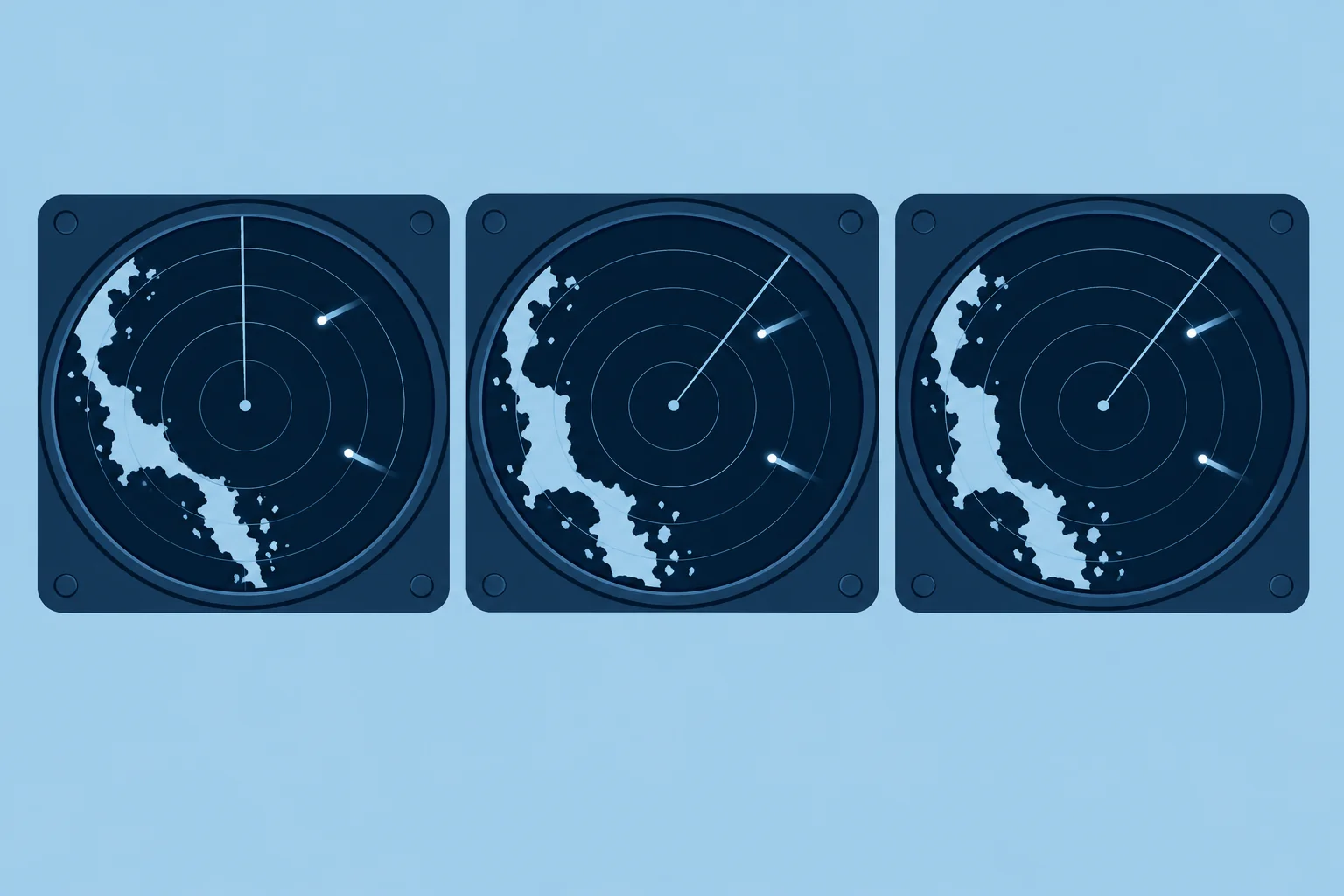
In relative motion, your boat stays fixed on the screen and everything moves relative to you. A buoy appears to drift backwards past you; a ship's echo moves along its relative track, which tells you whether it will pass close. In this mode, an echo whose bearing stays steady while its range closes indicates risk of collision.
True motion
In true motion, your boat moves across the screen. With motion referenced to the ground, land stays still and moving targets follow their courses over the ground. This needs heading and your course and speed over the ground, usually from GNSS. The display resets before your boat reaches the edge. It shows target movement, but relative motion makes close approaches easier to recognise.
Trails
Trails (echo trails) leave a fading wake behind each moving echo. Relative trails show each target's relative track; true trails show its movement over the ground or through the water. Know which you have chosen before you judge a target. Orientation and motion are separate settings: north-up can use relative motion.
Key figures
- Head-up
- Bow at top; no heading sensor needed; picture swings with yaw
- North-up / course-up
- Stabilised by heading sensor; picture steady as you yaw
- Relative motion
- Own boat fixed; echoes move on their relative tracks
- True motion
- Own boat moves; land fixed when referenced to the ground
- Spanish terms
- Proa arriba, norte arriba, rumbo arriba; movimiento relativo/verdadero
Remember
- Head-up matches the view ahead but swings with every yaw.
- North-up and course-up need a heading sensor; a sensor error rotates the whole picture.
- Relative motion and relative trails show directly whether a target will pass close.
- True motion shows targets' real courses; know which trail mode you are using.
Common mistakes
Wrong: Use true trails to judge whether a target will hit you.
Right: True trails show the target's own course. Relative trails or a steady bearing show the collision risk.
Wrong: North-up always shows the picture correctly aligned.
Right: It is only as good as the heading sensor. A 10° error turns every echo 10°.
Worked case
In north-up with relative trails, you hold a steady course and speed. Successive echoes of a ship 4 NM off your starboard bow keep the same true bearing and move closer. Its older trail extends away from the centre. Your crew says its true course shows it will cross safely ahead. Is that enough?
Show the answer
No. The successive positions show closing range on a steady bearing, so risk of collision exists. The trail marks past positions, behind the approaching echo. Follow the direction from the older trail through the current echo towards your position. Check successive EBL bearings and measured ranges. The Radar and collision avoidance unit covers what to do.
Practice question
Which display mode works on a radar with no heading sensor?
- North-up
- Course-up
- Head-up
- True motion
Show the answer
Answer: C. Head-up puts the bow at the top and needs no heading input. The others need a heading sensor.
4 · Gain & clutter
Gain, sea clutter and rain clutter: tuning the picture
A good picture shows small targets without drowning in noise. Set gain first, then sea clutter, then rain clutter, and check again often.
Gain
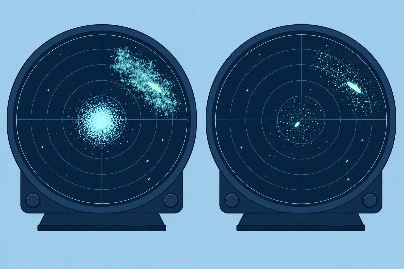
Gain sets how strongly the receiver amplifies echoes. Too low, and weak targets vanish. Too high, and the screen fills with speckled noise. The aim is a light speckle in the background on a long range scale, so the weakest echoes still show. Many sets have an automatic gain that is good most of the time.
Sea clutter
Waves near the boat reflect energy and make a bright patch around the centre: sea clutter. The sea clutter control (also called anti-clutter sea, or STC, sensitivity time control) reduces the gain close in and less further out. Set it so that the clutter breaks into scattered dots, not so that it is clean black. Over-suppression can remove a small boat or a buoy in the clutter.
Rain clutter
Rain and showers form broad patches that can hide targets. Traditional FTC (fast time constant) emphasises echo leading edges to reduce these broad returns. Modern rain controls may use other processing. Use the least suppression needed: it can weaken wanted echoes too. Rain echoes may warn of a squall, a sudden increase in wind; watch whether they approach.
Automatic modes
Most modern sets have auto gain, sea and rain, often with harbour, coastal and offshore presets. They work well in steady conditions but can hide small targets in a steep, short sea. Know how to switch to manual, and try it in calm conditions first.
Keep checking
Conditions change with wind, range scale and heading relative to the sea. Retune after changing range, and every time the sea or rain changes. A target lost in clutter is still there: keep a visual and a listening lookout.
Key figures
- Order of tuning
- Gain, then sea clutter, then rain clutter
- Sea clutter control
- STC: reduces gain close in, less with distance
- Rain clutter control
- Traditional FTC emphasises leading edges; other processing varies
- Spanish terms
- Ganancia, perturbación del mar (STC), de lluvia (FTC)
Setting up the picture
- For manual tuning, select a medium-to-long range scale and set sea- and rain-clutter suppression to minimum. — This lets you assess receiver noise before adding clutter suppression.
- Raise the gain until background noise appears, then adjust it to leave a light speckle. Check that a known weak echo remains visible. — This shows the weakest echoes without filling the screen with noise.
- Change to the working range scale and raise sea clutter until the clutter breaks into dots. — Scattered dots suggest moderate suppression, but weak targets can still be hidden. Check known echoes as you adjust.
- Add rain clutter only if rain hides part of the picture. — Rain suppression can weaken wanted echoes, so use the least that works.
- Retune after every range change and when the sea or rain changes. — The correct settings depend on range and conditions.
Remember
- Set gain for a light background speckle; too much hides targets in noise, too little loses them.
- Sea clutter: leave a few dots. A clean centre may hide a small boat.
- FTC emphasises leading edges; rain suppression can weaken wanted echoes.
- Retune after a range change and whenever the conditions change.
Common mistakes
Wrong: Turn sea clutter up until the centre is completely clear.
Right: That can remove small targets. Stop when the clutter breaks into scattered dots.
Wrong: Leave auto mode on and never touch the controls.
Right: Auto is good, but check it manually in a short, steep sea or heavy rain.
Wrong: Rain clutter makes rain disappear without any cost.
Right: FTC emphasises leading edges; rain suppression can weaken wanted echoes. Use the least that works.
Worked case
In a force 6 with a steep sea, your crew has turned sea clutter up so far that the centre of the screen is black. Visibility is 1 NM. A fishing boat was seen 0.5 NM ahead a few minutes ago and is no longer on the screen. What do you do?
Show the answer
The fishing boat may be hidden by over-suppression. Reduce sea-clutter suppression gradually until scattered dots remain, and use a suitable short range. Look for a persistent echo moving consistently over successive sweeps; a real target need not stay in one screen position. Keep a visual and listening lookout. A clear screen does not mean clear water. The Radar and collision avoidance unit covers safe speed and fog signals.
Practice question
Auto sea clutter clears the centre, but a known buoy disappears in a steep sea. What should you do?
- Compare manual settings and reduce suppression
- Keep auto because the centre is now clear
- Increase sea suppression to remove all speckle
- Use rain suppression to recover the buoy
Show the answer
Answer: A. Auto can hide weak targets. Compare manual settings and use the least suppression that gives a readable picture.
5 · False echoes
False echoes, blind sectors, reflectors and beacons
Some echoes on the screen are not where they appear, and some real targets do not appear. Know the common false echoes and blind sectors.
Side lobes and multiples
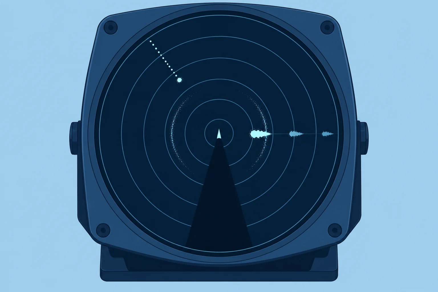
The beam has weak side lobes either side of the main beam. A strong target close by can show as an arc of echoes at the same range on both sides of it. Multiple echoes appear when energy bounces between you and a big target, such as a ship close abeam: you see two or three echoes on the same bearing at twice and three times the true range. Reduce gain cautiously to weaken them; this can also hide weak real targets.
Indirect echoes
An indirect echo reaches you by reflection from an obstruction such as your mast. It appears on that obstruction's bearing, often near the real target's range; the extra path can increase the apparent range. Check other echoes and the view before deciding it is false.
Second-trace echoes
On pulse radar, a distant echo can return after a later pulse has been sent. This second-trace echo appears at a false, shorter range. Super-refraction can make it more likely. If changing scale also changes pulse timing, its measured range may jump or the echo may disappear. This is a clue, not proof: screen position alone changes with scale even for a real target.
Shadows and blind sectors
Your mast or stacked dinghies can block part of the beam, especially if your scanner is mounted low. That blind sector hides targets on those bearings. Behind high land or big ships there are shadow areas too. Find your blind sectors in harbour and alter course now and then at sea to look into them.
Reflectors and beacons
A small yacht is a weak target: carry a good radar reflector or an active one (a radar target enhancer), mounted high. A RACON is a radar beacon on a mark that answers your pulse with a Morse letter on the screen. At several miles, an X-band radar SART (search and rescue transponder) produces 12 dots extending outwards beyond its position. Low-power FMCW sets may not trigger them.
Key figures
- Multiple echoes
- Same bearing, 2× and 3× the true range
- Side lobe echoes
- Arc at the same range either side of a strong close target
- Second-trace echo
- False short range; may jump when pulse timing changes
- SART on screen
- At several miles: 12 dots extending outward beyond the SART
Remember
- Reduce gain cautiously for side lobes and multiples; check that weak real echoes remain visible.
- Obstructions can create indirect echoes or blind sectors; a blind sector hides targets rather than making an echo.
- Find your blind sectors and alter course now and then to look into them.
- A RACON gives a Morse letter; at several miles, a SART gives 12 dots. Low-power FMCW sets may not trigger them.
Common mistakes
Wrong: Every echo on the screen is a real target where it appears.
Right: Side lobes, multiple, indirect and second-trace echoes are false. Check against the chart and the view.
Wrong: A yacht with a radar reflector is always seen by ships.
Right: Small reflectors give weak, patchy echoes, worse when heeled and in a sea. Keep a lookout and use AIS too.
Worked case
A large ferry passes 0.3 NM abeam. Your screen shows its echo, plus two more on the same bearing at 0.6 and 0.9 NM, and a faint arc at 0.3 NM curving round the bow. Nothing else is visible from the deck. What do these suggest, and how would you check without hiding weak targets?
Show the answer
The echoes at 0.6 and 0.9 NM suggest multiples; the arc at 0.3 NM suggests side lobes from the ferry. Reduce gain slightly, or cautiously increase sea-clutter suppression, while checking known weak echoes. Either adjustment can hide weak real targets, so use the minimum needed. Keep a lookout and check the remaining echoes against the view; do not dismiss them all as false.
Practice question
A ship close abeam produces extra echoes on the same bearing at twice and three times its range. What are they?
- Second-trace echoes
- Indirect echoes
- Side-lobe echoes
- Multiple echoes
Show the answer
Answer: D. Energy bouncing between your boat and the ship produces echoes at multiples of the true range.
6 · Target tracking
MARPA target tracking: CPA, TCPA and its limits
MARPA tracks echoes and works out how close they will pass and when. It needs a good heading input and time, and it lags after any manoeuvre.
What it does
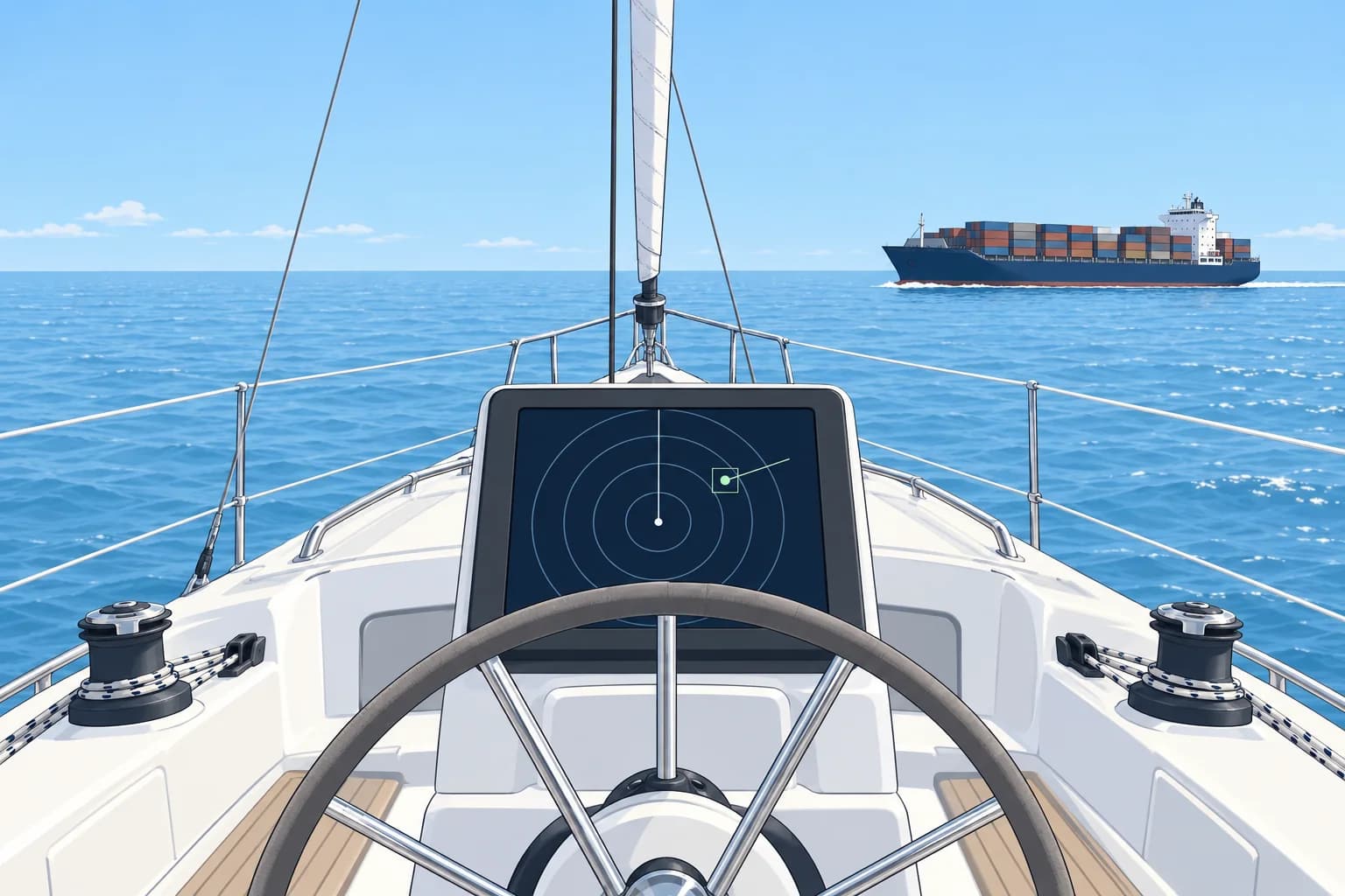
You select an echo for MARPA (mini automatic radar plotting aid) to track. A vector is an arrow: its direction shows motion and its length shows the predicted distance covered in the selected vector time. True vectors show target motion; relative vectors show motion relative to you. CPA (closest point of approach) is the predicted closest passing distance; TCPA is the time until it. Both assume that you and the target maintain course and speed.
What it needs
MARPA needs your own heading from a heading sensor, plus speed and course, usually from GNSS. Without accurate heading the target's calculated course is wrong, even when the CPA looks reasonable. Many sets refuse to run MARPA without a heading input.
It takes time
After you acquire a target, the tracker needs several sweeps to build a trend: allow about a minute for a first indication and about three minutes for a steady vector. When the target or your own boat alters course, the old calculation carries on for a while, then catches up. In that gap, the CPA is out of date.
Where it fails
Small, weak echoes in clutter can be lost, and the tracker may swap to another echo when two targets pass close. A ship turning slowly gives a vector that keeps changing. Treat MARPA as an aid: watch the echo's bearing with the EBL as well, compare with AIS when the target has it, and keep a visual lookout.
Where to go next
The rules for acting on what radar shows, including plotting, Rules 7, 8 and 19, belong to the Radar and collision avoidance unit. The Radar simulator lets you practise tracking and judging CPA without risk.
Key figures
- CPA
- Predicted closest distance if both maintain course and speed
- TCPA
- Time to the closest point of approach
- Tracking lag
- About 1 min for a trend, about 3 min for a steady vector
- Inputs
- Heading sensor, plus own speed and course (GNSS)
- Spanish terms
- Punto de máximo acercamiento (CPA), tiempo al CPA (TCPA)
Remember
- MARPA gives a target's course, speed, CPA and TCPA from successive echoes.
- It needs good heading input; a bad heading gives a wrong target course.
- Allow minutes for a steady vector; after any alteration the result lags.
- Check MARPA with EBL bearings, AIS and the view. Collision rules: Radar and collision avoidance unit.
Common mistakes
Wrong: A CPA shown seconds after acquiring a target is reliable.
Right: Allow about three minutes of steady tracking for a steadier vector. This is approximate and never guarantees accuracy.
Wrong: After the other ship alters course, the CPA updates at once.
Right: The calculation lags. Watch the echo's bearing and range directly while it catches up.
Wrong: MARPA works the same with or without a heading sensor.
Right: It needs accurate heading. Without it the target course is wrong or MARPA will not run.
Worked case
You acquired a ship 6 NM away two minutes ago. MARPA shows CPA 1.2 NM, TCPA 18 minutes. The EBL bearing has hardly changed in those two minutes and the range is closing. Your heading sensor was replaced last week and not yet calibrated. How much do you trust the CPA?
Show the answer
Treat the figures as provisional. The track may still be settling, and the uncalibrated heading sensor makes the target vector unreliable. Cross-check successive EBL bearings and measured ranges, the visual lookout and available AIS data. Keep the observed echo identified. Calibrate the heading input before relying on MARPA. The Radar and collision avoidance unit covers collision decisions and action.
Practice question
MARPA shows CPA 0.4 NM and TCPA 8 minutes. Assuming both vessels keep their courses and speeds, what is predicted?
- Closest passing distance 0.4 NM in 8 minutes
- Present target range 0.4 NM after 8 minutes
- Collision in 8 minutes at your present position
- Target speed 0.4 knots for the next 8 minutes
Show the answer
Answer: A. CPA predicts the closest passing distance, here 0.4 NM; TCPA predicts when, here in 8 minutes. Both assume unchanged courses and speeds.